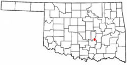
Sasakwa is a town in Seminole County, Oklahoma, United States. The population was 80 as of the 2020 census.[4]
Sasakwa, Oklahoma | |
|---|---|
 Location of Sasakwa, Oklahoma | |
| Coordinates: 34°56′48″N 96°31′31″W / 34.94667°N 96.52528°W | |
| Country | United States |
| State | Oklahoma |
| County | Seminole |
| Area | |
| • Total | 0.21 sq mi (0.55 km2) |
| • Land | 0.21 sq mi (0.55 km2) |
| • Water | 0.00 sq mi (0.00 km2) |
| Elevation | 827 ft (252 m) |
| Population (2020) | |
| • Total | 80 |
| • Density | 375.59/sq mi (144.69/km2) |
| Time zone | UTC-6 (Central (CST)) |
| • Summer (DST) | UTC-5 (CDT) |
| ZIP code | 74867 |
| Area code | 405 |
| FIPS code | 40-65500[3] |
| GNIS feature ID | 2413261[2] |
History
editSasakwa was originally located at a site 12 miles (19 km) west of the present townsite, where Governor John E Brown, Seminole, established a trading post, cotton gin, and 16 room mansion where he fed vagrants and poor.[5] A post office was established in 1880, and took the name from that given his trading post by Gov John E Brown, from the Seminole word meaning "wild goose".[5] Sasakwa Female Academy existed at Sasakwa from 1880 to 1892. At that time Sasakwa was part of the [not sure it was Creek, part of Seminole nation today] Nation in the Indian Territory. The site of the present town was moved to where the train station was located.
In 1917, hundreds of men gathered on a farm near Sasakwa to protest the draft in World War I, an event called the Green Corn Rebellion.[5]
Geography
editSasakwa is located 13 miles (21 km) south of Wewoka, the county seat. According to the United States Census Bureau,[5] the town has a total area of 0.2 square miles (0.52 km2), all land.
The town is on Oklahoma State Highway 56; Lake Konawa is to the west.[6]
Demographics
edit| Census | Pop. | Note | %± |
|---|---|---|---|
| 1910 | 241 | — | |
| 1920 | 355 | 47.3% | |
| 1930 | 781 | 120.0% | |
| 1940 | 532 | −31.9% | |
| 1950 | 365 | −31.4% | |
| 1960 | 253 | −30.7% | |
| 1970 | 321 | 26.9% | |
| 1980 | 335 | 4.4% | |
| 1990 | 169 | −49.6% | |
| 2000 | 150 | −11.2% | |
| 2010 | 150 | 0.0% | |
| 2020 | 80 | −46.7% | |
| U.S. Decennial Census[7] | |||
As of the census[3] of 2000, there were 150 people, 58 households, and 41 families residing in the town. The population density was 714.8 inhabitants per square mile (276.0/km2). There were 77 housing units at an average density of 367.0 per square mile (141.7/km2). The racial makeup of the town was 61.33% White, 1.33% African American, 28.67% Native American, and 8.67% from two or more races.
There were 58 households, out of which 27.6% had children under the age of 18 living with them, 48.3% were married couples living together, 19.0% had a female householder with no husband present, and 27.6% were non-families. 25.9% of all households were made up of individuals, and 15.5% had someone living alone who was 65 years of age or older. The average household size was 2.59 and the average family size was 3.02.
In the town, the population was spread out, with 30.7% under the age of 18, 9.3% from 18 to 24, 22.7% from 25 to 44, 20.7% from 45 to 64, and 16.7% who were 65 years of age or older. The median age was 35 years. For every 100 females, there were 74.4 males. For every 100 females age 18 and over, there were 79.3 males.
The median income for a household in the town was $20,750, and the median income for a family was $24,286. Males had a median income of $23,750 versus $13,542 for females. The per capita income for the town was $9,353. There were 19.6% of families and 24.3% of the population living below the poverty line, including 33.3% of under eighteens and 32.1% of those over 64.
Education
editIt is in the Sasakwa Public Schools school district.[8]
Notable people
editSasakwa was home to Seminole Chiefs John Jumper and John F. Brown.[5]
References
edit- ^ "ArcGIS REST Services Directory". United States Census Bureau. Retrieved September 20, 2022.
- ^ a b U.S. Geological Survey Geographic Names Information System: Sasakwa, Oklahoma
- ^ a b "U.S. Census website". United States Census Bureau. Retrieved January 31, 2008.
- ^ CensusViewer" Sasakawa, Oklahoma Population. Retrieved May 25, 2015.
- ^ a b c d e Wilson, Linda D. "Sasakwa - Encyclopedia of Oklahoma History & Culture". Oklahoma Historical Society. Retrieved May 9, 2011.
- ^ "Sasakwa, Oklahoma". Google Maps. Retrieved July 11, 2020.
- ^ "Census of Population and Housing". Census.gov. Retrieved June 4, 2015.
- ^ "2020 CENSUS - SCHOOL DISTRICT REFERENCE MAP: Seminole County, OK" (PDF). U.S. Census Bureau. Retrieved October 12, 2024. - Text list