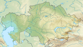
Sergeyev Dam or Sergeyevka Dam (Kazakh: Сергеев бөгені; Russian: Сергеевское водохранилище) is a gravity dam in Shal akyn District, North Kazakhstan Region, Kazakhstan.[2][3]
| Sergeyev Dam | |
|---|---|
 Sergeyev Reservoir Sentinel-2 image. Lake Kishi Torangyl is on the right. | |
| Official name | Сергеев бөгені |
| Country | Kazakhstan |
| Location | Shal akyn District, North Kazakhstan Region |
| Coordinates | 53°42′08″N 67°17′03″E / 53.70222°N 67.28417°E |
| Purpose | Power and water supply |
| Opening date | 1969[1] |
| Owner(s) | RSE "Kazvodkhoz" |
| Dam and spillways | |
| Type of dam | Earth, concrete |
| Impounds | Imanburlyq, Ishim River |
| Height | 150 m (490 ft) |
| Reservoir | |
| Creates | Sergeyev Reservoir |
| Total capacity | 693,000,000 m3 (562,000 acre⋅ft) |
| Surface area | 117 km2 (45 sq mi) |
| Maximum length | 75 km (47 mi) |
| Maximum width | 7 km (4.3 mi) |
| Normal elevation | 138 m (453 ft) |
| Type | Conventional |
| Turbines | 2 |
The dam is located a little upstream from Sergeyev town on the Ishim River, 15 kilometers (9.3 mi) to the southeast of lake Zhaltyr.[2] It has a road bridge, as well as a pumping station for the Sergeev city water supply, which is part of the Ishim Water Supply Network (Kazakh: Есіл су құбыры) that operates in the North Kazakhstan and Akmola Regions.[4]
History
editThe Sergeyevka Dam was commissioned in 1968 at the time of the Kazakh SSR. It had a hydroelectric power station with an installed power generation capacity of 2 MW. The hydroelectric power station building has a bottom spillway. The reservoir of the dam has a maximum storage capacity of 693,000,000 m3 (562,000 acre⋅ft) and a surface area of 117 km2 (45 sq mi). The Imanburlyq, a tributary of the Ishim River, has its mouth in the reservoir.[3]
Currently the power station has a capacity of 3.5 MW with two propeller turbines connected to VGSP 213/29-14 generators with a capacity of 1.23 MW each. The average annual electricity generation is 16 million kWh. The dam is owned by RSE "Kazvodkhoz", which manages 78 reservoirs in Kazakhstan.[1]
See also
editReferences
edit- ^ a b Kazakhstan National Encyclopedia. - Almaty: Kazakh encyclopedias, 2006. - T. V. -ISBN 9965-9908-5-9. (CC BY-SA 3.0)
- ^ a b Google Earth
- ^ a b "N-42 Topographic Chart (in Russian)". Retrieved 18 January 2024.
- ^ Сергеевкая ГЭС – уникальное сооружение и запас его прочности велик
External links
edit- Media related to Sergeyev Dam at Wikimedia Commons
