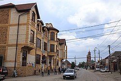
Shalinsky District (Russian: Шали́нский райо́н; Chechen: Шелан кӏошт, Şelan khoşt) is an administrative[1] and municipal[4] district (raion), one of the fifteen in the Chechen Republic, Russia. It is located in the center of the republic. The area of the district is 700 square kilometers (270 sq mi).[citation needed] Its administrative center is the town of Shali.[1] Population: 115,970 (2010 Census);[2] 68,862 (2002 Census);[6] 136,590 (1989 Soviet census).[7] The population of Shali accounts for 41.1% of the district's total population.[2]
Shalinsky District
Шалинский район | |
|---|---|
| Other transcription(s) | |
| • Chechen | Шелан кӏошт |
 Town of Shali, Shalinsky District | |
 Location of Shalinsky District in the Chechen Republic | |
| Coordinates: 43°9′N 45°54′E / 43.150°N 45.900°E | |
| Country | Russia |
| Federal subject | Chechen Republic[1] |
| Established | 1920 |
| Administrative center | Shali[1] |
| Area | |
• Total | 700 km2 (300 sq mi) |
| Population | |
• Total | 115,970 |
| • Density | 170/km2 (430/sq mi) |
| • Urban | 41.1% |
| • Rural | 58.9% |
| Administrative structure | |
| • Administrative divisions | 1 Town administrations, 1 Urban-type settlements, 8 Rural administrations |
| • Inhabited localities[1] | 1 cities/towns, 1 Urban-type settlements[3], 8 rural localities |
| Municipal structure | |
| • Municipally incorporated as | Shalinsky Municipal District[4] |
| • Municipal divisions[4] | 1 urban settlements, 9 rural settlements |
| Time zone | UTC+3 (MSK |
| OKTMO ID | 96637000 |
| Website | http://shalinsky.ru/ |
Healthcare
editState health facilities in the district are represented by one central district hospital in Shali and one district hospital in Chiri-Yurt.
References
editNotes
edit- ^ a b c d e Decree #500
- ^ a b c Russian Federal State Statistics Service (2011). Всероссийская перепись населения 2010 года. Том 1 [2010 All-Russian Population Census, vol. 1]. Всероссийская перепись населения 2010 года [2010 All-Russia Population Census] (in Russian). Federal State Statistics Service.
- ^ The count of urban-type settlements may include the work settlements, the resort settlements, the suburban (dacha) settlements, as well as urban-type settlements proper.
- ^ a b c Law #10-RZ
- ^ "Об исчислении времени". Официальный интернет-портал правовой информации (in Russian). June 3, 2011. Retrieved January 19, 2019.
- ^ Federal State Statistics Service (May 21, 2004). Численность населения России, субъектов Российской Федерации в составе федеральных округов, районов, городских поселений, сельских населённых пунктов – районных центров и сельских населённых пунктов с населением 3 тысячи и более человек [Population of Russia, Its Federal Districts, Federal Subjects, Districts, Urban Localities, Rural Localities—Administrative Centers, and Rural Localities with Population of Over 3,000] (XLS). Всероссийская перепись населения 2002 года [All-Russia Population Census of 2002] (in Russian).
- ^ Всесоюзная перепись населения 1989 г. Численность наличного населения союзных и автономных республик, автономных областей и округов, краёв, областей, районов, городских поселений и сёл-райцентров [All Union Population Census of 1989: Present Population of Union and Autonomous Republics, Autonomous Oblasts and Okrugs, Krais, Oblasts, Districts, Urban Settlements, and Villages Serving as District Administrative Centers]. Всесоюзная перепись населения 1989 года [All-Union Population Census of 1989] (in Russian). Институт демографии Национального исследовательского университета: Высшая школа экономики [Institute of Demography at the National Research University: Higher School of Economics]. 1989 – via Demoscope Weekly.
Sources
edit- Президент Чеченской Республики. Указ №500 от 30 ноября 2005 г. «Об утверждении перечня субъектов административно-территориального устройства Чеченской Республики». Вступил в силу 30 ноября 2005 г.. Опубликован: База данных "Консультант-плюс". (President of the Chechen Republic. Decree #500 of November 30, 2005 On Adopting the List of the Entities Within the Administrative-Territorial Structure of the Chechen Republic. Effective as of November 30, 2005.).
- Парламент Чеченской Республики. Закон №10-РЗ от 20 февраля 2009 г. «Об образовании муниципального образования Шалинский район и муниципальных образований, входящих в его состав, установлении их границ и наделении их соответствующим статусом муниципального района, городского и сельского поселения», в ред. Закона №21-РЗ от 28 июня 2010 г «О внесении изменений в некоторые законодательные акты Чеченской Республики». Вступил в силу по истечении 10 дней после официального опубликования. Опубликован: "Вести Республики", №35 (967), 27 февраля 2009 г. (Parliament of the Chechen Republic. Law #10-RZ of February 20, 2009 On Establishing the Municipal Formation of Shalinsky District and the Municipal Formations It Comprises, on Establishing Their Borders, and on Granting Them the Status of a Municipal District, Urban and Rural Settlement, as amended by the Law #21-RZ of June 28, 2010 On Amending Several Legislative Acts of the Chechen Republic. Effective as of after 10 days from the official publication date have passed.).
