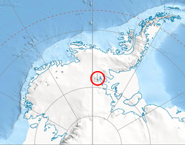
Sowers Glacier (78°37′S 84°59′W / 78.617°S 84.983°W) is a glacier that flows from the prominent cirque on the east side of Craddock Massif and continues between Willis Ridge on the north, and Sanchez Peak and Stolnik Peak on the south, to join Thomas Glacier north of Mount Osborne, in the Sentinel Range, Ellsworth Mountains in Antarctica.
| Sowers Glacier | |
|---|---|
 Location of Sentinel Range in Western Antarctica | |
Location of Sowers Glacier in Antarctica | |
| Type | tributary |
| Location | Ellsworth Land |
| Coordinates | 78°37′00″S 84°59′00″W / 78.61667°S 84.98333°W |
| Thickness | unknown |
| Terminus | Thomas Glacier |
| Status | unknown |

The glacier was named by the Advisory Committee on Antarctic Names (US-ACAN) in 2006 after Todd A. Sowers, Environment Institute, Department of Geosciences, Pennsylvania State University; United States Antarctic Program (USAP) investigator of climate change and abrupt climate change, using isotopes and atmospheric gases, including greenhouse gases, from the ice core record, 1991–2006.[1]
See also
editMaps
edit- Vinson Massif. Scale 1:250 000 topographic map. Reston, Virginia: US Geological Survey, 1988.
- Antarctic Digital Database (ADD). Scale 1:250000 topographic map of Antarctica. Scientific Committee on Antarctic Research (SCAR). Since 1993, regularly updated.
References
edit- This article incorporates public domain material from "Sowers Glacier". Geographic Names Information System. United States Geological Survey.
