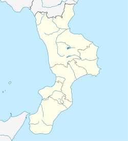
Spilinga is a comune (municipality) in the Province of Vibo Valentia in the Italian region Calabria, located about 70 kilometres (43 mi) southwest of Catanzaro and about 15 kilometres (9 mi) west of Vibo Valentia. As of 31 December 2004, it had a population of 1,665 and an area of 18.7 square kilometres (7.2 sq mi).[3]
Spilinga | |
|---|---|
| Comune di Spilinga | |
 | |
| Coordinates: 38°38′N 15°54′E / 38.633°N 15.900°E | |
| Country | Italy |
| Region | Calabria |
| Province | Province of Vibo Valentia (VV) |
| Frazioni | Panaìa, Monte Poro |
| Area | |
• Total | 18.7 km2 (7.2 sq mi) |
| Elevation | 650 m (2,130 ft) |
| Population (Dec. 2004)[2] | |
• Total | 1,665 |
| • Density | 89/km2 (230/sq mi) |
| Demonym | Spilingesi or Spilingoti |
| Time zone | UTC+1 (CET) |
| • Summer (DST) | UTC+2 (CEST) |
| Postal code | 89864 |
| Dialing code | 0963 |
| Patron saint | San Giovanni Battista (John the Baptist) |
The municipality of Spilinga contains the frazioni (subdivisions, mainly villages and hamlets) Panaìa and Monte Poro.
Spilinga borders the following municipalities: Drapia, Joppolo, Limbadi, Nicotera, Ricadi, Rombiolo, Zungri.
Points of interest
editMadonna delle Fonti
editThe Sanctuary of Madonna della Fontana is set in an ancient hermit cave near the town. The cult of Madonna of the Fountain begins in the early 1900s. The little church was built in 1920[4] in the same place where, as local people say, a woman found a statue of a Virgin Lady by following instructions she received in a dream.
Other points of interest
edit- Church of San Giovanni Battista: built in 1645[5]
- Church of Carciadi: set in the higher point of the town
- Rural aqueduct: about four miles from the town, on the road to Vibo Valentia. Its structure recalls an ancient Roman aqueduct
- Hermits caves: in medieval times, hermits chose these natural caves in the neighborhood of Spilinga as a place to take shelter and pray.[6]
- Ruffa Valley: crossed by the torrent Ruffa.[7] Very interesting for its variety of fauna and flora (among other things, a rare species of fern, Woodwardia radicans). Along the valley there are many old mills, that were an important economic resource till the 1950s.
- Spilinga is the home of 'nduja, a spicy pork paté.
Demographic evolution
edit
References
edit- ^ "Superficie di Comuni Province e Regioni italiane al 9 ottobre 2011". Italian National Institute of Statistics. Retrieved 16 March 2019.
- ^ "Popolazione Residente al 1° Gennaio 2018". Italian National Institute of Statistics. Retrieved 16 March 2019.
- ^ All demographics and other statistics: Italian statistical institute Istat.
- ^ G. Aceto, I Santuari della Diocesi di Mileto-Nicotera-Tropea, Rubbettino Editore, 2003
- ^ "www.comune.spilinga.vv.it".
- ^ G. Musolino, Santi eremiti italogreci. Grotte e chiese rupestri in Calabria, Rubbettino Editore, 2002
- ^ "Statistica delle acque fluenti nel territorio di Tropea".


