Infobox Canada electoral district/testcases Ontario electoral district Ontario electoral district |
|---|
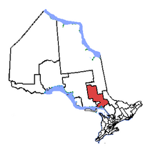
 Nickel Belt in relation to other Ontario electoral districts | | Coordinates: | 46°30′N 81°00′W / 46.5°N 81°W / 46.5; -81
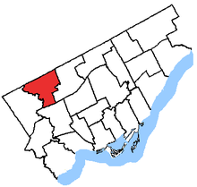
Location of the federal district constituency office in Sudbury (as of 10 June 2011[update]) |
|---|
|
| Legislature | House of Commons |
|---|
| MP | Claude Gravelle
New Democratic |
|---|
| District created | 1952 |
|---|
| First contested | 1953 |
|---|
| Last contested | 2008 |
|---|
| District webpage | profile, map |
|---|
|
| Population (2006) | 89,377 |
|---|
| Electors (2011) | 71,107 |
|---|
| Area (km²) | 34,160 |
|---|
| Pop. density (per km²) | 2.6 |
|---|
| Census division(s) | Greater Sudbury, Sudbury District plus small portions of Timiskaming, Manitoulin, Nipissing and Parry Sound |
|---|
| Census subdivision(s) | Biscotasing, Cartier, French River, Gogama, Greater Sudbury, Killarney, Markstay-Warren, St. Charles, West Nipissing, Whitefish Lake |
|---|
|
Infobox Canada electoral district/testcases Ontario electoral district Ontario electoral district |
|---|
 Nickel Belt in relation to other Ontario electoral districts | | Coordinates: | 46°30′N 81°00′W / 46.5°N 81°W / 46.5; -81
Location of the federal district constituency office in Sudbury (as of 10 June 2011[update]) |
|---|
|
| Legislature | House of Commons |
|---|
| MP | Claude Gravelle
New Democratic |
|---|
| District created | 1952 |
|---|
| First contested | 1953 |
|---|
| Last contested | 2008 |
|---|
| District webpage | profile, map |
|---|
|
| Population (2006) | 89,377 |
|---|
| Electors (2011) | 71,107 |
|---|
| Area (km²) | 34,160 |
|---|
| Pop. density (per km²) | 2.6 |
|---|
| Census division(s) | Greater Sudbury, Sudbury District plus small portions of Timiskaming, Manitoulin, Nipissing and Parry Sound |
|---|
| Census subdivision(s) | Biscotasing, Cartier, French River, Gogama, Greater Sudbury, Killarney, Markstay-Warren, St. Charles, West Nipissing, Whitefish Lake |
|---|
|


