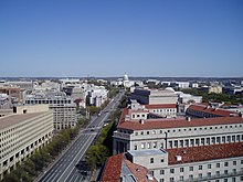
Avenue |
|---|
|
 Description of image | | Native name | Native Name Error {{native name checker}}: parameter value is malformed (help) |
|---|
| Former name(s) | Former Name |
|---|
| Part of | part of |
|---|
| Namesake | namesake |
|---|
| Type | type |
|---|
| Owner | Owner |
|---|
| Maintained by | Maint |
|---|
| Length | 2 km (1.2 mi) |
|---|
| Width | 1 |
|---|
| Addresses | Address |
|---|
| Location | Location |
|---|
| Postal code | Postcode |
|---|
| Nearest metro station | metro |
|---|
| Coordinates | coordinates |
|---|
| From | Start |
|---|
Major
junctions | Junctions |
|---|
| To | End |
|---|
|
| Commissioned | date |
|---|
| Construction start | date |
|---|
| Completion | date |
|---|
| Inauguration | date |
|---|
| Demolished | date |
|---|
|
| Designer | x |
|---|
| Known for | x |
|---|
| Status | x |
|---|
| Website | x |
|---|
|
Avenue |
|---|
|
 Description of image | | Native name | Native Name Error {{native name checker}}: parameter value is malformed (help) |
|---|
| Former name(s) | Former Name |
|---|
| Part of | part of |
|---|
| Namesake | namesake |
|---|
| Type | type |
|---|
| Owner | Owner |
|---|
| Maintained by | Maint |
|---|
| Length | 2 km (1 mi) |
|---|
| Width | 1 |
|---|
| Addresses | Address |
|---|
| Location | Location |
|---|
| Postal code | Postcode |
|---|
| Nearest metro station | metro |
|---|
| Coordinates | coordinates |
|---|
| From | Start |
|---|
Major
junctions | Junctions |
|---|
| To | End |
|---|
|
| Commissioned | date |
|---|
| Construction start | date |
|---|
| Completion | date |
|---|
| Inauguration | date |
|---|
| Demolished | date |
|---|
|
| Designer | x |
|---|
| Known for | x |
|---|
| Status | x |
|---|
| Website | x |
|---|
|

