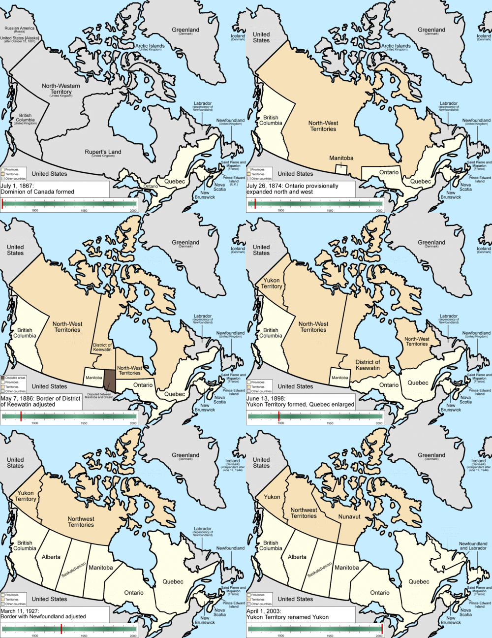
A map showing the territorial evolution of Canada. At Confederation in 1867, four provinces (Ontario, Quebec, New Brunswick, and Nova Scotia) were established from three British colonies. This nascent country continued to accrete new provinces and territories, including Manitoba in 1870, British Columbia in 1871, Prince Edward Island in 1873, and Alberta and Saskatchewan in 1905; previously established provinces also expanded their borders. The most recent province to be added was Newfoundland in 1949; it has since been renamed Newfoundland and Labrador.
Since the cession of the Northwest Territories to Canada in 1870 and 1880, sections of the territory have been converted several times into new territories (Yukon in 1898, Nunavut in 1999) and provinces (Alberta and Saskatchewan), and transferred to expand existing provinces.Animation: Golbez
