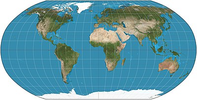
The Robinson projection is a map projection of a world map which shows the entire world at once. It was devised by Arthur H. Robinson in 1963 in response to an appeal from the Rand McNally company for a good compromise to the problem of readily showing the whole globe as a flat image. The company has used the projection since that time, and the National Geographic Society used the Robinson from 1988 to 1998.Map: Strebe, using Geocart
| This picture of the day has been featured on Portal:Geography. |
