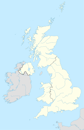
Will be used for Nuclear power in the United Kingdom and associated pages.
Plants (lat, long):
Wales
edit- Trawsfynydd (not operating)
- Latitude: 52° 55′ 30.06″ N (52.92502°)
- Longitude: 3° 56′ 57.23″ W (-3.94923°)
- Wylfa (not operating)
- Latitude: 53° 24′ 59.95″ N (53.41666°)
- Longitude: 4° 28′ 59.24″ W (-4.48312°)
Scotland
edit- Chapelcross nuclear power station (not operating)
- Latitude: 55° 0′ 56.29″ N (55.01562°)
- Longitude: 3° 13′ 33.78″ W (-3.22650°)
- Dounreay - Dounreay Fast Reactor (not operating)
- Latitude: 58° 34′ 49.94″ N (58.58054°)
- Longitude: 3° 44′ 42.83″ W (-3.74521°)
- Dounreay - Prototype Fast Reactor (not operating)
- Latitude: 58° 34′ 41.48″ N (58.57819°)
- Longitude: 3° 45′ 07.60″ W (-3.75211°)
- Hunterston A nuclear power station (not operating)
- Latitude: 55° 43′ 11.48″ N (55.71986°)
- Longitude: 4° 53′ 47.82″ W (-4.89662°)
- Hunterston B nuclear power station (not operating)
- Latitude: 55° 43′ 19.51″ N (55.72209°)
- Longitude: 4° 53′ 24.31″ W (-4.89009°)
- Torness nuclear power station
- Latitude: 55° 58′ 04.77″ N (55.96799°)
- Longitude: 2° 24′ 32.68″ W (-2.40908°)
England
edit- Berkeley nuclear power station (not operating)
- Latitude: 51° 41′ 33″ N 51.6925°
- Longitude: 2° 29′ 37″ W -2.493611°
- Bradwell Power Station (not operating)
- Latitude: 51° 44′ 28.56″ N 51.741266°
- Longitude: 0° 53′ 48.76″ E 0.896879°
- Culham (JET)
- Latitude: 51° 39′ 13″ N (51.634°)
- Longitude: 1° 13′ 37″ W (-1.227°)
- Dungeness A Power Station (not operating)
- Latitude: 50° 54′ 50″ N 50.913889°
- Longitude: 0° 57′ 50″ E 0.963889°
- Dungeness B Power Station (not operating)
- Latitude: 50° 54′ 50″ N 50.913889°
- Longitude: 0° 57′ 50″ E 0.963889°
- Hartlepool nuclear power station
- Latitude: 54° 38′ 6.12″ N 54.635034°
- Longitude: 1° 10′ 51.02″ W -1.18084°
- Harwell (decommissioned)
- Latitude: 51° 34′ 32″ N (51.576°)
- Longitude: 1° 18′ 49″ W (-1.314°)
- Heysham 1 Power Station
- Latitude: 54° 2′ 0″ N 54.033333°
- Longitude: 2° 54′ 0″ W -2.9°
- Heysham 2 Power Station
- Latitude: 54° 2′ 0″ N 54.033333°
- Longitude: 2° 54′ 0″ W -2.9°
- Hinkley Point A nuclear power station (not operating)
- Latitude: 51° 12′ 30.81″ N 51.208559°
- Longitude: 3° 7′ 49.52″ W -3.130424°
- Hinkley Point B nuclear power station (not operating)
- Latitude: 51° 12′ 30.81″ N 51.208559°
- Longitude: 3° 7′ 49.52″ W -3.130424°
- Hinkley Point C nuclear power station
- Latitude: 51° 12′ 30.81″ N 51.208559°
- Longitude: 3° 7′ 49.52″ W -3.130424°
- Oldbury nuclear power station (decommissioned)
- Latitude: 51° 38′ 56″ N 51.648889°
- Longitude: 2° 34′ 15″ W -2.570833°
- Sellafield (decommissioning)
- Latitude: 54° 25′ 12″ N 54.42°
- Longitude: 3° 30′ 0″ W -3.5°
- Sizewell A nuclear power station (not operating)
- Latitude: 52° 12′ 49″ N 52.213611°
- Longitude: 1° 37′ 6″ E 1.618333°
- Sizewell B nuclear power station
- Latitude: 52° 12′ 49″ N 52.213611°
- Longitude: 1° 37′ 6″ E 1.618333°
- Winfrith (decommissioned)
- Latitude: 50° 41′ 05.37″ N (50.68483°)
- Longitude: 2° 15′ 43.51″ W (-2.26209°)
Based on:
