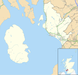
55°27′32″N 5°17′19″W / 55.45897°N 5.288585°W
 Torr a'Chaisteal | |
Shown within the Isle of Arran, Scotland | |
| Location | Isle of Arran |
|---|---|
| Coordinates | 55°27′32″N 5°17′19″W / 55.45897°N 5.288585°W |
| Type | Dun |
| History | |
| Periods | Iron Age |
| Site notes | |
| Ownership | Historic Scotland |
| Public access | Yes |
Torr a'Chaisteal (or Torr a'Chaisteil) is an Iron Age fort (dun), located about 1 mile (2 kilometres) northeast of the village of Sliddery, on the Isle of Arran in Scotland (grid reference NR92172326).
Description
editTorr a'Chaisteal is situated on an isolated grassy knoll on the west coast of Arran.[1]
It was a fortified residence, or dun, of a type common across western Scotland in the later Iron Age.[1] A similar structure can be seen at Kilpatrick Dun 2+1⁄2 mi (4 km) to the north.[2] The turf-covered walls are 0.5 metres high and have an average width of 4 metres.[3] The walls are formed of large sandstone boulders, enclosing an area with a diameter of around 7 metres.[1] A short stretch of wall lies beside the dun to the east, while on the landward approach is a substantial earthwork that may have formed an outer defence.[1]
Antiquarian excavations in the 19th century uncovered human and animal bones, shells, the top stone of a quern, and pieces of haematite iron.[3]
References
edit- ^ a b c d Torr A'chaisteal Fort, Historic Scotland, accessed 2 May 2014
- ^ Kilpatrick Dun (or Cashel), Historic Scotland, accessed 2 May 2014
- ^ a b Historic Environment Scotland. "Arran, Torr A' Chaisteil (39674)". Canmore. Retrieved 2 May 2014.
External links
editMedia related to Torr a'Chaisteal Fort at Wikimedia Commons
