User:Kew Gardens 613/List of closed New York City Subway entrances

This is a list of New York City Subway entrances that have been closed, demolished, or were planned to be closed, and those that have been reopened. This list does not include entrances to stations that have been closed or for stations that have been demolished. Many entrances were closed between the 1970s and 1990s due to concerns over crime, low ridership, and to cut costs by reducing station staffing. The two main waves of closings occurred in 1976 and 1991, as the country was in the midst of recessions. As crime has decreased, and as ridership has gone up, these entrances, for the most part have not been revisited. During some station renovation projects, closed entrances have been reopened.
Much of this information comes from websites such as stationreporter.net (now defunct), subwaynut.com, nycsubway.org, old photos, old tax photos, aerial photos, Google Maps streetview, public hearing notices, NYCTA board materials, newspaper clippings, Google Books, personal observations, whether they are images or memories of using the entrances in question, and through research done as part of Alan Minor's master's thesis.[1] This list is on Wikipedia–a subpage of my userpage–so that this list can be crowdsourced and can be easily added to, and with citations. One of the goals of this list is to migrate the information from here to the relevant articles once they are sufficiently referenced. Another main purpose is to eventually create an article in the mainspace, which would require a lot of research. Proper citations would be appreciated, whether they are newspaper articles detailing their closure, New York City Transit Authority (NYCTA) documentation, or images showing their existence. Additional information would be appreciated, including additional locations where closed entrances are located, the locations of demolished/removed entrances, more specific locational information including street corners and on mezzanine, the existence of entrances to private buildings and underground passageways connecting stations, and dates when the entrances in question closed, and if possible, why they closed.
In response to a request made by State Senator Martin Dilan, the Metropolitan Transportation Authority (MTA) stated that 119 stations either had a closed street stair or closed control area, and that 130 stations had closed entrances. Within these 130 stations, there are 114 closed control areas and 298 closed street stairs. 188 of these were connected to closed control areas, with the remainder connected to control areas that remain open.[2]
A history of closed New York City Subway entrances can be found here: User:Kew Gardens 613/History of closed New York City Subway entrances
Lists
editReopened entrances
editAs part of some station rehabilitation projects, closed subway entrances have been reopened. Reopening a subway entrance requires bringing stairs up to existing standards, including adding treads to them and evening them out. Turnstiles, security camera, signage, fare machines and Help Points also have to be installed.[3]
Closed street entrances
edit| Station | Division | Line | Borough | Location/Quantity | Date closed | Control area | Ridership (2017)[4] | Ridership rank out of 425 (2017)[4] | Number of exit points | ADA Accessible? |
|---|---|---|---|---|---|---|---|---|---|---|
| 45th Street | B (BMT) | Fourth Avenue Line | Brooklyn | Southwestern corner of 46th Street and Fourth Avenue (1); stair S1[5][6][7][8][note 1]
The board's chairman wanted it to be sealed up, so the entrance was closed at the board's request.[12][13]
|
c. 1979[12] | 2,390,684 | 205 | 1 | No | |
| Atlantic Avenue–Barclays Center | A (IRT)
B (BMT) |
Eastern Parkway Fourth Avenue Line Brighton Line |
Brooklyn | South side of Flatbush Avenue, between Atlantic Avenue and Pacific Street (2); stairs S1 and S3.[14][15][16][17][18]
|
1940-1980[note 2] | 13,571,093 | 21 | Yes | ||
Both southern corners of Atlantic Avenue and Fourth Avenue (2); stairs S3 and S4[21][22][23]
|
c. 1982[note 3] | |||||||||
| Atlantic Avenue | B (BMT) | Canarsie Line | Brooklyn | Southeastern corner of East New York Avenue and Van Sinderen Avenue (1); stair S2[25] | By 1948 | 557,103 | 403 | 1 | No | |
| Avenue M | B (BMT) | Brighton Line | Brooklyn | North side of Avenue M (1); stair S1/P9[28][29][30]
|
N/A | 1,828,941 | 261 | 1 (2 for northbound) | No | |
| Avenue U | South side of Avenue U (1); stair S1/P1[31][32][33][29]
|
Before 1947[note 4] | B025A | 2,360,833 | 210 | 1 | No | |||
| Bedford–Nostrand Avenues | B (IND) | Crosstown Line | Brooklyn | Both western corners of Bedford Avenue and Lafayette Avenue (2); stairs S7 and S8[35][36][37] | 2005[note 5] | (still open) | 2,779,124 | 186 | 2 | No |
Both eastern corners of Nostrand Avenue and Lafayette Avenue (2), Stairs S1 and S2[35][37][36][43][44][45]
|
1983-1988 | (still open) | ||||||||
| Bergen Street | A (IRT) | Eastern Parkway Line | Brooklyn | Northwestern corner of 6th Avenue and Bergen Street (1), Stair S6[47][48][49][50][51]: 365 | 1980-1986[54] | (still open) | 1,180,684 | 331 | No | |
| Bergen Street | B (IND) | Culver Line | Brooklyn | Southwestern corner of Warren Street and Smith Street, Stair S6 (1)[14][55]: 6 [56][57][58]
|
1940[62]-1965[63][64] | (still open) | 3,525,144 | 143 | No | |
| Broadway | B (IND) | Crosstown Line | Brooklyn | Northeastern corner of Montrose Avenue and Union Avenue; stair S8 (1)[65][66] | 1941-1958 | N411 | 1,385,797 | 312 | 1 | No |
Southeastern corner of Montrose Avenue and Union Avenue; stair S6 (1)[65]
|
1941-1967[70][71] | N411 | ||||||||
| Northwestern corner of Johnson Avenue and Union Avenue; stair S5 (1)[65][66] | N/A | |||||||||
Northwestern corner of South 5th Street and Union Avenue; stair S7 (1)[66][65]
|
1941-1967[71][72] | |||||||||
| Broadway Junction | B (BMT/IND) | Jamaica Line | Brooklyn | Both eastern corners of Eastern Parkway and Broadway, stairs S1 and S2 (2)[73]
|
1989-1994[77][78] | J019 | 2,911,532 | 179 | 1 | No; planned |
| Carroll Street | B (IND) | Culver Line | Brooklyn | Northeastern corner of 3rd Street and Smith Street; stair S2 (1)[47][55]: 8 [79][80][81][82] | 1934[85][86][87] | 3,537,661 | 142 | 2 | No | |
| Southwestern corner of 2nd Place and Smith Street; stair S1 (1)[47][55]: 8 [79][84][80][88] | 1933-1949[91][92] | |||||||||
| Chauncey Street | B (BMT) | Jamaica Line | Brooklyn | Southwestern corner of Marion Street and Broadway (1); stair S1/P1[93][94][95] | After February 2, 1999[99]: 1:51:13 | J018[8] | 1,095,638 | 340 | 1 | No |
Northwestern corner of Pilling Street and Broadway (1); stair S2/P2[93][95][94]
| ||||||||||
| Church Avenue | A (IRT) | Nostrand Avenue Line | Brooklyn | Second staircase to southwestern corner of Church Avenue and Nostrand Avenue (1)[100][101]
|
c. 1997 | 2,916,680 | 178 | 1 | Yes | |
| DeKalb Avenue | B (BMT) | Fourth Avenue Line Brighton Line |
Brooklyn | Passageway to southeastern corner of Willoughby Street and Flatbush Avenue Extension (1); stair S7[14][102][103]
|
April 1991 (emergency)[105] c. 1992[106] |
Yes | ||||
| Eastern Parkway–Brooklyn Museum | A (IRT) | Eastern Parkway Line | Brooklyn | Eastern Parkway between Underhill Avenue and Washington Avenue, stairs S3 and S4 (2)[107][43][108]
|
1966[110][111][112]-1985[113] | R620[8] | 1,530,635 | 301 | 1 | Yes |
| Flushing Avenue | B (IND) | Crosstown Line | Brooklyn | Southeast corner of Walton Street and Union Avenue (1), Stair S3[65][51]: 2602 [114]
|
c. 1984[note 6] | N413 | 849,840 | 378 | 1 | No |
| Fort Hamilton Parkway | B (IND) | Culver Line | Brooklyn | Northeastern corner of Prospect Avenue and Reeve Place (1)[5][121][122]
|
1934-1941[note 7] | 1,786,458 | 267 | No | ||
| Franklin Avenue–Fulton Street[125] | B (IND/BMT) | Fulton Street Line | Brooklyn | Northeastern corner of Classon Avenue and Fulton Street; stair S4 (1)[35][126][51]: 1230 | 1953-1965[note 8] | N113A | 2,058,258 | 239 | 1 | Yes |
Southeastern corner of Classon Avenue and Fulton Street; stair S3 (1)[35][126][51]: 1230 [132][133][134][131]
|
after August 1992[140] | N114A | ||||||||
| Gates Avenue | B (BMT) | Jamaica Line | Brooklyn | Northwest corner of Palmetto Street and Broadway (1), Stair S2/P2[35]
|
After April 17, 1990[142]: 10:21 | J014 | 2,262,915 | 219 | 1 | No |
Southwest corner of Monroe Street and Broadway (1), Stair S1/P1[35][143]
| ||||||||||
| Halsey Street | Eastern corners of Jefferson Avenue and Broadway (2), Stairs S3 and S4[93][145][146]
|
1965[148][149][129]-1986[150]: 145, 275 | J015[8] | 2,131,177 | 233 | 1 | No | |||
| Hoyt–Schermerhorn Streets | B (IND) | Crosstown Line
Fulton Street Line |
Brooklyn | Passage from the Bond Street exit to the southwestern corner of Bond Street and Livingston Street & now-defunct McCrory Stores (originally Loeser's Department Store), Stair S9[14][151][152][153][154][155]
|
April 1991 (Emergency) 1992[106] |
3,264,293 | 157 | No; planned | ||
South side of Schermerhorn Street, west of Hoyt Street (1), Stair S6[126][160]
|
By 1950 | |||||||||
North side of Schermerhorn Street, west of Hoyt Street, under 187 Schermerhorn Street (1), Stair S7[126][160][14]
|
N/A | |||||||||
Northeastern corner of Bond Street and Schermerhorn Street, under 33 Bond Street, Stairs S2 (on Schermerhorn Street) and S10 (on Bond Street) (2)[160][14]
|
After 1942[164][165] | |||||||||
Southeastern corner of Bond Street and Schermerhorn Street (1), Stair S1[160]
|
N/A | |||||||||
North side of Schermerhorn Street, under 231 Schermerhorn Street, Stair S3 (1)[160][14][154]
|
By 1940 | |||||||||
| Hoyt Street | A (IRT) | Eastern Parkway Line | Brooklyn | Northwestern corner of Fulton Street and Duffield Street (1), Stair S4[14] | 1985 c. March 1988 (permanent) |
(still open) | 2,137,478 | 232 | No | |
| Jay Street–MetroTech | B (IND/BMT) | Fulton Street Line
Culver Line Fourth Avenue Line |
Brooklyn | Southern corners of Fulton Street and Smith Street (IND only) (2), Stairs S1 and Stair S7[14][55]: 22 [43][168] | 1980[174]-1986[175][176] | N105[177] | 13,007,176 | 22 | Yes | |
| Junius Street | A (IRT) | New Lots Line | Brooklyn | Western corners of Junius Street and Livonia Avenue (2)[178][8]
|
1980-1988 | R631 | 298,119[a] | 417 | 1 | No; planned |
| Kosciuszko Street | B (BMT) | Jamaica Line | Brooklyn | Eastern corners of DeKalb Avenue and Broadway, Stairs S3/P3 and S4/P4 (2)[35][145][179][180][181]
|
1974[183][184][185][186]-1986[150]: 145, 269 | J011[8] | 1,979,192 | 248 | 1 | No |
| Metropolitan Avenue/Lorimer Street | B (IND/BMT) | Crosstown Line
Canarsie Line |
Brooklyn | Northern corners of Grand Street and Union Avenue (IND only) (2), Stairs S1 and S2[65][187][188][189][190][191][192]: D.31
|
2000[194] | (still open) | 5,010,601 | 97 | 3 | Yes |
Southeastern corner of Union Avenue and Metropolitan Avenue, stair S8.[65][55]: 26 [192]: D.31 [195]
|
(still open) | |||||||||
| Morgan Avenue | B (BMT) | Canarsie Line | Brooklyn | Northeastern corner of Morgan Avenue and Harrison Place (1), Stair S2[65][197][198][51]: 2890
|
2011 or earlier[note 9] | (still open) | 2,594,607 | 195 | 2 | No |
| Myrtle–Willoughby Avenues | B (IND) | Crosstown Line | Brooklyn | Northwestern corner of Willoughby Avenue and Marcy Avenue, stair S1 (1)[35][200][201] | c. 1976-1977[205][206] | N415A | 1,765,653 | 268 | 1 | No |
| Southeastern corner of Willoughby Avenue and Marcy Avenue, stair S2 (1)[35][200][201] | N416A | |||||||||
| Myrtle–Wyckoff Avenues | B (BMT) | Canarsie Line
Myrtle Avenue Line |
Brooklyn | Northern side of Myrtle Avenue between Gates Avenue and Wyckoff Avenue[207]
|
2007 | |||||
| Prospect Park | B (BMT) | Brighton Line
Franklin Avenue Line |
Brooklyn | East side of Ocean Avenue between Flatbush Avenue and Lincoln Road, stair S1.
Southwestern corner of Ocean Avenue and Flatbush Avenue, stair S4.
|
c. 1992[210][106] | Yes | ||||
| Ralph Avenue | B (IND) | Fulton Street Line | Brooklyn | Western corners of Howard Avenue and Fulton Street (2), Stairs S1 and S2[35][211][212] | c. 1992[217][106] | N121C[8] | 1,894,817 | 258 | 1 | No |
Southwestern corner of Ralph Avenue and Fulton Street (1), Stair S5[35][211][218][219][51]: 1251
|
||||||||||
| Rockaway Avenue | B (IND) | Fulton Street Line | Brooklyn | Eastern corners of Thomas S Boyland Street and Fulton Street (2), Stairs S5 and S6[220][221] | 1968[227][228]-1980[229] | 1,794,365 | 264 | 2 | No | |
| Seventh Avenue | B (BMT) | Brighton Line | Brooklyn | Northern corners of Sterling Place and Flatbush Avenue (2), stairs S1 and S2[47][230][231][232]: 627 [233]
|
1965[237][238][239][240]-1980[241][242] | B005 | 5,105,535 | 90 | 1 | No |
| Sutter Avenue | B (BMT) | Canarsie Line | Brooklyn | Eastern corners of Belmont Avenue and Van Sinderen Avenue (2)[243] | 1980-1986[150]: 304–305 | H036 | 1,394,283 | 311 | 1 | No |
| Pedestrian footbridge to western corners of Junius Street and Belmont Avenue (2)[252][253][254] | ||||||||||
| Utica Avenue | B (IND) | Fulton Street Line | Brooklyn | Northwestern corner of Stuyvesant Avenue and Fulton Street (1)[35][256]
|
N/A |
2 | Yes | |||
North side of Fulton Street between Stuyvesant Avenue and Utica Avenue (1)[35]
|
||||||||||
| 5th Avenue/53rd Street | B (IND) | Queens Blvd Line | Manhattan | Southeast corner of 53rd Street and Fifth Avenue (1)[257]
|
Before 1953 | 2 | No; planned | |||
| 14th Street/ | B (IND/BMT) | Eighth Avenue Line
Canarsie Line |
Manhattan | Southern corners of 17th Street and Eighth Avenue (2),[258][126][259] Stairs S9 and S10 | 1994-1995 | 14,153,266 | 19 | 3 | Yes | |
| 14th Street/Sixth Avenue | B (BMT) | Canarsie Line | Manhattan | North side of 14th Street between 5th Avenue and 6th Avenue.[258][262]
|
by 1931[264] | 2 | No; planned | |||
| 28th Street | B (BMT) | Broadway Line | Manhattan | Eastern corners of 29th Street and Broadway (2), Stairs S5 and S7[265][51]: 3650 [266][267][268][269] | After 1953[270][271] | A026 | 4,065,263 | 126 | 1 | No |
Western corners of 29th Street and Broadway, Stairs S6 and S8 (2)[265][51]: 3650 [272][273][269]
|
A028 | |||||||||
| (passage between 14th Street/Sixth Avenue and 14th Street/Eighth Avenue) | Manhattan |
No exits |
April 1991 | 0 | ||||||
| (passage between 34th Street–Herald Square and 34th Street–Penn Station) | A (IRT)/
B (IND) |
Broadway–Seventh Avenue Line
Sixth Avenue Line |
Manhattan | To Pennsylvania Station under 33rd Street.
|
1986[277] | 0 | ||||
| (passage between 34th Street–Herald Square and 42nd Street–Bryant Park) | B (IND) | Sixth Avenue Line | Manhattan | Northwestern, northeastern, & southeastern corners of Sixth Avenue and 38th Street (3); stairs S1, S2, & S3[278][279][280][281][282][283]
|
March 21, 1991 | 0 | ||||
| (passage between 50th Street and 50th Street) | A (IRT) B (IND) |
Broadway—Seventh Avenue Line
Eighth Avenue Line |
Manhattan | Paramount Plaza at the Northwestern corner of 50th Street and Broadway[285] | After September 11, 2001,
2011-2017[288] |
|||||
| 34th Street–Herald Square | B (BMT/IND) | Broadway Line Sixth Avenue Line |
Manhattan | Southwestern corner of 33rd Street and Sixth Avenue (1)[8][289]
|
After 1940 | 39,672,507 | 3 | Yes | ||
| Northwestern corner of 33rd Street and Sixth Avenue; stair SB2 (1)[265] | N/A | |||||||||
Southeastern corner of Sixth Avenue and 34th Street; stair S3 (BMT)[274][265] (1)
|
c. 1941[291] | |||||||||
| 34th Street–Penn Station | A (IRT) | Broadway–Seventh Avenue Line | Manhattan |
Passage to Amtrak concourse of Penn Station, B level (1) |
early 1990s[294] | 26,034,238 | 6 | 3 | Yes | |
|
Stair down to LIRR concourse of Penn Station; stair O7 and (2)[292][295]: S.4-21
| ||||||||||
Passage to southeastern corner of 32nd Street and Seventh Avenue (1)[265][297][298]
|
1995 | |||||||||
| 34th Street–Penn Station | B (IND) | Eighth Avenue Line | Manhattan | Southwestern corner of 33rd Street and Eighth Avenue (1)[299]: F-538, F-541
|
N/A | (still open) | 3 | Yes | ||
Southeastern corner of 34th Street and Eighth Avenue (1)[299]: F-538, F-543
|
N/A | (still open) | ||||||||
| 42nd Street–Bryant Park/Fifth Avenue | A (IRT) B (IND) |
Flushing Line
Sixth Avenue Line |
Manhattan | Southwestern corner of Sixth Avenue and 40th Street, Stair S4 | 2012-2013 | 16,594,289 | 14 | 4 | No; planned | |
| 49th Street | B (BMT) | Broadway Line | Manhattan | Southeastern corner of 47th Street and Seventh Avenue (2)[265][302][303] | c. 1989 | 8,626,669 | 38 | 2 | Partially (Uptown-only; Downtown planned) | |
| 50th Street | B (IND) | Eighth Avenue Line | Manhattan | Southeastern corner of 52nd Street and Eighth Avenue (1)[308]: F-506
|
N/A | N052 | 6,694,422 | 65 | 2 | Partially (Downtown-only) |
Eastern corners of 52nd Street and Eighth Avenue (3), Stairs S15, S16, and S17[51]: 1174 [309]
|
April 1991 (emergency) 1992 (finalization)[106]: E.30 | |||||||||
Western corners of 52nd Street and Eighth Avenue (2), Stairs S13 and S14[51]: 1174 [309]
|
N053 | |||||||||
|
Southwestern corner of 51st Street and Eighth Avenue (southbound only) (1), Stair S11[51]: 1174 [309]
|
1992[106] | N055 | ||||||||
Southeastern corner of 50th Street and Eighth Avenue (2)[308]: F-505
|
||||||||||
Northwestern corner of 50th Street and Eighth Avenue (1)[308]: F-502
|
||||||||||
| Southwestern corner of 50th Street and Eighth Avenue through Madison Square Garden (1)[308]: F-502 | Before 1969 | |||||||||
| Madison Square Garden (1)[308]: F-502 | ||||||||||
Southeastern corner of 49th Street and Eighth Avenue (northbound only) (1), Stair S3[309]
|
Before 1969[312] | N058 | ||||||||
| 59th Street–Columbus Circle | A (IRT)/
B (IND) |
Broadway–Seventh Avenue Line
Eighth Avenue Line |
Manhattan | Northwestern corner of 61st Street and Central Park West; stair S6[309][313][314]: 87–88, 320, 325
|
1937[319]-1980 c. 1994-1995[316]: E.3 |
N048 | 22,929,203 | 8 | Yes | |
| 72nd Street | B (IND) | Eighth Avenue Line | Manhattan | Southwestern corner of 71st Street and Central Park West, with a connection between platforms concurrent with former exit location, Stair S2 (1)[320][230][126][321][322][323] | 1932-1970s[326] | N046A[8] | 2,799,974 | 183 | 2 | No |
| 96th Street | B (IND) | Eighth Avenue Line | Manhattan | Western corners of 95th Street and Central Park West, with a connection between platforms concurrent with former exit location (2), stairs S1 and S2.[320][51]: 1165 [126][327][328] | November 1932[331] | N041[8] | 2,887,965 | 180 | 2 | No; planned |
| 103rd Street | Western corners of 104th Street and Central Park West, with a connection between platform concurrent with former exit location (2)[320][230][126][332], Stairs S4 and S5[333] | November 1932[331] | N036 | 1,470,838 | 309 | 1 | No | |||
| Southwestern corner of 102nd Street and Central Park West, with a connection between platforms concurrent with former exit location (2),[320][230][337][338] Stairs S1 and S2[333] | After 1940 | N038 | ||||||||
| 110th Street | A (IRT) | Lexington Avenue Line | Manhattan | Southeastern corner of 111th Street and Lexington Avenue, Stair S6[339][51]: 498 [230][8][340][341] | April 1991 (emergency) c. 1992[217][106] |
R253X | 3,734,660 | 135 | 1 | No; planned |
Southwestern corner of 111th Street and Lexington Avenue, Stair S5[339][51]: 498 [188][8]
|
1965[343][129]-1980s | R255 | ||||||||
| 110th Street | B (IND) | Eighth Avenue Line | Manhattan | Northwestern corner of 109th Street and Central Park West, Stair S3 (1)[320][344]
|
1995[345]-1997[346] | 2,377,135 | 207 | 1 (2 for downtown) | No | |
Northwestern corner of 111th Street and Frederick Douglass Boulevard, Stair S6 (1)[344][347]
|
1932-1963 | N032 | ||||||||
Northeastern corner of 111th Street and Frederick Douglass Boulevard, Stair S7 (1)[344]
|
1932-1940 c. 1992[106] |
N031 | ||||||||
Northeastern corner of 110th Street and Central Park West, Stair S5 (1)[55]: 100 [346][344]
|
c. 1963[126][350][351] | N033 | ||||||||
| 116th Street | Northeastern corner of 118th Street and Frederick Douglass Boulevard (1), Stair S4[126][352][353] | 1932-1941 | N027[8] | 2,253,473 | 222 | 1 | No | |||
Northwestern corner of 118th Street and Frederick Douglass Boulevard (1), Stair S3[126][352][353][357]
|
N028[8] | |||||||||
| 125th Street | East side of St. Nicholas Avenue between 125th Street and 124th Street (1), stair S1[51]: 2195 [361]
|
ּBefore 1984[356] | (still open) | 9,335,382 | 32 | 2 | Yes | |||
Southeastern and northwestern corners of 126th Street and St. Nicholas Avenue (2), stairs S4, S7[363][126][51]: 2195 [364][365]
|
1962[369]-1981[366] | (still open) | ||||||||
| 145th Street | B (IND) | Concourse Line
Eighth Avenue Line |
Manhattan | Northwestern corner of St. Nicholas Avenue and 146th Street (1), Stair S5[363][370][371][372] | c. 1992[375] | 7,714,122 | 48 | 2 | No | |
| 155th Street | B (IND) | Eighth Avenue Line | Manhattan | Southern corners of 153rd Street and St. Nicholas Avenue; stairs S1 and S2 (2)[363][376][377][378]
|
July 1989[382] | N018 | 887,427 | 373 | 1 | No |
| 163rd Street | Southern corners of 163rd Street and St. Nicholas Avenue (3)[383][384], Stairs S4, S5, S6[385] | c. March 1988[76] | N015[8] | 1,437,340 | 310 | 1 | No | |||
| 168th Street | A (IRT) B (IND) |
Broadway–Seventh Avenue Line Eighth Avenue Line |
Southeastern corner of 167th Street and St. Nicholas Avenue,[383][387] Stairs S3 and S8 (2)[388][389][384]
|
April 1991 (emergency) c. 1992[106] |
N014 | 7,945,871 | 45 | 3 | Partially (IND only; IRT planned) | |
Mitchel Square Park, south side of 167th Street, Stairs S1 and S2 (2)[383][388][390]
|
1984[384]-1991 | N014A | ||||||||
| 175th Street | B (IND) | Eighth Avenue Line | Passageway to southeastern corner of 174th Street and Fort Washington Avenue, Stair S1 (1)[383][391][392] | 1984[384]-1988 | 4,112,450 | 124 | 2 | Yes | ||
| 190th Street | B (IND) | Eighth Avenue Line | Manhattan | Margaret Corbin Drive near Cabrini Boulevard, Stair S4 (1)[396][397]
|
N/A | 1,494,996 | 303 | 2 | No | |
| Bowery | B (BMT) | Nassau Street Line | Manhattan | Western mezzanine to western corners of Kenmare Street and Bowery, Stairs S1 and S2 (2)[258][398][399]
|
1941[401][402]-1980s[403] | 1,327,970 | 321 | 1 | No | |
| Median of Delancey Street east of Bowery (1)[399][404] | 1910-1941[405] | |||||||||
| Broad Street |
Southwestern corner of Broad Street and Wall Street, outside the New York Stock Exchange; stairs S5 and S7 (2)[406]
|
2002 (S7) 2012 (S5) |
2,056,754 | 240 | No; In progress | |||||
Northwestern corner of Cedar Street and Nassau Street (1)[406][411][412][413]
|
1999[414] | |||||||||
West side of Nassau Street between Pine Street and Wall Street, Stair S3 (1)[412][406]
|
c. 1992[415] | |||||||||
Southwestern corner of Broad Street and Exchange Place, Stair S11 (1)[406]
|
||||||||||
| Broadway/Lafayette Street/ | B (IND)
A (IRT) |
Sixth Avenue Line
Lexington Avenue Line |
Manhattan | Western corners of Broadway and Houston Street (2),[258][416] Stairs S10 and S11
|
January 26th, 1989 - 1997[417][418] | 11,956,465 | 24 | Yes | ||
Northeastern corner of Houston Street and Mercer Street (1),[258][416] Stair S12
|
||||||||||
Second stairway to the northwestern corner of Lafayette Street and Houston Street (1)[419]: F-510
|
N/A | |||||||||
Northwestern corner of Houston Street and Mulberry Street (2)[419]: F-510
|
N/A | |||||||||
Western corners of Bleecker Street and Lafayette Street (2)[416]
|
1939 - April 29th, 1988[420][421][422] | |||||||||
| Brooklyn Bridge–City Hall/Chambers Street | A (IRT)
B (BMT) |
Lexington Avenue Line
Nassau Street Line |
Manhattan | Underneath 1 Centre Street, the Municipal Building (1), Stair S8[423][424] | Before 1950 | (still open) | 9,360,484 | 31 | Yes | |
| Underneath 1 Centre Street, the Municipal Building (2), Stairs S9 and S11[406] | Before 1990 | |||||||||
| Brooklyn Bridge walkway (1)[406][428][429][430][431] | 1999 | (still open) | ||||||||
Northwestern corner of Centre Street and Duane Street, Stair S1 (1)[406][412][424]
|
c. 1992[434][424][435][436] | (still open) | ||||||||
| Canal Street | A (IRT) | Broadway–Seventh Avenue Line | Manhattan | Southeastern corner of Laight Street and Varick Street (2),[406][51]: 195 [8][437][438] Stairs S1 and S2
|
c. 1992[106]: E.14–E.17, E.42 | 1,756,236 | 269 | 1 | No | |
Southeastern corner of Canal Street and Varick Street (1)[406][51]: 195 [8][444]
| ||||||||||
| Canal Street | A (IRT)
B (BMT) |
Lexington Avenue Line
Nassau Street Line Broadway Line |
Manhattan | Northeastern corner of Canal Street and Centre Street (1)[406][445] | Late 1960s | 16,285,516 | 15 | 3 | Partially
(IRT only) | |
Southeastern corner of Canal Street and Centre Street (2)[406][449][450][451]
|
November 1995-July 1997[452][453] | |||||||||
Second staircase to the Northeastern corner of Canal Street and Lafayette Street; stair S7 (1)[454]
|
After 1940 | |||||||||
Second staircase to the Northwestern corner of Canal Street and Lafayette Street (1)[455]
|
||||||||||
| Second staircase to the Southwestern corner of Canal Street and Lafayette Street (1)[456] | ||||||||||
| Canal Street | B (IND) | Eighth Avenue Line | Manhattan | Passageway to: | April 1991 (emergency)[105] c. 1992[106] |
5,932,386 | 75 | No | ||
| Passageway to Southeastern corner of Walker Street and West Broadway (1),[406][459][460][461] Stair S2 | ||||||||||
| Chambers Street–World Trade Center/Park Place/Cortlandt Street | A (IRT)/
B (IND/BMT) |
Broadway–Seventh Avenue Line
Eighth Avenue Line Broadway Line |
Manhattan | Northeastern corner of Warren Street and Church Street; stair S16 (1)[463][406]
|
c. 1994 | 16,079,624 | 16 | Partially
(World Trade Center and Cortlandt Street only) | ||
Outside 6 Park Place, at southeastern corner of Park Place and Broadway (1)[406]
|
||||||||||
Southeastern corner of Park Place and Church Street (1)[394]: D.102, D.103, D.105, D.108–D.111
|
2013-2014[466] | |||||||||
| Delancey Street/ | B (BMT/IND) | Nassau Street Line
Sixth Avenue Line |
Manhattan | Southern corners of Rivington Street and Essex Street (IND only), stairs S7 and S8 (2)[467][8][468]
|
1960s[467]-March 1967[469] | N524[8] | 8,128,719 | 44 | 2 | No; planned |
Southern corners of Broome Street and Essex Street (IND only), stairs S1 and S2 (2)[8][468]
|
N/A | N527[8] | ||||||||
Essex Street mall (BMT only) (1)[473][474]
|
December 28, 1950 | |||||||||
|
Southwestern corner of Norfolk Street and Delancey Street (BMT only), stairs S11 and S12 (2)[468][476]
|
1981[478] | A062 | ||||||||
Southeastern corner of Norfolk Street and Delancey Street (BMT only), stair S10 (1)[468][481]
| ||||||||||
Second staircase to the northeastern corner of Norfolk Street and Delancey Street (BMT only) (1)[486]
|
Before 1949[488] | (still open) | ||||||||
| Northwestern corner of Suffolk Street and Delancey Street (BMT only), Stair S2 and ? (2)[486][489] | c. 1921[492][493] | |||||||||
| East Broadway | B (IND) | Sixth Avenue Line | Manhattan | Northeastern and southwestern corners of Henry Street and Rutgers Street, Stairs S3 and S4 (2)[468]
|
N/A | 4,458,909 | 110 | No; planned | ||
| Northeastern corner of Madison Street and Rutgers Street,[496][468] Stair S2;[497](1) | After 1936-1961[499] | |||||||||
| Fulton Street | A (IRT)
B (IND/BMT) |
Broadway–Seventh Avenue Line Lexington Avenue Line
Eighth Avenue Line Nassau Street Line |
Manhattan | Northwestern corner of John Street and Nassau Street (BMT only), stair O6 (1)[412][500][51]: 2758 [406]
|
c. March 1988[76] | A078 | 26,838,473 | 5 | Yes | |
Southwestern corner of John Street and Nassau Street (BMT only), stair S7 and one more (2)[412][500][51]: 2758 [406][501]: F-529, F-530
| ||||||||||
Northeastern and southeastern corners of Beekman Street and Nassau Street (BMT only), Stairs S1 and S2 (2)[51]: 2758 [406][503]
|
A079 | |||||||||
Southwestern and northwestern corners of Ann Street and Nassau Street (BMT only), Stairs S5 and S6 (2)[412][51]: 2758 [406]Cite error: A <ref> tag is missing the closing </ref> (see the help page).
|
November 1991-1992[316] | A076 | ||||||||
Southeastern corner of Ann Street and William Street (IRT only) (1),[406][504] Stair O4
|
After early 1962[507]: 77, 88 | |||||||||
Southwestern corner of Dey Street and Broadway (IRT only) (3)[406][508][509]
|
2007-2009 | |||||||||
Southeastern corner of Broadway and John Street (IRT only) (1)[406][510]
|
2011-2012 | |||||||||
Northeastern corner of William Street and Fulton Street (1)
|
Before 1929 | |||||||||
Northeastern corner of Broadway and Fulton Street (1)[513]
|
1933 | |||||||||
Northwestern corner of Broadway and Fulton Street (1)[513]
|
||||||||||
| Lexington Avenue/59th Street | A (IRT) B (BMT) |
Lexington Avenue Line Broadway Line |
Manhattan | Southwestern corner of 59th Street and Lexington Avenue, Stair S4 (1)
|
N/A | 17,888,188 | 11 | 3 | No | |
| South Ferry | A (IRT)
B (BMT) |
Broadway–Seventh Avenue Line
Broadway Line |
Manhattan | Outside of Staten Island Ferry Terminal (1) | 2009 2017 |
10,205,836 | 29 | Partially
(IRT only) | ||
| Peter Minuit Plaza (1) | 2005 | |||||||||
| Spring Street | B (IND) | Eighth Avenue Line | Manhattan | Northeastern corner of Sixth Avenue and Prince Street, Stairs S9 and S10 (2)[258][517][51]: 1201
|
1940-1981[518] | N084 | 3,637,863 | 140 | No | |
Southeastern corner of Prince Street and MacDougal Street, Stair S7 (1)[258][519][51]: 1201
| ||||||||||
Both western corners of Charlton Street and Sixth Avenue, Stairs S6 and S8 (2)[126][51]: 1201 [258]
|
1932-1963[note 10] | N085 | ||||||||
Southeastern corner of Spring Street and Sixth Avenue, Stair S2 (1)[51]: 1201 [258]
|
1932-1940 | (still open) | ||||||||
| Times Square–42nd Street/ | A (IRT) B (BMT/IND) |
42nd Street Shuttle
Broadway–Seventh Avenue Line |
Manhattan | Northeastern corner of 42nd Street and 7th Avenue, by 1 Times Square, stair S10/M12[522][523][524] (1)
|
1998-2000 | R150 | 64,815,739 | 1 | Partially (except 42nd Street Shuttle, in progress) | |
Western corners of 41st Street and 7th Avenue (2), Stairs S1 and S3[265][525][192]: D.30, D.37, D.38, D.39 [526][295]
|
R141 | |||||||||
South side of 41st Street between 7th Avenue and 8th Avenue, in passageway,[265][528][529][530] stair M12A, M12B, M13, S13 (1)[531]
|
c. 1989 | |||||||||
Southeastern corner of 41st Street and 8th Avenue (1)[478][532]
|
c. 1981 | |||||||||
Northeastern corner of 41st Street and 7th Avenue (2)[192]: D.30, D.37, D.38, D.39
|
1998-2000 | |||||||||
Northwestern corner of 41st Street and Broadway, Stair S8/M8 (1)[295][265]
|
Before 1992 | |||||||||
North side of 42nd Street, between Broadway and 6th Avenue (1)[265][533][534]
|
Before 1992 | old R153 | ||||||||
Southwestern corner of 43rd Street and Broadway, stair S12 (1)[192]: D.30, D.37, D.38, D.39
|
October 19, 2019[536] | |||||||||
Southwestern corner of 40th Street and Eighth Avenue (1)[299]: F-573, F-578
|
N/A | (still open) | ||||||||
Southwestern and northeastern corners of 42nd Street and Eighth Avenue[299]: F-573, F-579
|
N/A | (still open) | ||||||||
| Wall Street | A (IRT) | Broadway—Seventh Avenue Line | Manhattan | Southeastern corner of Pine Street and William Street (1)
|
After 1944 | No | ||||
Southwestern corner of Pine Street and William Street, Stair S5 (1)[537][538]
|
After April 1992[540] | |||||||||
Northeastern corner of Pine Street and William Street (2)
|
By 1944[542][543] | |||||||||
Northwestern corner of Pine Street and William Street (1)
|
After 1944 | |||||||||
| West Fourth Street– | B (IND) | Eighth Avenue Line
Sixth Avenue Line |
Manhattan | Southwestern corner of Washington Place and Sixth Avenue, Stair S4 (1)[258][544][51]: 1196
|
c. 1946[546][547] | 13,849,130 | 20 | 2 | Yes | |
Southeastern[548] corner of West Fourth Street and Sixth Avenue, Stair S3 (1)[126][51]: 1196 [258]
|
||||||||||
Northwestern[548][553] corner of West Fourth Street and Sixth Avenue, Stair S6 (1)[126][51]: 1196 [258]
|
||||||||||
Southwestern corner of Greenwich Avenue and Sixth Avenue, Stair S10 (1)[545][258]
|
1932-1962 | (still open) | ||||||||
| 21st Street | B (IND) | Crosstown Line | Queens | North side of 48th Avenue between Jackson Avenue and 11th Street, Stair S1 (1)[556][557] Southeastern corner of Jackson Avenue and 48th Avenue, Stair S2 (1)[558][556] |
1933-1936[note 11] | N402 | 598,061 | 397 | 1 | No |
Western corners of 47th Road and Jackson Avenue, Stairs S3 and S4 (2)[558][556]
|
1933-1936[564][565] | |||||||||
| 33rd Street–Rawson Street | A (IRT) | Flushing | Queens | Eastern corners of 34th Street and median of Queens Boulevard (2); stairs S1 and S2[556][192]: D.31, D.44–D.45
|
c. 1996[571] | (still open) | 3,402,610 | 151 | 2 | No; planned |
| 46th Street–Bliss Street | A (IRT) | Flushing Line | Queens | Eastern corners of 47th Street and median of Queens Boulevard (2); stairs S1 and S2[556][8][192]: D.31, D.46, D.47
|
(still open) | 4,303,987 | 117 | 2 | No; planned | |
| 63rd Drive—Rego Park station | B (IND) | Queens Boulevard Line | Queens | Southern side of Queens Boulevard east of 63rd Drive (1), Stair S3[576][577]
|
February 11, 1962 | No | ||||
| 65th Street | B (IND) | Queens Boulevard Line | Queens | Southwestern corner of 63rd Street and Broadway (1)[556][578][579]
|
1933-1941[581]
|
N321 | 1,120,703 | 339 | 1 | No |
| Southeastern corner of 63rd Street and 35th Avenue (1)[556][230][578][579] | 1933-1980[583] | N320 | ||||||||
| Briarwood | B (IND) | Queens Boulevard Line | Queens | South side of Queens Boulevard between two legs of Main Street, Stair S4 (1)[584][585] | August 2012[588] | 1,489,396 | 304 | No; planned | ||
West side of the Van Wyck Expressway service road, just south of Queens Boulevard, Stair S3 (1)[585][589][590][591]
|
Before 1996[592] | |||||||||
East side of the Van Wyck Expressway service road south of Queens Boulevard, Stair S2 (1)[585]
|
1950s | |||||||||
| Broad Channel |
B (IND) |
Rockaway Line | Queens | East side of West Road at East 6th Road[594][51]: 1303 [595] | After 1956 | No | ||||
| Court Square– | B (IND)
A (IRT) |
Crosstown Line
Queens Boulevard Line Flushing Line |
Queens | Southeastern corner of Court Square West and Jackson Avenue (1))[556][598] | Before July 1986[600]: 59 | 7,003,218 | 59 | Partially (all except Jamaica-bound Queens Boulevard Line platform) | ||
Southwestern corner of Pearson Street and Jackson Avenue (1)[598][601]
|
1933-1941 | |||||||||
North side of 44th Drive between 23rd Street and Hunter Street (1), stair S2
|
April 16, 2018[605] | |||||||||
| Elmhurst Avenue station | B (IND) | Queens Boulevard Line | Queens | Northwestern corner of Broadway and Elmhurst Avenue (1), Stair S2[606][607]
|
No | |||||
| Flushing– | A (IRT) | Flushing Line | Queens | North and south side of Roosevelt Avenue between Main Street and Lippman Plaza[608] (3)[51]: 956
|
1996-1999 | 18,746,832 | 10 | Yes | ||
| Jackson Heights–Roosevelt Avenue | A (IRT)
B (IND) |
Flushing Line
Queens Boulevard Line |
Queens | Northeastern corner of 37th Road and 73rd Street (1)[610]: F-522
|
Around 1938[611] | 17,095,073 | Yes | |||
| Kew Gardens–Union Turnpike | B (IND) | Queens Boulevard Line | Queens |
Western and eastern sides of Union Turnpike under Queens Boulevard (2) |
c. 1984 | 7,811,007 | 46 | Yes | ||
| Northern Boulevard | B (IND) | Queens Boulevard Line | Queens | Southeastern corner of 56th Street and Broadway, stair S1 (1)[614][615]
|
1965[129]-1980s[624] | N318A | 2,140,551 | 231 | 1 | No; planned |
| Woodhaven Boulevard | Slattery Plaza, south side of Queens Blvd under Long Island Expressway overpass (westbound only) (1), Stair S1)[607][625][626] | 1991 (emergency)[631] 1993[632] |
6,871,409 | 63 | No; planned | |||||
Northeastern corner of Horace Harding Expressway eastern service road and Queens Boulevard (1)[607][633][626]
|
1954[634]-1960[635] | |||||||||
| 167th Street | B (IND) | Concourse Line | The Bronx | Entire walkway on the underpass at 167th Street and Grand Concourse and the northern/southern free zone staircases to the upper station mezzanine, Stair S7, S8, S13, and S14 (4)[636][637][51]: 2213 | after August 1992[140] | XN207 | 3,293,451 | 155 | 2 | No; planned |
| Underpass platforms at 167th Street and Grand Concourse, Stair S9, S10, S11, and S12 (4)[640][637] | c. 1990[636] | |||||||||
| 170th Street | North and south sides of underpass at 170th Street, under Grand Concourse (2)[51]: 2213 [645][646][647]
|
c. 1992[210] | (still open) | 2,270,027 | 217 | No | ||||
| 174th-175th Streets | South side of 175th Street and Morris Avenue under Grand Concourse, stair S4 (1)[648][649]
|
1984-1990s | N211[8][649] | 1,735,321 | 273 | No | ||||
West side of Grand Concourse over 174th Street, stair S1 (1)[649][652]
|
1980s | N210A[8] | ||||||||
| 182nd-183rd Streets | East and west sides of Grand Concourse near Anthony Avenue, stairs S1 and S2 (2)[653][654][655]
|
July 1989[382] to 1993[658] | N215A[8] | 1,577,144 | 292 | 1 | No | |||
All corners of 183rd Street and Grand Concourse (4), stairs S7, S8, S9 and S10[653][654][659][660][661][662]
|
1983-1993[669] | N216[8][670] | ||||||||
| East 180th Street | A (IRT) | White Plains Road Line | The Bronx | North side of East 180th Street between Bronx Park Avenue and Morris Park Avenue | 1980s | Yes | ||||
| Fordham Road | B (IND) | Concourse Line | The Bronx | Western corners of Fordham Road and Grand Concourse, in front of 148 East Fordham Road (southwestern) and Alexander's store (now P.C. Richard & Son) (northwestern); stairs S5 and S7 (2)[653][379][673][674]
|
April 1991 (emergency)[683] c. 1992 |
N219[674] | 3,843,008 | 132 | 2 | No |
| Gun Hill Road | A (IRT) | Dyre Avenue Line | The Bronx | South side of Gun Hill Road between Sexton and Dewitt Places
|
2018-2019[685][686] | Yes | ||||
| Kingsbridge Road | B (IND) | Concourse Line | The Bronx | Southern corners of Kingsbridge Road and Grand Concourse, Stairs S1 and S2 (2)[687][688][689][690]
|
1980s c. 1992 (permanently)[210] |
(still open) | 2,589,970 | 197 | 2 | Yes |
Southern side of underpass at Kingsbridge Road, under Grand Concourse (1), Stair S3[691][692]
|
March 4, 1935[694] | |||||||||
Middle of both directional roadways in Kingsbridge Road at Grand Concourse to Kingsbridge Road underpass, Stairs S4 and S5 (2)[691]
| ||||||||||
| Morris Park | A (IRT) | Dyre Avenue Line | The Bronx | Before 1970[note 12] | R725 | 685,577 | 389 | 1 | No | |
Paulding Avenue (northbound only), Stair G2 (1)[696]: 4 [703][697]
|
Before 1998 | |||||||||
| Third Avenue–138th Street | A (IRT) | Pelham Line | The Bronx | Northeastern corner of Lincoln Avenue and 138th Street, Stair S1 (1)[705][706][707][708]
|
1952[710] | 2,515,479 | 200 | No | ||
| Third Avenue–149th Street | A (IRT) | White Plains Road Line | The Bronx | Northwestern corner of 149th Street and Melrose Avenue west of the current staircase (1)[711][705]
|
c. 1992[713]: 129–133 | 7,458,222 | 52 | 1 | Yes | |
Second staircase to the southwestern corner of 149th Street and Third Avenue (1)
|
1931[714][715] |
Closed easement entrances
edit| Station | Division | Line | Borough | Location | Date closed | Control area | Ridership (2017)[4] | Ridership rank out of 425 (2017)[4] | Number of exit points | ADA Accessible? |
|---|---|---|---|---|---|---|---|---|---|---|
| Borough Hall/Court Street | A (IRT)
B (BMT) |
Eastern Parkway Line
Fourth Avenue Line |
Brooklyn | Northwestern corner of Cadman Plaza West and Montague Street (1)[14]
|
After 1985[716] | 10,693,598 | 28 | Partially (Eastern Parkway local & northbound express only); southbound downtown Eastern Parkway express planned | ||
Second and third staircases to the southwestern corner of Joralemon Street and Court Street (2)[14][8][717][718]: 16
|
c.1960[719][720] | |||||||||
Brooklyn Municipal Building (2)[14]
|
February 13, 1996[721] | |||||||||
| DeKalb Avenue | B (BMT) | Fourth Avenue Line Brighton Line |
Brooklyn | 340 Flatbush Avenue Extension, west side of Flatbush Avenue (1)[14][102][8]
|
1980s[722]
2003 |
C007 | Yes | |||
| Hoyt–Schermerhorn Streets | B (IND) | Crosstown Line
Fulton Street Line |
Brooklyn | Passageway from the Bond Street exit to southeastern corner of Bond Street and Livingston Street, to the basement of the now-defunct Loeser's Department Store on the north side of Livingston Street (1) and to the street-level lobby landing (1)[154][14][154]
|
April 1991 (Emergency) 1992 (Permanently)[106] | 3,264,293 | 157 | No; planned | ||
| Hoyt Street | A (IRT) | Eastern Parkway Line | Brooklyn | Martin's Department store (501 Fulton Street) (1)[14][726] | After 1938[729] | 2,137,478 | 232 | Southbound only | ||
| Sheepshead Bay | B (BMT) | Brighton Line | Brooklyn | Passage behind the full-time booth to a restaurant and a small arcade of stores (1 passage)
|
1998 | 4,297,325 | 118 | 2 | No; planned | |
| 14th Street–Union Square | A (IRT)
B (BMT) |
Lexington Avenue Line Broadway Line Canarsie Line |
Manhattan | Southwestern corner of 14th Street and Broadway to 853 Broadway (1)[258][8][730]: 18 [731][732][733]
|
c. 1995 | 34,557,551 | Partially (Except IRT) | |||
| 23rd Street | A (IRT) | Lexington Avenue Line | Manhattan | 303 Park Avenue South building lobby (northeastern corner of 23rd Street and Park Avenue South); stair O4.[265]
|
N/A | 8,265,227 | 42 | 2 | Yes | |
304 Park Avenue South basement and second stairway to southwestern corner of 23rd Street and Park Avenue South[265][734]: 29, 31 [735]
|
N/A | |||||||||
| 33rd Street | A (IRT) | Lexington Avenue Line | Manhattan | West side of Park Avenue between 33rd Street and 32nd Street, into 2 Park Avenue (2)[265][55]: 71 [736][737]
|
After 1973[738]: 2 [note 13] | 8,916,102 | 35 | 2 | No | |
| 34th Street–Herald Square | B (BMT/IND) | Broadway Line Sixth Avenue Line |
Manhattan | Macy's Herald Square[265]
|
c. 1970s[290] | 39,672,507 | 3 | Yes | ||
| Northeastern corner of 32nd Street and Sixth Avenue to 1270 Broadway.[295][265] | N/A | |||||||||
| Korvette's (later Modell's (1)[290] | N/A | |||||||||
| 42nd Street–Bryant Park/Fifth Avenue | A (IRT) B (IND) |
Flushing Line
Sixth Avenue Line |
Manhattan | Passage to 1114 Sixth Avenue WR Grace Chemical building (formerly Stern's Department Store)[265][740], with street stair on the north side of 42nd Street between Fifth Avenue and Sixth Avenue; stairs O1 and O2 (1) | Before 2004[295]: S.4-139 | R500 | 16,594,289 | 14 | 4 | No; planned |
| 59th Street-Columbus Circle | A (IRT)
B (IND) |
Broadway-Seventh Avenue Line
Eighth Avenue Line |
Manhattan | Passage through 3 Columbus Circle (Formerly the General Motors building) on east side of Eighth Avenue between 57th and 58th Streets (1)[744]: F-530, F-531, F-543 [745]: 77 | N/A | Yes | ||||
| 68th Street–Hunter College | A (IRT) | Lexington Avenue Line | Manhattan | Passage to basement of Hunter College North (1)[746]: 36 [747]
|
After September 1984[749] | 1 | No; planned | |||
| 125th Street | B (IND) | Eighth Avenue Line | Manhattan | 285 St. Nicholas Avenue, West side of St. Nicholas Avenue between 125th Street and 124th Street (1), stair O1[51]: 2195 [363]
|
1940 | XN026 | 9,335,382 | 32 | 2 | Yes |
| Astor Place | A (IRT) | Lexington Avenue Line | Manhattan | Clinton Hall (former Mercantile Library) (southbound only) (1) | 1940s[754] | (still open) | 5,245,449 | 89 | 1 (per platform) | No |
|
Kmart (formerly Wanamaker Department Store Annex) basement level
|
2020-2021[758] | |||||||||
| Brooklyn Bridge–City Hall/Chambers Street | A (IRT)
B (BMT) |
Lexington Avenue Line
Nassau Street Line |
Manhattan | Eastern side of Centre Street opposite Duane Street to the US Federal Courthouse (1)[8][406] | 1997 | 9,360,484 | 31 | Yes | ||
| Chambers Street–World Trade Center/Park Place/Cortlandt Street | A (IRT)/
B (IND/BMT) |
Broadway–Seventh Avenue Line
Eighth Avenue Line Broadway Line |
Manhattan | Passageway to the Woolworth Building, at southwestern corner of Broadway and Park Place (1)[406][464][463] | After September 11, 2001 | 16,079,624 | 16 | Partially
(World Trade Center and Cortlandt Street only) | ||
| Passageway to basement of Woolworth Building (1)[464] | N/A | |||||||||
| Passage to 99 Church Street (1 passage)[406][759][760][463] | After 1963[761] | |||||||||
| Basement of 99 Church Street (1 passage) | ||||||||||
| City Hall | B (BMT) | Broadway Line | Manhattan | Passageway to the Woolworth Building (1)[406][8][55]: 123 [762][763] | 1982 | old A049 | 2,258,254 | 220 | 1 | No |
| Fulton Street | A (IRT)
B (IND/BMT) |
Broadway–Seventh Avenue Line Lexington Avenue Line
Eighth Avenue Line Nassau Street Line |
Manhattan | Northwestern corner of Broadway and Dey Street inside 195 Broadway (IRT only) (1)[406][766]
|
May 1, 2012[768]: 2 | 26,838,473 | 5 | Yes | ||
Northeastern corner of Broadway and Fulton Street inside 222 Broadway (1)[406][769]
|
October 29, 2011[771] | |||||||||
North side of Fulton Street, east of Nassau Street, inside the Hilton Building (1)[501]: F-529, F-533
|
N/A | (still open) | ||||||||
South side of Ann Street, east of Nassau Street, inside the Hilton Building (1)[501]: F-529, F-537
|
N/A | |||||||||
| Grand Central–42nd Street | A (IRT) | 42nd Street Shuttle
Flushing Line |
Manhattan | 315 Madison Avenue, at the southeastern corner of Madison Avenue and 42nd Street (1)[265] | c. March 1988[76] | R234 | 44,928,488 | 2 | Partially
(Except 42nd Street Shuttle, in progress) | |
| Pershing Building, at the north side of 41st Street between Park Avenue South and Lexington Avenue (1)[774][265] | Before 1991 | |||||||||
| Lincoln Building, on the north side of 41st Street between Madison Avenue and Park Avenue South (1)[265] | 1958[777]- 1991[774] | |||||||||
| Lincoln Building, on the east side of Madison Avenue between 41st Street and 42nd Street (1)[265][774] | Before 1991 | |||||||||
Passage to the Socony–Mobil Building [774], with street stair on the south side of 42nd Street between Lexington Avenue and Third Avenue (1)[265]
|
Before 1991 | |||||||||
Passage to Graybar Building on the west side of Lexington Avenue and 43rd Street (1)[265][778]
|
1991
1992 (Permanent) |
|||||||||
| Inwood– | B (IND) | Eighth Avenue Line | Manhattan | Northwestern corner of 207th Street and Broadway located inside a building, stair O1 (1)[782][383][783][784]
|
late 1980s/early 1990s? | 2,954,523 | 174 | Yes | ||
| Lexington Avenue/51st Street | A (IRT) B (IND) |
Lexington Avenue Line Queens Boulevard Line |
Manhattan | Basement of 570 Lexington Avenue, southwestern corner of 51st Street and Lexington Avenue (1)[265] | 1965 | 18,940,774 | 10 | 1 | Yes | |
| Lexington Avenue/59th Street | A (IRT) B (BMT) |
Lexington Avenue Line Broadway Line |
Manhattan | 731 Lexington Avenue, east side of Lexington Avenue between 58th Street and 59th Street (1)[265]
|
N/A | 17,888,188 | 11 | 3 | No | |
| Rector Street | A (IRT) | Broadway–Seventh Avenue Line | Manhattan | Southwestern corner of Rector Street and Greenwich Street, into 19 Rector Street (1)[406]
|
1931-1941[787] | No | ||||
| Rector Street | B (BMT) | Broadway Line | Manhattan | Basement of American Express Building; uptown only (1) | Before 1967 | 2,213,971 | 226 | No; Downtown in progress | ||
| South Ferry | A (IRT)
B (BMT) |
Broadway–Seventh Avenue Line
Broadway Line |
Manhattan | Inside of Staten Island Ferry Terminal (1)
|
March 2009 | 10,205,836 | 29 | Partially
(IRT only) | ||
| Times Square–42nd Street/ | A (IRT) B (BMT/IND) |
42nd Street Shuttle
Broadway–Seventh Avenue Line |
Manhattan | Knickerbocker Hotel, southeastern corner of Broadway and 42nd Street[791][792] (1 or 2) | N/A | 64,815,739 | 1 | Yes | ||
To 700 Eighth Avenue, northeastern corner of 44th Street and Eighth Avenue (1)[299]: F-573, F-580
|
N/A | |||||||||
| Wall Street | A (IRT) | Lexington Avenue Line | Manhattan | To 57-61 Broadway (1), west side of Broadway, stair O1, P1A/B[406][793][794]
|
1997[208] | 5,704,122 | 78 | 2 | No | |
65 Broadway, American Express Building (1)[406][796][797]
|
N/A | |||||||||
| 1 Wall Street, to the west side of New Street between Wall Street and Exchange Place (1)[406][730]: 5–6 | After 1931 | |||||||||
| Basement of 1 Wall Street[730]: 5–6 [406] | ||||||||||
Northwestern corner of Thames Street and Broadway, to 115 Broadway, stair O9 (1)[406][799]
|
1997 | |||||||||
| Flushing– | A (IRT) | Flushing Line | Queens | Basement of Duane Reade (former Woolworth's) at northeastern corner of Main Street and Roosevelt Avenue (1 passage)
(may be missing one more) |
N/A | 18,746,832 | 10 | Yes | ||
| Hunters Point Avenue | Southeastern corner of 49th Avenue and 21st Street into Paragon Building (1)[556][51]: 997 [801] | c. 1982[801] | 1,999,970 | 245 | No | |||||
| Vernon Boulevard–Jackson Avenue | A (IRT) | Flushing Line | Queens | Entrance into shop basement of 10-01 50th Avenue[51]
|
N/A | 4,821,191 | 100 | 2 | No; planned | |
| Brook Avenue | A (IRT) | Pelham Line | Bronx | Basement of 511 East 138th Street at the northeastern corner of 138th Street and Brook Avenue (1 passage)[8][805][51]: 827 | N/A | No |
Removed entrances
edit| Station | Division | Line | Borough | Location | Date closed | Control area | Ridership (2017)[4] | Ridership rank out of 425 (2017)[4] | Number of exit points | ADA Accessible? |
|---|---|---|---|---|---|---|---|---|---|---|
| Alabama Avenue | B (BMT) | Jamaica Line | Brooklyn | North side of Fulton Street between Alabama Avenue and Georgia Avenue[150]: 371 | c. 1953 | |||||
| Atlantic Avenue–Barclays Center | A B (BMT) |
Eastern Parkway Line Fourth Avenue Line |
Brooklyn | Former IRT headhouse at triangular island formed by Flatbush Avenue, Fourth Avenue, and Atlantic Avenue triangle[808][809]
|
1980s | Yes | ||||
Northeastern corner of Atlantic Avenue and Fourth Avenue (BMT only); stair S6.[808][809]
|
c. 1982 | |||||||||
| Fourth Avenue/Ninth Street | B (BMT/IND) | Culver Line
Fourth Avenue Line |
Brooklyn | East and west side of Fourth Avenue between Eighth and Ninth Streets (2)[810] | 1960s | No | ||||
| 25th Avenue | B (BMT) | West End Line | Brooklyn | Bay 41st Street and 86th Street (2)[232]: 625
|
1916-1949[817] | 1,789,365 | 265 | No | ||
| 25th Street | B (BMT) | Fourth Avenue Line | Brooklyn | East and west sides of Fourth Avenue between 25th and 26th Streets (2)[818]
|
1960s | No | ||||
| 36th Street | Median of Fourth Avenue between 35th and 36th Streets (1)[820] | No; planned | ||||||||
| 59th Street | Median of Fourth Avenue between 58th and 59th Streets[821], and at 60th Street[822] (2)
|
Yes | ||||||||
| Avenue X | B (IND) | Culver Line | Brooklyn | South end of the platforms to Avenue Y and Shell Road (2) | Before 1950 | 738,274 | 386 | No | ||
| Bay 50th Street | B (BMT) | West End Line | Brooklyn | Southern corners of Bay 49th Street[825] and Stillwell Avenue (2)[232]: 625
|
1951[834][835] to 1957 | 900,508 | 371 | No | ||
| Broadway Junction | B (BMT/IND) | Jamaica Line
Canarsie Line Fulton Street Line |
Brooklyn | Both northern corners of Conway Street and Broadway (2)[836][73][837] | By 1971[840] | H034 | 2,911,532 | 179 | No; planned | |
| Central Avenue | B (BMT) | Myrtle Avenue Line | Brooklyn | Western corners of Hart Street and Myrtle Avenue (2) | 1983-1986[150]: 334–335 | K016 | 539,681[a] | 404 | 1 | No |
| Cypress Hills | B (BMT) | Jamaica Line | Brooklyn | North side of Jamaica Avenue east of Autumn Avenue (1); Stair S2[846] | c. March 1988[76] | J026 | 435,855 | 410 | No | |
| Fort Hamilton Parkway | B (IND) | Culver Line | Brooklyn | Northwestern corner of Prospect Avenue and Fort Hamilton Parkway (easement entrance) (1)[850]: F-530, F-531
|
N/A | 1,786,458 | 267 | No | ||
| Franklin Avenue/ | B (BMT) | Franklin Avenue Line | Brooklyn | North side of President Street, west of Franklin Avenue (1) | 1975[855]-1980 | B011 | 4,762,184 | 103 | No | |
| Franklin Avenue–Fulton Street | B (BMT/IND) | Franklin Avenue Line
Fulton Street Line |
Brooklyn | Southwestern corner of Franklin Avenue and Fulton Street (2)
|
1998 | 2,058,258 | 239 | Yes | ||
Northwestern corner of Franklin Avenue and Fulton Street (2)
|
||||||||||
| Jay Street–MetroTech | B (IND) | Fulton Street Line Culver Line |
Brooklyn | West side of Jay Street at Myrtle Promenade.
|
By 1952[856] | (still open) | Yes | |||
| Knickerbocker Avenue | B (BMT) | Myrtle Avenue Line | Brooklyn | Western corners of Harriman Street and Myrtle Avenue (2)[857] | 1969-1980s | K018 | 593,366[a] | 399 | 1 | No |
| Myrtle Avenue | B (BMT) | Jamaica Line | Brooklyn | Northwestern corner of Jefferson Street and Broadway (1), Stair S3[862][863] | c. March 1988[76] | J010 | No; planned | |||
| Myrtle-Wyckoff Avenues | B (BMT) | Myrtle Avenue Line | Brooklyn | Eastern corners of Linden Street and Myrtle Avenue[866][867][868][869][870]
|
After 1939-1941[872] | Yes | ||||
| Ocean Parkway | B (BMT) | Brighton Line | Brooklyn | South side of Brighton Avenue west of Ocean Parkway (2)[873] | Before 1986[874]: 15 [875]: 26:45 | |||||
| Park Place | B (BMT) | Franklin Avenue Line | Brooklyn | South side of Park Place (1)[876][877] | 1998 | Yes | ||||
| West Eighth Street–New York Aquarium | B (BMT/IND) | Brighton Line
Culver Line |
Brooklyn | Pedestrian bridge over Surf Avenue to New York Aquarium parking lot | August 8, 2013 | 789,104 | 383 | No | ||
| 14th Street–Union Square | A (IRT)
B (BMT) |
Broadway Line
Canarsie Line Lexington Avenue Line |
Manhattan | Basement of S. Klein department store (easement entrance) (1)[883]: 22 | July-August 1975[884] | (still open) | 34,557,551 | Partially (Except IRT) | ||
| Northeastern corner of 14th Street and Fourth Avenue (2)[883]: 22 | 1975-1987 | |||||||||
| 68th Street–Hunter College | A (IRT) | Lexington Avenue Line | Manhattan | Southwestern corner of 68th Street and Lexington Avenue (1)[885]
|
1975-1980[886] | (still open) | No; planned | |||
Southeastern corner of 68th Street and Lexington Avenue (1)[887]
| ||||||||||
| 86th Street | A (IRT) | Lexington Avenue Line | Manhattan | Northeastern corner of 86th Street and Lexington Avenue (easement entrances), stairs O1 and O2 (2)[888]
|
2017 | No; planned | ||||
| 96th Street | A (IRT) | Broadway–Seventh Avenue Line | Manhattan | Both southern corners of 96th Street and Broadway, stairs S3 & S4 (2)[889]
|
April 5, 2010 | 11,948,981 | 25 | Yes | ||
| 116th Street–Columbia University | A (IRT) | Broadway–Seventh Avenue Line | Manhattan | Median of Broadway north of 116th Street
|
1968[891]: 1122 | 4,380,469 | 112 | No | ||
| Canal Street | B (BMT)
A (IRT) |
Broadway Line
Nassau Street Line Lexington Avenue Line |
Manhattan | Northwestern corner of Canal Street and Centre Street (1)[892][406]
|
Before 1979 | 16,285,516 | 15 | Partially (IRT only) | ||
| Canal Street | A (IRT) | Broadway-Seventh Avenue Line | Manhattan | Southwestern corner of Canal Street and Varick Street (2)[893]
|
1926? | No | ||||
| Chambers Street–World Trade Center/Park Place/Cortlandt Street | B (IND) | Eighth Avenue Line Broadway–Seventh Avenue Line Broadway Line |
Manhattan | Southwest corner of Vesey Street and Church Street (1)[894]: F-502 [507]: 81
|
After early 1962[507]: 77 | |||||
West side of Church Street between Fulton Street and Vesey Street (1)[894]: F-502 [507]: 81
|
August 1968[895]-1971 | |||||||||
Hudson Terminal and connection between IND local platform and southbound BMT platform
|
1971-1973 | 14,825,863 | 17 | Partially (World Trade Center and Cortlandt Street only) | ||||||
World Trade Center's lower concourse to the BMT platforms
|
September 11th, 2001 | |||||||||
| Second Avenue | B (IND) | Sixth Avenue Line | Manhattan | East side of Second Avenue and Houston Street intersection (temporary entrance) (1)[896]: F-524
|
After 1936 | 1 | No | |||
East side of Second Avenue and Houston Street intersection (permanent entrance) (1)[896]: F-524
|
N/A | N522 | ||||||||
West side of Second Avenue and Houston Street intersection (1)[896]: F-524
|
After 1936 | |||||||||
| WTC Cortlandt | A (IRT) | Broadway–Seventh Avenue Line | Manhattan | Liberty Street through 4 World Trade Center[897]
|
2001 | 0[b] | 425 | Yes | ||
World Trade Center concourse
Vesey Street and West Broadway (former southeastern corner)[900]
|
||||||||||
| 75th Street–Elderts Lane | B (BMT) | Jamaica Line | Queens | Western corners of Elderts Lane and Jamaica Avenue, stairs S2 and S3 (2)[905][906][907]
|
c. 1988[913]: 1:25:08 | J027 | 1,069,608 | 346 | No | |
| 85th Street–Forest Parkway | Northwestern corner of Forest Parkway and Jamaica Avenue, stair S3 (1)[914][915][916][917]
|
c. 1988 | J029 | 1,156,600 | 336 | No | ||||
| 88th Street | B (IND) | Fulton Street Line | Queens | Both western corners of Liberty Avenue and 86th Street (2), Stairs S3 and S4[126] | 1971-1980[923] | N132[920] | 880,776 | 375 | 1 | No |
| 104th Street | B (BMT) | Jamaica Line | Queens | Eastern corners of 102nd Street and Jamaica Avenue, stairs S3 and S4 (2)[924][925][926][927][928][929]
|
c. 1988[930]: 1:24:34 | J033 | 502,541[a] | 406 | No | |
| 111th Street | A (IRT) | Flushing Line | Queens | Western corners of 112th Street and Roosevelt Avenue (2)[931][932]
|
1971-1994[note 14] | R531[8] | 3,721,445 | 137 | 1 | No |
Southeastern corners of 112th Street and Roosevelt Avenue (2)
|
1938 to 1945 | |||||||||
| 111th Street | B (IND) | Jamaica Line | Queens | Southeastern corner of 113th Street and Jamaica Avenue (1), Stair S1[942] | After 1975[948] | J036 | 948,885 | 368 | 1 | No |
| Astoria Boulevard | B (BMT) | Astoria Line | Queens | Northern corners of Hoyt Avenue and 31st Street (2)[949]
|
1931-1932 | 1 | Yes | |||
| Beach 25th Street | B (IND) | Rockaway Line | Queens | Southeastern corner of Far Rockaway Boulevard and Rockaway Freeway (1) | By June 1955 (pre-NYCTA)[953] | |||||
| Beach 36th Street | Southeastern corner of Beach 35th Street and Rockaway Freeway (1) | By June 1955 (pre-NYCTA)[953] | ||||||||
| Beach 44th Street | Southeastern corner of Beach 44th Street and Rockaway Freeway (1) | By June 1955 (pre-NYCTA)[953] | ||||||||
| Beach 90th Street | Northwestern corner of Beach 87th Street and Rockaway Freeway (1)[230][958] | By June 1955 (pre-NYCTA)[961][953] | 411,887 | 411 | No | |||||
| Northwestern corner of Beach 90th Street and Rockaway Freeway (1)[8][962][51]: 1308 | By June 1955 (pre-NYCTA)[953] | |||||||||
| Beach 98th Street | Northwestern corner of Beach 97th Street and Rockaway Freeway (1)[230][51]: 1313 [8][966][967] | By June 1955 (pre-NYCTA)[953] | 180,588 | 422 | No | |||||
| Northeastern corner of Beach 101st Street and Rockaway Freeway (1)[8] | ||||||||||
| Beach 105th Street | Northwestern corner of Rockaway Freeway and Beach 105th Street (1)[230][8][51]: 1318
|
By June 1955 (pre-NYCTA)[953] | 97,654 | 423 | No | |||||
North side of Rockaway Freeway between Beach 105th Street and Beach 106th Street, stair S1 (1)[595]
|
2010-2011 | |||||||||
| Court Square-23rd Street | A (IRT)
B (IND) |
Flushing Line
Queens Boulevard Line Crosstown Line |
Queens | Eastern corners of 23rd Street and 45th Road (2)
|
November 2007[977]-2009[978] | Partially (IRT only; Crosstown Line under construction, Jamaica-bound Queens Boulevard Line platform in design) | ||||
Northwestern corner of 23rd Street and 45th Road (1)
|
June 2009[979]-2012 | |||||||||
| Forest Avenue | B (BMT) | Myrtle Avenue Line | Queens | East and west sides of Madison Street north of Woodward Avenue (2)[8][980] | 1965[129]-1970s[984] | K023 | 796,742[a] | 381 | 1 | No |
| Howard Beach–JFK Airport | B (BMT) | Rockaway Line | Queens | Passageway to bus terminal (1)[8][985][986][987]
|
2003 | Yes | ||||
| Mets–Willets Point | A (IRT) | Flushing Line | Queens | Northwestern and southwestern corners of Seaver Way (by Willets Point Boulevard) and Roosevelt Avenue; stairway to street removed (2)[988][989]
|
1939 | 1,873,789 | 259 | No | ||
| Queens Plaza | B (IND) | Queens Blvd Line | Queens | Queensboro Bridge Plaza traffic median, west side of Northern Blvd north of Queens Blvd (1)[990]
|
N/A | 2 | Yes | |||
| Queensboro Plaza | A (IRT)
B (BMT) |
Flushing Line
Astoria Line |
Queens | Six street stairs to medians[991]
|
1949-1964 | R509 (still open) | 13,502 | 105 | 2 | No; planned |
North side of Queens Plaza North (easement entrance), stair O1/O2 in a shopping arcade (1)[992]
|
April 22, 2022 | |||||||||
| Vernon Boulevard–Jackson Avenue | A (IRT) | Flushing Line | Queens | 10-27 50th Avenue, south side of 50th Avenue between Jackson Avenue and Vernon Boulevard (1)[51]: 999 [556]
|
1926 | 4,821,191 | 100 | 2 | No; planned | |
| 167th Street | A (IRT) | Jerome Avenue Line | The Bronx | East side of River Avenue between 167th Street and McClellan Street (1)[999] | 1939 to 1988 | |||||
| 170th Street | Second staircase to the southeastern corner of West 170th Street and Jerome Avenue (1)
|
2019-2020[1004] | ||||||||
| 225th Street | A (IRT) | White Plains Road Line | The Bronx | Southwestern corner of 225th Street and White Plains Road[1005][1006][1007]
|
c. 2005 | |||||
| 233rd Street | Southeastern corner of 233rd Street and White Plains Road[1009][1010]
|
After 1939 | ||||||||
| Bronx Park East | Southwestern corner of Sagamore Street and Birchall Avenue (1)[8][1011]
|
before 1996[1013] | 799,927 | 379 | No |
Unopened entrances and previously unopened entrances
editEntrances that were initially slated for closure
edit| Station | Division | Line | Borough | Location | Reason for not being closed | Ridership (2017)[4] | Ridership rank out of 425 (2017)[4] |
|---|---|---|---|---|---|---|---|
| 62nd Street/New Utrecht Avenue | B (BMT) | Sea Beach Line
West End Line |
Brooklyn | 15th Avenue and 63rd Street
|
|||
| Borough Hall/ | A (IRT)
B (BMT) |
Eastern Parkway Line
Lexington Avenue Line |
Brooklyn | Southwestern corner of Montague Street and Clinton Street[22]
The proposal to close this entrance, along with two at two other stations, was initially released in 1982, with a public hearing.[1014] |
The entrance and those at two other stations were revisited in 1983. The decision to close the station was postponed to the following MTA board meeting so it could be studied further. Initially, the NYCTA cited the design preference of the architect rehabilitating the station as the rationale for the closure, but later stated that safety concerns were the real issue. The move to close the entrance was opposed by City Council President Carol Bellamy and local residents.[1015] This entrance was to be closed for being too far away from the token booth.[1016] | 10,693,598 | 28 |
| Carroll Street | B (IND) | Culver Line | Brooklyn | Passageway to Southeastern corner of Second Place and Smith Street
|
|||
| Church Avenue | Passageway to Southern corners of McDonald Avenue and Church Avenue
|
||||||
| Lafayette Avenue | B (IND) | Fulton Street Line | Brooklyn | Southwestern corner of Lafayette Avenue and South Portland Avenue (S8-M10);[1017] | 1,621,121 | 286 | |
| Metropolitan Avenue/Lorimer Street | B (IND/BMT) | Crosstown Line
Canarsie Line |
Brooklyn | Northeastern corner of Union Avenue and Metropolitan Avenue, stair S5[192]: D.31
Southeastern corner of Union Avenue and Metropolitan Avenue, stair S7[192]: D.31
|
5,010,601 | 97 | |
| 14th Street–Union Square | A (IRT)
B (BMT) |
Lexington Avenue Line Broadway Line Canarsie Line |
Manhattan | Southwestern corner of 14th Street and Fourth Avenue (1)
|
34,557,551 | ||
| 59th Street–Columbus Circle | A (IRT) B (IND) | Broadway–Seventh Avenue Line
Eighth Avenue Line |
Manhattan | Southwestern corner of 57th Street and Eighth Avenue through the Hearst Tower (2)[1018]
|
Unclear | ||
| 103rd Street | A (IRT) | Lexington Avenue Line | Manhattan | Southeastern corner of 103rd Street and Lexington Avenue[22]
The proposal to close this entrance, along with two at two other stations, was initially released in 1982, with a public hearing.[1014] |
The entrance and those at two other stations were revisited in 1983. The decision to close the station was postponed to the following MTA board meeting so that an entrance at one of the two other stations–Court Street–could be studied further. The rationale for the closure was safety.[1015][1016] | 4,402,069 | 112 |
| 125th Street | B (IND) | Eighth Avenue Line | Manhattan | Southern corners of 127th Street and St. Nicholas Avenue[366]
|
9,335,382 | 32 | |
| Chambers Street–World Trade Center/Park Place/Cortlandt Street | A (IRT)/
B (BMT/IND) |
Broadway–Seventh Avenue Line
Eighth Avenue Line Broadway Line |
Manhattan | Southeastern corner of Warren Street and Church Avenue, Stair S14
|
|||
| 63rd Drive–Rego Park | B (IND) | Queens Boulevard Line | Queens | Junction Boulevard and 63rd Road | |||
| Jackson Heights–Roosevelt Avenue/74th Street | A (IRT)/
B (IND) |
Flushing Line
Queens Boulevard Line |
Queens | Eastern corners of Broadway and 75th Street (2)[192]: D.31, D.48, D.49 | 17,095,073 | 17 | |
| Fordham Road | B (IND) | Concourse Line | The Bronx | Northeastern corner of 188th Street and Grand Concourse[1021]
|
3,843,008 | 132 |
Notes
edit- ^ While the cited articles state it was at the northwestern corner. However, tax photos[9] and comparing old images with more recent Google Street View images show that the entrance was on the southwestern corner. To be sure what was in the image of the southwestern corner was in fact a station entrance, it was compared with an image of an entrance at 45th Street[10]
- ^ A 1940 tax photo shows the entrance as open,[19] while an aerial photo of the area from 1980 shows that the entrance had been removed by that point.[20]
- ^ A public hearing for the proposed closure of these two entrances was held on October 18, 1982. The public notice for this hearing mistakenly states that entrances at the northern corners of Fourth Avenue and Atlantic Avenue would close, instead of saying that the entrances at the southern corners would close.[22]
- ^ A 1947 photo from the New York Transit Museum archive shows this entrance as closed, and is titled as "Avenue U Station on the BMT Brighton Beach Line. Showing the closed off platform."[34]
- ^ An image of the closed off area shows advertisement posters that date the entrance's closure to the second half of 2005.[41] One such poster, for the Curious George Movie, which came out in February 2006, was put out in around October 2005[42] There are also other posters for movies that come out in 2005, including Deuce Bigalow: European Gigolo, Four Brothers, and Everybody Hates Chris, which first aired in September 2005.
- ^ These entrances may have been closed in 1984 as Pfizer provided funding for security improvements as part of the Adopt-A-Station Program. The MTA, during this time period, closed entrances and passageways at stations undergoing renovations to improve station security, so this is a reasonable assumption, but this closure date is not definitive.
- ^ The entrance structure for this entrance was in place in a tax photo taken sometime between 1939 and 1941. However, the signage and globes were removed, or were never put up, and the staircase was blocked off. Either the entrance was already closed between 1933, when the station opened, and 1939 to 1941, when this photo was taken, or the entrance never opened.[124]
- ^ A New York Times article from 1965 included a list of subway entrances that Mayor Wagner was considering to be closed during late nights in order to reduce crime. An entrance at the "North end of the Southbound platform" at Franklin Avenue was included on the list, indicating that the entrance to the southeastern corner of Classon Avenue and Fulton Street would be closed during the overnight period. There would have been no logical reason not to close this entrance-at the intersection's northeastern corner-unless the entrance was already closed. However, there is an unlikely possible there was some reason only this entrance to be kept open overnight.[129][130] In any case, the entrance was not shown on the 1986 neighborhood map-although the entrance at the southeastern corner of this intersection was shown on that map.[131]
- ^ The entrance was shown as gated off in a Google Maps Street View from October 2011.[199]
- ^ The entrances closed sometime between 1932, when the station and 1963, given that the easement for the southwestern corner entrance was relinquished that year.[520] While it is not guaranteed that the entrance to the northwestern corner closed during this time frame, it is likely considering these two entrances are part of the same control area, N085.
- ^ The closure can be narrowed due to the presence of a fragment of an old subway map on a wall in the closed mezzanine area found on the LTV Squad website. It shows the C, CC, E, and GG routes. Since there is no HH route for the Court Street shuttle, this map is from before April 9, 1936, indicating that the station closed in 1936, given that the IND likely would have updated the map to account for this change.[557]
- ^ A photo of the northbound station platform from 1970 shows the entrance removed, with remnants of the former staircase visible.[702] In addition, the entrance was slabbed over with concrete that year, meaning the entrance must have closed in 1970, if not earlier.[701] It is possible that the entrance closed along with the New York, Westchester and Boston Railway in 1937, or when the station's platforms were extended to the south in 1969.
- ^ The renting agent is listed on the last page of the real estate listing as James Felt-Huberth & Huberth Inc., which had been operating under said name since 1973 [739]
- ^ In a video from 1994, remaining platform stairs were shown as closed and blocked by a small metal gate. The sign over the stairs appears to be a typical sign that would have pointed to the exit stairs directly below it, as is typical at most elevated stations; however, the sign appears to have stickers placed over it to point toward the remaining exit at 111th Street. Additionally, the sign contains extremely small text, which suggests it was originally printed in the late 1970s or during the 1980s, when such a design was used on station signage.
References
edit- ^ Minor, Alan (January 2018). "Sally Shears: A Practical Application Of Spatial Justice Theory". researchgate.net. Retrieved February 15, 2021.
{{cite web}}: CS1 maint: url-status (link) - ^ Bianco, Carmen (April 15, 2015). "Re: Closed Subway Station Entrances". New York City Transit. Retrieved February 21, 2019.
- ^ "L Project Weekly #9: Behind the scenes of entrance openings, the latest on the non-L-Project smell, send us your "what's this all about?" photos". us18.campaign-archive.com. New York City Transit. February 9, 2019. Retrieved February 9, 2019.
- ^ a b c d e f g h "Annual Subway Ridership (2018–2023)". Metropolitan Transportation Authority. 2023. Retrieved April 20, 2024.
- ^ a b "Elevate Transit: Zoning for Accessibility Brooklyn, Community District 7" (PDF). nyc.gov. October 2021. Retrieved February 20, 2022.
- ^ "Station ADA Accessibility Analysis 2017 Station: 45th Street". New York City Transit. 2019. Retrieved March 26, 2021.
{{cite web}}: CS1 maint: url-status (link) - ^ "4602-12 4 Avenue". New York City Department of Records and Informational Services. New York City Department of Finance. 1939–1941. Retrieved July 14, 2019.
{{cite web}}: CS1 maint: date format (link) - ^ a b c d e f g h i j k l m n o p q r s t u v w x y z aa ab ac ad ae af ag ah ai aj ak al am an ao ap aq ar as at "datanews/subway-stair-closures". GitHub. Retrieved May 5, 2020.
- ^ "4602-12 4 Avenue". New York City Department of Records and Informational Services. New York City Department of Finance. 1939–1941. Retrieved September 17, 2021.
{{cite web}}: CS1 maint: date format (link) - ^ "4416 4 Avenue". New York City Department of Records and Informational Services. New York City Department of Finance. 1939–1941. Retrieved September 17, 2021.
{{cite web}}: CS1 maint: date format (link) - ^ Thrall, Judy (June 1, 1979). "Mull Closing of 46 St. Station" (PDF). Home Reporter and Sunset News.
- ^ a b "Public Hearing". New York Daily News. May 14, 1979. Retrieved December 18, 2018.
- ^ "Express Ideas on BMT Station". New York Daily News. May 14, 1979. Retrieved December 18, 2018.
- ^ a b c d e f g h i j k l m n o Cite error: The named reference
BK02was invoked but never defined (see the help page). - ^ "Atlantic Terminal". Atlantic Terminal. Retrieved December 18, 2018.
- ^ "Entrance 4th/Pacific".
- ^ http://www.subwaynut.com/ct/atlanticn2/atlanticn218.jpg
- ^ a b "Atlantic Yards FEIS Chapter 7: Cultural Resources" (PDF). esd.ny.gov. Empire State Development Corporation. November 2006. Retrieved May 21, 2020.
{{cite web}}: CS1 maint: url-status (link) - ^ "148 Flatbush Avenue". New York City Department of Records and Informational Services. New York City Department of Finance. 1939–1941. Retrieved September 19, 2021.
{{cite web}}: CS1 maint: date format (link) - ^ "1980 Aerial Map of Flatbush Avenue". Flickr. April 12, 2021. Retrieved April 12, 2021.
- ^ "Atlantic Ave/Barclays Center". Unused NYC Subway. Retrieved May 10, 2020.
- ^ a b c d "Legal Notice". New York Daily News. September 17, 1982. Retrieved December 16, 2018.
- ^ "578-580 Atlantic Avenue". New York City Department of Records and Informational Services. New York City Department of Finance. 1939–1941. Retrieved September 19, 2021.
{{cite web}}: CS1 maint: date format (link) - ^ "578-80 Atlantic Avenue". New York City Department of Records and Informational Services. New York City Department of Finance. 1983–1988. Retrieved April 12, 2021.
{{cite web}}: CS1 maint: date format (link) - ^ https://www.google.com/maps/@40.6753839,-73.9034911,3a,31.2y,73.65h,96.06t/data=!3m6!1e1!3m4!1sUpXnTIFUIdnbu_Ypl8cHZg!2e0!7i16384!8i8192
- ^ "Atlantic Ave". Unused NYC Subway. Retrieved December 11, 2020.
- ^ "City of New York Borough of Brooklyn Office of the President Bureau of Highways and Sewers Map Showing A Change In The Street System By Widening Atlantic Avenue Between New Atlantic Avenue and Van Sinderen Avenue And Establishing the Roadway Treatment and Adjusting The Grades In the Territory Bounded by Eastern Parkway Extension, Herkimer Street, Fulton Street, Alabama Avenue, Atlantic Avenue, Georgia Avenue, Liberty Avenue, Watkins Street, East New York Avenue, Stone Avenue And Bergen Street And By Eliminating The Lines of New Atlantic Avenue From Atlantic Avenue to East New York Avenue" (PDF). New York City Board of Estimate. September 16, 1948. Retrieved February 6, 2022.
- ^ "Station ADA Accessibility Analysis 2017 Station: Avenue M". New York City Transit. 2019. Retrieved March 26, 2021.
{{cite web}}: CS1 maint: url-status (link) - ^ a b c d Darlington, Peggy. "Q Train". stationreporter.net. Archived from the original on February 14, 2009. Retrieved January 20, 2020.
- ^ "Elevate Transit: Zoning for Accessibility Brooklyn, Community District 14" (PDF). nyc.gov. October 2021. Retrieved February 20, 2022.
- ^ "Elevate Transit: Zoning for Accessibility Brooklyn, Community District 15" (PDF). nyc.gov. October 2021. Retrieved February 20, 2022.
- ^ "Station ADA Accessibility Analysis 2017 Station: Avenue U". New York City Transit. 2019. Retrieved March 26, 2021.
{{cite web}}: CS1 maint: url-status (link) - ^ https://goo.gl/maps/hFtPwGK3SYCGBNCw5
- ^ "Avenue U Station on the BMT Brighton Beach Line. Showing the closed off platform". New York Transit Museum. May 20, 1947. Retrieved August 13, 2021.
- ^ a b c d e f g h i j k l m "Elevate Transit: Zoning for Accessibility Brooklyn, Community District 3" (PDF). nyc.gov. October 2021. Retrieved February 20, 2022.
- ^ a b "Bedford/Nostrand Aves". Unused NYC Subway. Retrieved January 15, 2020.
{{cite web}}: CS1 maint: url-status (link) - ^ a b "Station ADA Accessibility Analysis 2017 Station: Bedford-Nostrand Avenues". New York City Transit. 2019. Retrieved March 26, 2021.
{{cite web}}: CS1 maint: url-status (link) - ^ "Google Maps". Google Maps. Retrieved July 14, 2019.
- ^ "Google Maps". Google Maps. Retrieved July 14, 2019.
- ^ "Google Maps". Google Maps. Retrieved July 14, 2019.
- ^ https://www.reddit.com/r/AbandonedPorn/comments/jkxjh5/an_nyc_subway_station_entrance_closed_off_for/gamqi3k/?utm_source=reddit&utm_medium=web2x&context=3
- ^ "Curious George (2006)". October 12, 2005. Retrieved August 13, 2021.
- ^ a b c Walsh, Kevin (September 29, 2012). "Old And On A Train". forgotten-ny.com. Retrieved January 30, 2018.
- ^ "575 Lafayette Avenue". New York City Department of Records and Informational Services. New York City Department of Finance. 1939–1941. Retrieved September 19, 2021.
{{cite web}}: CS1 maint: date format (link) - ^ "261 Nostrand Avenue". New York City Department of Records and Informational Services. New York City Department of Finance. 1939–1941. Retrieved September 19, 2021.
{{cite web}}: CS1 maint: date format (link) - ^ "257 Nostrand Avenue". New York City Department of Records and Informational Services. New York City Department of Finance. 1983–1988. Retrieved June 4, 2020.
{{cite web}}: CS1 maint: date format (link) - ^ a b c d "Elevate Transit: Zoning for Accessibility Brooklyn, Community District 6" (PDF). nyc.gov. October 2021. Retrieved February 20, 2022.
- ^ https://goo.gl/maps/Lxhqjd7uRe9AT67m6
- ^ "Station ADA Accessibility Analysis 2017 Bergen Street". New York City Transit. December 31, 2019. Retrieved August 12, 2021.
{{cite web}}: CS1 maint: url-status (link) - ^ "479 Bergen Street". New York City Department of Records and Informational Services. New York City Department of Finance. 1939–1941. Retrieved September 19, 2021.
{{cite web}}: CS1 maint: date format (link) - ^ a b c d e f g h i j k l m n o p q r s t u v w x y z aa ab ac ad ae af ag ah ai aj ak al am an ao ap aq ar as at "New York City Transit SYSTEM-WIDE PLATFORM SCREEN DOOR FEASIBILITY STUDY SUMMARY OF CONCLUSIONS". mta.info. February 2020. Retrieved February 6, 2022.
{{cite web}}: CS1 maint: url-status (link) - ^ Proceedings of the New York State Public Service Commission. New York State Public Service Commission. 1916.
- ^ "Bergen St-Flatbush Ave". Unused NYC Subway. Retrieved January 15, 2020.
{{cite web}}: CS1 maint: url-status (link) - ^ "NW corner of Bergen and 6th Avenue 1980". Flickr. November 27, 2020. Retrieved November 27, 2020.
- ^ a b c d e f g h i "2009 NYCT Booth Closures". New York City Transit. 2009. Retrieved February 11, 2020.
- ^ https://www.google.com/maps/@40.6855163,-73.9914929,3a,75y,219.18h,65.69t/data=!3m6!1e1!3m4!1sIvM1IoEc6VNRgHPH5zXzSg!2e0!7i13312!8i6656
- ^ "Google Maps". Google Maps. Retrieved February 9, 2020.
- ^ "Station ADA Accessibility Analysis 2017 Bergen Street". New York City Transit. December 31, 2019. Retrieved August 12, 2021.
{{cite web}}: CS1 maint: url-status (link) - ^ "City's Subway Open March 20 to Bergen St". The Brooklyn Daily Eagle. March 12, 1933. Retrieved May 24, 2022.
- ^
- "187 Smith Street". New York City Department of Records and Informational Services. New York City Department of Finance. 1939–1941. Retrieved September 19, 2021.
{{cite web}}: CS1 maint: date format (link) - "180 Smith Street". New York City Department of Records and Informational Services. New York City Department of Finance. 1939–1941. Retrieved September 19, 2021.
{{cite web}}: CS1 maint: date format (link)
- "187 Smith Street". New York City Department of Records and Informational Services. New York City Department of Finance. 1939–1941. Retrieved September 19, 2021.
- ^ "Wants Unused Tube Entrance Opened". The Brooklyn Daily Eagle. July 25, 1949. Retrieved May 24, 2022.
- ^ "182 Smith Street". New York City Department of Records and Informational Services. New York City Department of Finance. 1939–1941. Retrieved September 19, 2021.
{{cite web}}: CS1 maint: date format (link) - ^ Operating Budget for the Fiscal Year Ending June 30 ... New York City Transit Authority. 1965.
- ^ "SW corner of Warren/Smith 1980". Flickr. November 27, 2020. Retrieved November 27, 2020.
- ^ a b c d e f g h Cite error: The named reference
BK01was invoked but never defined (see the help page). - ^ a b c "Station ADA Accessibility Analysis 2017 Station: Broadway". New York City Transit. 2019. Retrieved March 26, 2021.
{{cite web}}: CS1 maint: url-status (link) - ^ Sperr, Percy Loomis (September 24, 1941). "Brooklyn: Union Ave. - Montrose Ave". NYPL Digital Collections. Retrieved January 17, 2020.
{{cite web}}: CS1 maint: url-status (link) - ^ Minutes and Proceedings of the New York City Transit Authority. New York City Transit Authority. 1959. pp. 434, 697.
- ^ Minutes and Proceedings of the New York City Transit Authority. New York City Transit Authority. 1958. pp. 58, 675, 692.
- ^ "Aerial photo showing Montrose/Union". Flickr. Historic Aerials. 1980. Retrieved January 20, 2020.
{{cite web}}: CS1 maint: url-status (link) - ^ a b "Re: South 4th Street station shell". SubTalk. October 21, 2002. Retrieved September 19, 2021.
- ^ "213 Union Avenue". New York City Department of Records and Informational Services. New York City Department of Finance. 1983–1988. Retrieved June 4, 2020.
{{cite web}}: CS1 maint: date format (link) - ^ a b "Ocean Hill Neighborhood Map" (PDF). mta.info. Metropolitan Transportation Authority. 2015. Retrieved September 17, 2021.
- ^ "Google Maps". Google Maps. Retrieved May 27, 2020.
- ^ "Broadway Junction".
- ^ a b c d e f g h New York City Transit Authority Committee Agenda March 1988. New York City Transit Authority. March 18, 1988. pp. H-51-59.
- ^ https://nycsubway.org/perl/show?150297
- ^ https://nycsubway.org/perl/show?127900
- ^ a b "Station ADA Accessibility Analysis 2017 Station: Carroll Street". New York City Transit. 2019. Retrieved March 26, 2021.
{{cite web}}: CS1 maint: url-status (link) - ^ a b Monroe, Gates (February 20, 1949). "500 in Protest On Sealing of Subway Entrance". New York Daily News. p. 531. Retrieved December 9, 2019.
{{cite news}}: CS1 maint: url-status (link) - ^ "Subway Entry Being Sealed Over Protests". New York Daily News. February 6, 1949. p. 508. Retrieved December 9, 2019.
- ^ "Smith and Third". Retrieved April 18, 2021.
- ^ a b Proceedings of the New York City Board of Transportation. New York City Board of Transportation. 1948. p. 303.
- ^ a b "Carroll St". Unused NYC Subway. Retrieved January 15, 2020.
{{cite web}}: CS1 maint: url-status (link) - ^ "Sealing of Subway Entrance Fought in South Brooklyn". The Brooklyn Daily Eagle. February 10, 1949. Retrieved May 16, 2022.
- ^ "5 3 Street". New York City Department of Records and Informational Services. New York City Department of Finance. 1939–1941. Retrieved September 19, 2021.
{{cite web}}: CS1 maint: date format (link) - ^ Sperr, Percy Loomis (June 5, 1932). "Brooklyn: Smith Street - 3rd Street". NYPL Digital Collections. Retrieved September 2, 2020.
- ^ "134 2 Place". New York City Department of Records and Informational Services. New York City Department of Finance. 1939–1941. Retrieved September 19, 2021.
{{cite web}}: CS1 maint: date format (link) - ^ "134 2 Place". New York City Department of Records and Informational Services. New York City Department of Finance. 1983–1988. Retrieved November 29, 2020.
{{cite web}}: CS1 maint: date format (link) - ^ "Google Maps". Google Maps. Retrieved November 29, 2020.
- ^ "SW corner of Smith and 2nd Place (1954)". Flickr. November 29, 2020. Retrieved November 29, 2020.
- ^ "Carroll Street 1951". Flickr. December 6, 2020. Retrieved December 6, 2020.
- ^ a b c "Elevate Transit: Zoning for Accessibility Brooklyn, Community District 4" (PDF). nyc.gov. October 2021. Retrieved February 20, 2022.
- ^ a b "Station ADA Accessibility Analysis 2017 Station: Chauncey Street". New York City Transit. 2019. Retrieved March 26, 2021.
{{cite web}}: CS1 maint: url-status (link) - ^ a b "Google Maps". Google Maps. Retrieved January 24, 2020.
- ^ Testagrose, Joe (April 12, 1970). "Showing Image 5575". nycsubway.org. Retrieved September 1, 2020.
- ^ "1780 Broadway". New York City Department of Records and Informational Services. New York City Department of Finance. 1983–1988. Retrieved June 5, 2020.
{{cite web}}: CS1 maint: date format (link) - ^ "1782 Broadway". New York City Department of Records and Informational Services. New York City Department of Finance. 1983–1988. Retrieved June 5, 2020.
{{cite web}}: CS1 maint: date format (link) - ^ "NEWS EVENTS IN AND AROUND NEW YORK CITY, ALL BOROUGHS 1/29/99 - 2/2/99". Historic Films. 1999.
{{cite web}}: CS1 maint: url-status (link) - ^ "2848 Church Avenue". New York City Department of Records and Informational Services. New York City Department of Finance. 1939–1941. Retrieved September 19, 2021.
{{cite web}}: CS1 maint: date format (link) - ^ "Google Maps". Google Maps. Retrieved April 19, 2021.
- ^ a b "DeKalb Ave-Flatbush Ave". Unused NYC Subway. Retrieved January 15, 2020.
{{cite web}}: CS1 maint: url-status (link) - ^ "295 Flatbush Avenue Ext". New York City Department of Records and Informational Services. New York City Department of Finance. 1983–1988. Retrieved April 12, 2021.
{{cite web}}: CS1 maint: date format (link) - ^ "142 Willoughby Street". Google Maps. Retrieved April 19, 2021.
- ^ a b c Sims, Calvin (March 29, 1991). "15 More Areas In Subways To Be Closed". The New York Times. ISSN 0362-4331. Retrieved February 1, 2018.
- ^ a b c d e f g h i j k l m n January 1992 Transit Authority Committee Agenda. New York City Transit Authority. January 17, 1992.
- ^ "Elevate Transit: Zoning for Accessibility Brooklyn, Community District 8" (PDF). nyc.gov. October 2021. Retrieved February 20, 2022.
- ^ "Google Maps". Google Maps. Retrieved July 28, 2020.
- ^ "85 Eastern Parkway". New York City Department of Records and Informational Services. New York City Department of Finance. 1939–1941. Retrieved September 19, 2021.
{{cite web}}: CS1 maint: date format (link) - ^ "Eastern Parkway-Brooklyn Museum". subchat.com. February 24, 2019. Retrieved September 19, 2021.
- ^ "Survey photograph of Eastern Parkway Station along the North Service Road at station 40+00 looking west. The photograph shows the station entrance and signage, cars parked along the street, and apartments". nytm.pastperfectonline.com. New York City Transit Authority. March 29, 1963. Retrieved July 28, 2020.
{{cite web}}: CS1 maint: url-status (link) - ^ "Closed Eastern Parkway entrance 1966". Flickr. November 29, 2020. Retrieved November 29, 2020.
- ^ "s-l1600-82". Flickr. August 15, 2019. Retrieved December 13, 2020.
- ^ a b "Station ADA Accessibility Analysis 2017 Flushing Avenue". New York City Transit. December 31, 2019. Retrieved February 6, 2022.
{{cite web}}: CS1 maint: url-status (link) - ^ a b c d e f g h i New York (N.Y.) Board of Transportation (1935). Invitation to Contractors... For... Station Finish... Route No. 107, Sections Nos. 8 and 9 Contract drawings.
- ^ "Walton and Union 1980". Flickr. June 4, 2020. Retrieved June 5, 2020.
- ^ https://ny.curbed.com/2017/9/19/16330874/williamsburg-pfizer-rezoning-city-planning-commission
- ^ "Pfizer Sites Rezoning FINAL SCOPE OF WORK FOR AN ENVIRONMENTAL IMPACT STATEMENT" (PDF). NYC.gov. May 19, 2017.
{{cite web}}: CS1 maint: url-status (link) - ^ "Plot Diagram". NYC Department of Buildings. December 14, 2020. Retrieved April 11, 2023.
- ^ https://twitter.com/pinguman789/status/1653495147995320325?cxt=HHwWisC-4fLEsvItAAAA.
{{cite web}}: Missing or empty|title=(help) - ^ Proceedings of the Board of Transportation of the City of New York. New York City Board of Transportation. 1929. p. 1654.
- ^ "Station ADA Accessibility Analysis 2017 Fort Hamilton Parkway". New York City Transit. December 31, 2019. Retrieved August 12, 2021.
{{cite web}}: CS1 maint: url-status (link) - ^ "New Subway Entrance". The Brooklyn Daily Eagle. December 22, 1934. Retrieved March 28, 2022.
- ^ "1235 Prospect Avenue". New York City Department of Records and Informational Services. New York City Department of Finance. 1939–1941. Retrieved April 12, 2021.
{{cite web}}: CS1 maint: date format (link) - ^ Walter, Brian (February 7, 2019). "Abandoned mezzanine at Franklin Ave. Used to exit to the street at Classon & Fulton". Facebook. Retrieved September 19, 2021.
- ^ a b c d e f g h i j k l m n o p q r s t u "Review of the A and C Lines" (PDF). mta.info. Metropolitan Transportation Authority. December 11, 2015. p. 72–73. Retrieved January 19, 2016.
- ^ "1083 Fulton Street". New York City Department of Records and Informational Services. New York City Department of Finance. 1939–1941. Retrieved September 19, 2021.
{{cite web}}: CS1 maint: date format (link) - ^ "Google Maps". Google Maps. Retrieved August 30, 2020.
- ^ a b c d e "List of Subway Entrances" (PDF). The New York Times. May 2, 1965. Retrieved March 14, 2021.
{{cite news}}: CS1 maint: url-status (link) - ^ Based on a sign
- ^ a b "1986 Neighborhood Map". Photobucket. 1986. Retrieved May 4, 2020.
{{cite web}}: CS1 maint: url-status (link) - ^ "1060 Fulton Street". New York City Department of Records and Informational Services. New York City Department of Finance. 1983–1988. Retrieved June 17, 2019.
{{cite web}}: CS1 maint: date format (link) - ^ "Google Maps". Google Maps. Retrieved June 17, 2019.
- ^ a b Sperr, Percy Loomis (May 14, 1942). "Fulton Street at Classon Avenue and , to Southeast, Brooklyn". NYPL Digital Collections. Retrieved July 28, 2020.
- ^ "Tell Mayor to Fix 'Inhuman' Transit Facilities in Boro: Midwood Civic League Says Buses, Trolleys Are 'More Infrequent'". The Brooklyn Daily Eagle. December 15, 1942. p. 16. Retrieved August 24, 2020.
- ^ "Midtown Civics Urges Better Transit Service: Three Improvements For Central Areas Of Borough Sought". The Brooklyn Daily Eagle. July 28, 1940. p. 11. Retrieved August 24, 2020.
- ^ New York Supreme Court Appelate Division—Second Department Manufacturers Trust Company, as Trustee under the Last Will and Testament of Ernest F. Ayrault, for Guy Ayrault, Plaintiff-Appellant-Respondent, against Abraham Kodziesen, also known as Abraham Kodziessen, also known as Abraham Kadziesen, Amy E. Rosenberg and Vera I. Rosenberg, as Executrices of and named as Trustees in the Last Will and Testament of Aaron H. Rosenberg, deceased, Defendants-Repondents-Appellants. 1942.
- ^ "1060 Fulton Street". New York City Department of Records and Informational Services. New York City Department of Finance. 1939–1941. Retrieved August 24, 2020.
{{cite web}}: CS1 maint: date format (link) - ^ Harney, James (September 20, 1981). "The people speak, but is MTA listening". New York Daily News. pp. B2. Retrieved August 24, 2020.
{{cite news}}: CS1 maint: url-status (link) - ^ a b New York City Transit Authority Committee Agenda August 1992. New York City Transit Authority. August 7, 1992. pp. E.13-25.
- ^ "Station ADA Accessibility Analysis 2017 Station: Gates Avenue". New York City Transit. 2019. Retrieved March 26, 2021.
{{cite web}}: CS1 maint: url-status (link) - ^ "NEWS FOOTAGE FILMED IN NEW YORK CITY AND SURROUNDING AREAS / BOROUGHS APRIL 16 1990 - APRIL 19 1990". Historic Films. Retrieved February 1, 2023.
{{cite web}}: CS1 maint: url-status (link) - ^ "1382 Broadway". New York City Department of Records and Informational Services. New York City Department of Finance. 1939–1941. Retrieved September 19, 2021.
{{cite web}}: CS1 maint: date format (link) - ^ "Google Maps". Google Maps. Retrieved September 1, 2020.
- ^ a b Harshbarger, Rebecca; De La Hoz, Felipe (October 12, 2015). "Brooklyn subway entrances remain locked despite ridership spike". am New York. Retrieved January 29, 2018.
- ^ "Station ADA Accessibility Analysis 2017 Station: Halsey Street". New York City Transit. 2019. Retrieved August 12, 2021.
{{cite web}}: CS1 maint: url-status (link) - ^ "Google Maps". Google Maps. Retrieved September 1, 2020.
- ^ "1517 Broadway". New York City Department of Records and Informational Services. New York City Department of Finance. 1939–1941. Retrieved September 19, 2021.
{{cite web}}: CS1 maint: date format (link) - ^ "Showing Image 113393". nycsubway.org. Retrieved September 1, 2020.
- ^ a b c d e Coppola, Philip Ashforth (1990). Silver Connections Volume II. The Four Oceans Press.
- ^ https://www.facebook.com/227572127438335/posts/mccrory-store-200-brooklyn-ny-what-a-difference-50-years-makes-this-store-once-h/671200009742209/
- ^ https://www.flickr.com/photos/127872292@N06/48471458422/in/album-72157709193539126/
- ^ https://www.brownstoner.com/brooklyn-life/walkabout-a-for-1/
- ^ a b c d e f g h https://a836-acris.nyc.gov/DS/DocumentSearch/DocumentImageView?doc_id=2016010700498001
- ^ "Brooklyn: Livingston Street - Bond Street". NYPL Digital Collections. Retrieved July 31, 2022.
- ^ a b "Notice of Public Hearing". Brooklyn Daily Eagle. October 6, 1936. p. 28. Retrieved August 28, 2016 – via Newspapers.com.
- ^ a b "Loeser's Gets Tunnel To Join With Subway". Brooklyn Daily Eagle. November 21, 1937. p. 3. Retrieved August 28, 2016 – via Newspapers.com.
- ^ a b Proceedings of the New York City Board of Transportation. New York City Board of Transportation. 1938. pp. 750, 751, 863.
- ^ https://www.flickr.com/photos/1278oy72292@N06/48471458422/in/album-72157709193539126
- ^ a b c d e "Station ADA Accessibility Analysis 2017 Station: Hoyt & Schermerhorn". New York City Transit. 2019. Retrieved March 26, 2021.
{{cite web}}: CS1 maint: url-status (link) - ^ "180 Schermerhorn Street Enivornnmental Assessment Statement" (PDF). zap.planning.nyc.gov. August 18, 2022. Retrieved August 25, 2022.
- ^ https://a836-acris.nyc.gov/DS/DocumentSearch/DocumentImageView?doc_id=2019122700264001
- ^ https://goo.gl/maps/fxCjrDPaoppCdYULA
- ^ "Brooklyn: Schermerhorn Street - Bond Street". NYPL Digital Collections. Retrieved July 31, 2022.
- ^ "Brooklyn: Bond Street - Schermerhorn Street". NYPL Digital Collections. Retrieved July 31, 2022.
- ^ "Google Maps". Google Maps. Retrieved July 26, 2021.
- ^ "Google Maps". Google Maps. Retrieved July 26, 2021.
- ^ "Google Maps". Google Maps. Retrieved February 1, 2018.
- ^ Records & Briefs New York State Appellate Division.
- ^ "Taken in 1990, this #NYTMCollection photo from the Joseph Raskin Collection shows the Jay Street - MetroTech station on the A, C, and F lines. Formerly called Jay Street – Borough Hall, the station opened on the line in 1933. Can you recognize any differences compared to today?". Twitter. March 10, 2021. Retrieved September 19, 2021.
- ^ "Google Maps". Google Maps. Retrieved September 15, 2020.
- ^ "Google Maps". Google Maps. Retrieved September 15, 2020.
- ^ "Google Maps". Google Maps. Retrieved November 27, 2020.
- ^ "SE corner of Smith and Fulton 1980". Flickr. November 27, 2020. Retrieved November 27, 2020.
- ^ Brooklyn Renaissance Plaza: Environmental Impact Statement. 1986.
- ^ "386-88 Fulton Street". New York City Department of Records and Informational Services. New York City Department of Finance. 1983–1988. Retrieved November 27, 2020.
{{cite web}}: CS1 maint: date format (link) - ^ Darlington, Peggy (August 27, 2005). "Ghost Booths IND". stationreporter.net. Archived from the original on August 27, 2005. Retrieved December 9, 2020.
- ^ "Google Maps". Google Maps. Retrieved May 4, 2020.
- ^ "s-l1600-82". Flickr. May 31, 2020. Retrieved June 5, 2020.
- ^ "1117 Broadway". New York City Department of Records and Informational Services. New York City Department of Finance. 1983–1988. Retrieved June 7, 2020.
{{cite web}}: CS1 maint: date format (link) - ^ "Station ADA Accessibility Analysis 2017 Kosciuszko Street". New York City Transit. December 31, 2019. Retrieved August 12, 2021.
{{cite web}}: CS1 maint: url-status (link) - ^ "Google Maps". Google Maps. Retrieved September 1, 2020.
- ^ "Showing Image 66519". nycsubway.org. Retrieved September 1, 2020.
- ^ "Showing Image 8075". nycsubway.org. Retrieved September 1, 2020.
- ^ "1118 De Kalb Avenue". New York City Department of Records and Informational Services. New York City Department of Finance. 1939–1941. Retrieved September 19, 2021.
{{cite web}}: CS1 maint: date format (link) - ^ "Showing Image 144458". nycsubway.org. Retrieved September 1, 2020.
- ^ "499 Grand Street". New York City Department of Records and Informational Services. New York City Department of Finance. 1939–1941. Retrieved September 19, 2021.
{{cite web}}: CS1 maint: date format (link) - ^ a b "499 Grand Street". New York City Department of Records and Informational Services. New York City Department of Finance. 1983–1988. Retrieved September 17, 2021.
{{cite web}}: CS1 maint: date format (link) CS1 maint: url-status (link) - ^ "505 Grand Street". New York City Department of Records and Informational Services. New York City Department of Finance. 1983–1988. Retrieved September 17, 2021.
{{cite web}}: CS1 maint: date format (link) CS1 maint: url-status (link) - ^ "505 Grand Street". New York City Department of Records and Informational Services. New York City Department of Finance. 1939–1941. Retrieved September 19, 2021.
{{cite web}}: CS1 maint: date format (link) - ^ a b c Kabak, Benjamin (January 24, 2013). "Inside Metropolitan Avenue's shuttered G passageway - Second Ave. Sagas". Second Avenue Sagas. Retrieved January 29, 2018.
- ^ a b c d e f g h i j k l m n o p q r s t u v w x y z aa ab ac ad ae af ag ah ai aj NYC Transit Committee Agenda November 1995. New York City Transit. November 14, 1995. p. D.31.
- ^ https://www.flickr.com/photos/127872292@N06/48018342842/in/album-72157709193539126/
- ^ "Re: Closed IND Exits (Longish Post) (103884)". talk.nycsubway.org. Retrieved February 22, 2019.
- ^ "454 Union Avenue". New York City Department of Records and Informational Services. New York City Department of Finance. 1939–1941. Retrieved September 19, 2021.
{{cite web}}: CS1 maint: date format (link) - ^ a b July 1996 New York City Transit Committee Agenda. New York City Transit. July 18, 1996. p. 238.
- ^ "Morgan Ave". Unused NYC Subway. Retrieved January 15, 2020.
{{cite web}}: CS1 maint: url-status (link) - ^ "Station ADA Accessibility Analysis 2017 Morgan Avenue". New York City Transit. December 31, 2019. Retrieved August 12, 2021.
{{cite web}}: CS1 maint: url-status (link) - ^ "Google Maps". Google Maps. October 2011. Retrieved January 22, 2023.
- ^ a b "Myrtle/Willoughby Aves". Unused NYC Subway. Retrieved January 15, 2020.
{{cite web}}: CS1 maint: url-status (link) - ^ a b "Station ADA Accessibility Analysis 2017 Station: Myrtle-Willoughby Avenues". New York City Transit. 2019. Retrieved March 26, 2021.
{{cite web}}: CS1 maint: url-status (link) - ^ "602 Marcy Avenue". New York City Department of Records and Informational Services. New York City Department of Finance. 1939–1941. Retrieved September 19, 2021.
{{cite web}}: CS1 maint: date format (link) - ^ a b "Win Marcy Ave. Subway Entrance". The Brooklyn Daily Eagle. December 12, 1943. Retrieved March 28, 2022.
- ^ "Google Maps". Google Maps. Retrieved July 14, 2019.
- ^ http://www.subchat.com/readflat.asp?Id=1147226
- ^ Guse, Clayton (January 15, 2020). "Stringer wants MTA to reopen long-closed subway entrances to prevent overcrowding". New York Daily News. Retrieved September 19, 2021.
- ^ "Google Maps". Google Maps. Retrieved April 25, 2023.
- ^ a b c d e f g September 2007 MTA Board Action Items. Metropolitan Transportation Authority. 2007. Cite error: The named reference "2007access" was defined multiple times with different content (see the help page).
- ^ Cox, Jeremiah (June 29, 2009). "Passengers figure out their MetroCards, in front of two doors that say Emergency Exit Only, No Reentry outside of fare control in the northern station house at Prospect Park". subwaynut.com. Retrieved June 7, 2020.
{{cite web}}: CS1 maint: url-status (link) - ^ a b c d April 1992 Transit Authority Committee Agenda. New York City Transit Authority. April 16, 1992. p. E.144.
- ^ a b "Ralph Ave". Unused NYC Subway. Retrieved January 15, 2020.
{{cite web}}: CS1 maint: url-status (link) - ^ "Station ADA Accessibility Analysis 2017 Station: Ralph Avenue". New York City Transit. 2019. Retrieved August 12, 2021.
{{cite web}}: CS1 maint: url-status (link) - ^ "Google Maps". Google Maps. Retrieved July 14, 2019.
- ^ "SW corner of Howard and Fulton 2014". Google Maps. Retrieved July 7, 2019.
- ^ "SW Fulton Howard 2016". Google Maps. Retrieved July 7, 2019.
- ^ "1925 Fulton Street". New York City Department of Records and Informational Services. New York City Department of Finance. 1983–1988. Retrieved August 13, 2021.
{{cite web}}: CS1 maint: date format (link) - ^ a b c d Chang, Dean (March 29, 1991). "15 dangerous corridors to be closed". New York Daily News. p. 7. Retrieved February 24, 2019.
- ^ "1932 Fulton Street". New York City Department of Records and Informational Services. New York City Department of Finance. 1983–1988. Retrieved June 17, 2019.
{{cite web}}: CS1 maint: date format (link) - ^ "Google Maps". Google Maps. Retrieved June 17, 2019.
- ^ "Elevate Transit: Zoning for Accessibility Brooklyn, Community District 16" (PDF). nyc.gov. October 2021. Retrieved February 20, 2022.
- ^ "Station ADA Accessibility Analysis 2017 Station: Rockaway Avenue". New York City Transit. 2019. Retrieved August 12, 2021.
{{cite web}}: CS1 maint: url-status (link) - ^ "2096 Fulton Street". New York City Department of Records and Informational Services. New York City Department of Finance. 1939–1941. Retrieved September 19, 2021.
{{cite web}}: CS1 maint: date format (link) - ^ "2096 Fulton Street". New York City Department of Records and Informational Services. New York City Department of Finance. 1983–1988. Retrieved May 27, 2020.
{{cite web}}: CS1 maint: date format (link) - ^ "3 Somers Street". New York City Department of Records and Informational Services. New York City Department of Finance. 1983–1988. Retrieved May 27, 2020.
{{cite web}}: CS1 maint: date format (link) - ^ "Google Maps". Google Maps. Retrieved May 27, 2020.
- ^ "Google Maps". Google Maps. Retrieved May 27, 2020.
- ^ State of New York Supreme Court Appellate Division Second Department.
- ^ Campbell, Robert (1974). The Chasm: The Life and Death of a Great Experiment in Ghetto Education. Houghton Mifflin. ISBN 978-0-395-18502-5.
- ^ "Thomas S Boyland and Fulton 1980". Flickr. November 27, 2020. Retrieved November 27, 2020.
- ^ a b c d e f g h i j k l m "Reopening Closed Subway Entrances Using High Entry/Exit Turnstiles. Suggestions from the New York City Transit Riders Council" (PDF). pcac.org. New York City Transit Riders Council. November 2001. Retrieved January 29, 2018.
- ^ Muessig, Ben (April 16, 2009). "Park Slope to MTA: Unseal our long-lost subway entrances". The Brooklyn Paper. Retrieved January 29, 2018.
- ^ a b c d e Final Report of the Joint Legislative Committee Appointed to Investigate the Public Service Commissions Vol. 1. New York State Legislature. 1915.
- ^ https://twitter.com/west_4th/status/967065325958246400
- ^ "7th Ave-Flatbush Ave". Unused NYC Subway. Retrieved July 14, 2020.
- ^ "A Closed Subway Entrance" (PDF). Brooklyn Standard Union. October 18, 1930. Retrieved December 11, 2020.
{{cite news}}: CS1 maint: url-status (link) - ^ "Station ADA Accessibility Analysis 2017 Station: 7th Avenue". New York City Transit. 2019. Retrieved March 22, 2021.
{{cite web}}: CS1 maint: url-status (link) - ^ "367 Flatbush Avenue". New York City Department of Records and Informational Services. New York City Department of Finance. 1939–1941. Retrieved June 3, 2020.
{{cite web}}: CS1 maint: date format (link) - ^ "365 Flatbush Avenue". New York City Department of Records and Informational Services. New York City Department of Finance. 1939–1941. Retrieved June 3, 2020.
{{cite web}}: CS1 maint: date format (link) - ^ "Stirling/Flatbush 1954". Flickr. November 29, 2020. Retrieved November 29, 2020.
- ^ a b Cite error: The named reference
:43was invoked but never defined (see the help page). - ^ "365 Flatbush Avenue". New York City Department of Records and Informational Services. New York City Department of Finance. 1983–1988. Retrieved June 3, 2020.
{{cite web}}: CS1 maint: date format (link) - ^ "Stirling/Flatbush 1980". Flickr. November 29, 2020. Retrieved November 29, 2020.
- ^ https://www.google.com/maps/@40.6696407,-73.9019796,3a,75y,329.02h,99.88t/data=!3m6!1e1!3m4!1s8t48O_7GyOSqOwany_xi2w!2e0!7i16384!8i8192
- ^ "Showing Image 34784". nycsubway.org. Retrieved June 3, 2020.
- ^ "Showing Image 64469". nycsubway.org. Retrieved June 3, 2020.
- ^ "Showing Image 62373". nycsubway.org. Retrieved June 3, 2020.
- ^ a b "Former passageway and exits at Sutter Avenue (L) 1980". Flickr. May 27, 2020. Retrieved May 27, 2020.
- ^ a b "Former passageway and exits at Sutter Avenue (L) 1994". Flickr. May 27, 2020. Retrieved May 27, 2020.
- ^ a b "Junius Street". New York City Department of Records and Informational Services. New York City Department of Finance. 1983–1988. Retrieved May 27, 2020.
{{cite web}}: CS1 maint: date format (link) - ^ a b "Google Maps". Google Maps. Retrieved May 27, 2020.
- ^ a b "Station ADA Accessibility Analysis 2017 Station: Sutter Avenue". New York City Transit. 2019. Retrieved August 12, 2021.
{{cite web}}: CS1 maint: url-status (link) - ^ Rugen, William J. (February 8, 1915). "Belmont Street Footbridge". digitalarchives.queenslibrary.org. Retrieved June 3, 2020.
{{cite web}}: CS1 maint: url-status (link) - ^ "204 Junius Street". New York City Department of Records and Informational Services. New York City Department of Finance. 1939–1941. Retrieved September 19, 2021.
{{cite web}}: CS1 maint: date format (link) - ^ Hanley, Robert (October 18, 1972). "Mayor Terms Slaying of Woman A 'Senseless, Cowardly' Deed". The New York Times. ISSN 0362-4331. Retrieved May 28, 2021.
- ^ 9209248. "The ERA Bulletin 2017-02". Issuu. Retrieved May 28, 2021.
{{cite web}}:|last=has numeric name (help) - ^ https://www.google.com/maps/@40.6795363,-73.9314003,3a,28.8y,302.42h,80.64t/data=!3m6!1e1!3m4!1sBph4o9ekyeLgwSOYbVOceg!2e0!7i16384!8i8192
- ^ "570 Fifth Avenue - NYC Department of City Planning (min 27:14)". YouTube. February 10, 2022. Retrieved January 6, 2023.
{{cite web}}: CS1 maint: url-status (link) - ^ a b c d e f g h i j k l m n "Elevate Transit: Zoning for Accessibility Manhattan, Community District 2" (PDF). nyc.gov. October 2021. Retrieved February 20, 2022.
- ^ "139-141 8 Avenue". New York City Department of Records and Informational Services. New York City Department of Finance. 1939–1941. Retrieved September 19, 2021.
{{cite web}}: CS1 maint: date format (link) - ^ "Closed entrance as shown in Seinfeld". Flickr. February 7, 2020. Retrieved February 7, 2020.
- ^ "14th St/8th Ave". Unused NYC Subway. Retrieved January 15, 2020.
{{cite web}}: CS1 maint: url-status (link) - ^ https://www.google.com/maps/@40.7367062,-73.9951687,3a,75y,272.35h,84.17t/data=!3m8!1e1!3m6!1sAF1QipOyQHKEQEohPuJ1XsM3XFORNCPPx5S79DexPq_V!2e10!3e11!6shttps:%2F%2Flh5.googleusercontent.com%2Fp%2FAF1QipOyQHKEQEohPuJ1XsM3XFORNCPPx5S79DexPq_V%3Dw203-h100-k-no-pi4.47186-ya282.5226-ro21.363894-fo100!7i5376!8i2688
- ^ Christian, Michael Wilson With Nichole M. (November 29, 2002). "Killed in the Subway They Tried to Make Safer for Others". The New York Times. ISSN 0362-4331. Retrieved May 14, 2021.
- ^ https://groups.google.com/g/nyc.transit/c/gAhxNsU2wjE/m/4S0czyHZdCUJ
- ^ a b c d e f g h i j k l m n o p q r s t u v w x "Elevate Transit: Zoning for Accessibility Manhattan, Community District 5" (PDF). nyc.gov. October 2021. Retrieved February 20, 2022.
- ^ "28th St-Broadway". Unused NYC Subway. Retrieved January 15, 2020.
{{cite web}}: CS1 maint: url-status (link) - ^ Sperr, Percy Loomis (June 2, 1928). "Manhattan: Broadway - 29th Street". NYPL Digital Collections. Retrieved January 17, 2020.
{{cite web}}: CS1 maint: url-status (link) - ^ "Breslin Hotel, East 29th Street, New York City, undated". digitalcollections.nyhistory.org. Retrieved February 19, 2021.
- ^ a b "Station ADA Accessibility Analysis 2017 Station: 28th Street". New York City Transit. 2019. Retrieved February 6, 2022.
{{cite web}}: CS1 maint: url-status (link) - ^ Miller, Tom (April 8, 2020). "Daytonian in Manhattan: The Hotel Breslin (Ace Hotel) - Broadway and 29th Street". Daytonian in Manhattan. Retrieved February 19, 2021.
- ^ Based on NYCTA sign
- ^ "Manhattan: Broadway - 29th Street". NYPL Digital Collections. Retrieved February 19, 2021.
- ^ "1200-1202 Broadway". New York City Department of Records and Informational Services. New York City Department of Finance. 1939–1941. Retrieved September 19, 2021.
{{cite web}}: CS1 maint: date format (link) - ^ a b Bolden, Eric. "33rd Street Passageway". erictb.info. Retrieved February 21, 2019.
- ^ "Remembering the Gimbels tunnel". New York Post. November 28, 2010. Retrieved December 14, 2018.
- ^ Steve Cuozzo (April 13, 2010). "Vornado's Penn tower deal". New York Post. Retrieved July 23, 2015.
- ^ "City Planning Commission July 14, 2010 / Calendar No. 31 C 100049 ZSM" (PDF). citylaw.org. City Planning Commission. July 14, 2010. Retrieved March 3, 2019.
- ^ "B'klyn man slain on IND stairway". New York Daily News. December 7, 1984. Retrieved May 31, 2021.
- ^ Kabak, Benjamin (April 15, 2010). "Remembering subway passageways lost to time". Second Avenue Sagas. Retrieved February 1, 2018.
- ^ Kahn, E. J.; Ross, Harold (April 27, 1940). "Underground". The New Yorker. ISSN 0028-792X. Retrieved February 1, 2018.
- ^ ""The Longest Pedestrian Subway Underpass in the History of Pedestrian Subway Underpasses" New Penn Station". newpennstation.org. The Municipal Art Society of New York. March 10, 2008. Retrieved February 1, 2018.
- ^ trainluvr (July 10, 2011), 1991 6th Ave IND Passageway from 35th to 40th Streets, retrieved February 1, 2018
- ^ Walsh, Kevin (September 4, 2015). "6th Avenue Subway Passageway". forgotten-ny.com. Retrieved February 1, 2018.
- ^ Wolff, Craig (March 23, 1991). "Subway Path Boarded Shut After a Rape". The New York Times. ISSN 0362-4331. Retrieved February 1, 2018.
- ^ "A walk through a re-opened passageway at IND/IRT 50th Street Station with Almost Old signs". Youtube. January 18, 2011. Retrieved December 11, 2020.
{{cite web}}: CS1 maint: url-status (link) - ^ Kabak, Benjamin (January 17, 2011). "Photo of the Day: At 50th St., a passageway reopens". Second Ave. SagasS. Retrieved December 11, 2020.
- ^ "Passage-50th St". Unused NYC Subway. Retrieved December 11, 2020.
- ^ "50th Street Passageway closed again?". November 17, 2017. Retrieved December 11, 2020.
{{cite web}}: CS1 maint: url-status (link) - ^ "34th St-Herald Square". Unused NYC Subway. Retrieved April 13, 2021.
- ^ a b c Darlington, Peggy. "Herald Square Complex". stationreporter.net. Archived from the original on June 9, 2011. Retrieved February 22, 2019.
- ^ Proceedings of the Board of Transportation of the City of New York. New York City Board of Transportation. 1941. p. 1009.
{{cite book}}: CS1 maint: date and year (link) - ^ a b https://gothamist.com/arts-entertainment/photos-original-guastavino-penn-station
- ^ https://new.mta.info/document/73216
- ^ https://www.nytimes.com/2014/04/24/nyregion/with-vaults-and-domes-two-architects-helped-shape-new-york-citys-look.html
- ^ a b c d e "Hudson Yards FGEIS Appendix S.4 Transit Analysis" (PDF). nyc.gov. New York City Department of City Planning. November 2004. Retrieved February 9, 2020.
{{cite web}}: CS1 maint: url-status (link) - ^ https://www.facebook.com/groups/1576908292628997/posts/3045415719111573/?comment_id=3045760805743731&reply_comment_id=3045893515730460&__cft__[0]=AZXd4uLlQp9VdPgcfOL42ir6IcaxBwmn_PaK2nrKTuGUoBhpJShuaeXUvqTG9XfAoECO21ZqJoB_R0xORBhzzY4JveaajNOj9udnYfJldhnhVHaNz084RvK0Y24c2RHXXZoF6c55EMvP0PspAPhrwFir&__tn__=R]-R
- ^ https://www.flickr.com/photos/127872292@N06/46265360155/in/dateposted/
- ^ "Penn Station Neighborhood Map" (PDF). mta.info. Metropolitan Transportation Authority. 2015. Retrieved September 17, 2021.
- ^ a b c d e New York (N.Y.) Board of Transportation (1928). Invitation to Contractors... For... Station Finish... Route No. 102, Sections Nos. 1 to 4 Contract drawings.
- ^ [1]
- ^ a b "Midtown Neighborhood Map" (PDF). mta.info. Metropolitan Transportation Authority. 2015. Retrieved February 28, 2019.
- ^ https://www.flickr.com/photos/127872292@N06/40214698023/in/dateposted/
- ^ "Midtown West Neighborhood Map" (PDF). mta.info. Metropolitan Transportation Authority. 2015. Retrieved September 17, 2021.
- ^ a b c d Eleventh Annual Report For The Calendar Year 1931. New York State Transit Commission. 1931.
- ^ "1568-70 Broadway". New York City Department of Records and Informational Services. New York City Department of Finance. 1983–1988. Retrieved June 7, 2020.
{{cite web}}: CS1 maint: date format (link) - ^ Kennedy, Shawn G. (March 1, 1989). "Real Estate; Theater-Hotel Partnership in Times Square". The New York Times. ISSN 0362-4331. Retrieved June 7, 2020.
- ^ Cox, Jeremiah (May 10, 2010). "The street stair from the SE corner of 47 St and 7th". subwaynut.com. Retrieved June 7, 2020.
{{cite web}}: CS1 maint: url-status (link) - ^ a b c d e New York (N.Y.) Board of Transportation (1928). Invitation to Contractors... For... Station Finish... Route No. 102, Sections Nos. 5 and 6, and Route No. 78, Section No. 1 Contract drawings.
- ^ a b c d e "Elevate Transit: Zoning for Accessibility Manhattan, Community District 4" (PDF). nyc.gov. October 2021. Retrieved February 20, 2022.
- ^ "Google Maps". Google Maps. Retrieved July 14, 2019.
- ^ Reports of Selected Cases Decided in Courts of the State of New York Other Than the Court of Appeals and the Appellate Division of the Supreme Court: Miscellaneous Reports. Williams Press. 1943.
- ^ https://www1.nyc.gov/assets/planning/download/pdf/about/cpc/860305.pdf page
- ^ "59th Street-Columbus Circle Station Directory". Metropolitan Transportation Authority. 1992. Retrieved January 16, 2020.
{{cite web}}: CS1 maint: url-status (link) - ^ a b c New York Court of Appeals. Records and Briefs.: 67 NY2D 297, Record part 1, Corinno Civetta Construction Corp V City of New York. New York State Court of Appeals. 1984.
- ^ "News Footage Filmed In New York City And Surrounding Areas / Boroughs November 11, 1990 - November 13, 1990". historicfilms.com. 1990. Retrieved November 26, 2020.
{{cite web}}: CS1 maint: url-status (link) - ^ a b c Transit Authority Committee Agenda November 1991. New York City Transit Authority. November 15, 1991. p. E.3.
- ^ NYC Transit Committee Agenda September 1994. New York City Transit. September 16, 1994.
- ^ "59th St/Columbus Circle". Unused NYC Subway. Retrieved January 15, 2020.
{{cite web}}: CS1 maint: url-status (link) - ^ Proceedings of the Board of Transportation of the City of New York Volume XXVIII January 1 to June 30, 1937. New York City Board of Transportation. 1937. p. 546.
- ^ a b c d e "Elevate Transit: Zoning for Accessibility Manhattan, Community District 7" (PDF). nyc.gov. October 2021. Retrieved February 20, 2022.
- ^ Cox, Jeremiah (June 22, 2009). "The dirty closed off staircase from the downtown platform to 71 Street". subwaynut.com. Retrieved January 29, 2018.
- ^ Cox, Jeremiah (June 24, 2011). "A 72ND St name tablet with a 71 arrow that has had its sign covering removed beneath". subwaynut.com. Retrieved January 29, 2018.
- ^ "Station ADA Accessibility Analysis 2017 72nd Street". New York City Transit. December 31, 2019. Retrieved August 11, 2021.
{{cite web}}: CS1 maint: url-status (link) - ^ New York (N.Y.) Board of Transportation (1928). Invitation to Contractors... For... Station Finish... Route No. 102, Sections Nos. 5 and 6, and Route No. 78, Section No. 1 Contract drawings.
- ^ "72nd St". Unused NYC Subway. Retrieved January 15, 2020.
{{cite web}}: CS1 maint: url-status (link) - ^ "Aerial photo showing 71/CPW from the 1970s". Flickr. December 6, 2020. Retrieved December 6, 2020.
- ^ Cox, Jeremiah (December 8, 2003). "A name tablet at 96 Street with a 95 exit arrow beneath it for an exit that doesn't exist". subwaynut.com. Retrieved January 29, 2018.
- ^ Cox, Jeremiah (November 10, 2013). "On the lower level the tiled over former staircase to the upper level and 95th Street exit". subwaynut.com. Retrieved January 29, 2018.
- ^ "352 Central Park West". New York City Department of Records and Informational Services. New York City Department of Finance. 1939–1941. Retrieved September 19, 2021.
{{cite web}}: CS1 maint: date format (link) - ^ "Station ADA Accessibility Analysis 2017 Station: 96th Street". New York City Transit. 2019. Retrieved March 22, 2021.
{{cite web}}: CS1 maint: url-status (link) - ^ a b Feinman, Mark S. (2000). "History of the Independent Subway". nycsubway.org. Retrieved August 13, 2021.
- ^ Cox, Jeremiah (November 10, 2013). "A name tablet arrow points towards the tiled up former staircase off the lower-level downtown platform to the upper-level". subwaynut.com. Retrieved January 29, 2018.
- ^ a b c "Station ADA Accessibility Analysis 2017 Station: 103rd Street". New York City Transit. 2019. Retrieved March 26, 2021.
- ^ "440 Central Park West". New York City Department of Records and Informational Services. New York City Department of Finance. 1939–1941. Retrieved September 19, 2021.
{{cite web}}: CS1 maint: date format (link) - ^ "4 West 104 Street". New York City Department of Records and Informational Services. New York City Department of Finance. 1939–1941. Retrieved September 19, 2021.
{{cite web}}: CS1 maint: date format (link) - ^ a b "103rd St". Unused NYC Subway. Retrieved January 15, 2020.
{{cite web}}: CS1 maint: url-status (link) - ^ Cox, Jeremiah (November 10, 2013). "The second closed staircase at southern end of the downtown platform formerly to 102 Street". subwaynut.com. Retrieved January 29, 2018.
- ^ Cox, Jeremiah (November 10, 2013). "A 103rd St name tablet and 102 beneath (once covered up)". subwaynut.com. Retrieved January 29, 2018.
- ^ a b "Elevate Transit: Zoning for Accessibility Manhattan, Community District 11" (PDF). nyc.gov. October 2021. Retrieved February 20, 2022.
- ^ "150 East 110 Street". New York City Department of Records and Informational Services. New York City Department of Finance. 1939–1941. Retrieved September 19, 2021.
{{cite web}}: CS1 maint: date format (link) - ^ "Station ADA Accessibility Analysis 2017 Station: 110th Street". New York City Transit. 2019. Retrieved March 26, 2021.
{{cite web}}: CS1 maint: url-status (link) - ^ "110th St-Lexington Ave". Unused NYC Subway. Retrieved May 10, 2020.
- ^ "144 East 111 Street". New York City Department of Records and Informational Services. New York City Department of Finance. 1939–1941. Retrieved June 3, 2020.
{{cite web}}: CS1 maint: date format (link) - ^ a b c d "Station ADA Accessibility Analysis 2017 Cathedral Pkwy (110th St.)". New York City Transit. December 31, 2019. Retrieved June 7, 2020.
{{cite web}}: CS1 maint: url-status (link) - ^ https://www.flickr.com/photos/127872292@N06/48004030481/in/album-72157709193539126/
- ^ a b https://www.youtube.com/watch?v=G9aEDoaDEgA
- ^ "2049 8 Avenue". New York City Department of Records and Informational Services. New York City Department of Finance. 1939–1941. Retrieved September 19, 2021.
{{cite web}}: CS1 maint: date format (link) - ^ "2052-2056 8 Avenue". New York City Department of Records and Informational Services. New York City Department of Finance. 1939–1941. Retrieved September 19, 2021.
{{cite web}}: CS1 maint: date format (link) - ^ a b April 1992 Transit Authority Committee Agenda. New York City Transit Authority.
- ^ "June 1995 NYC Transit Committee Agenda". New York City Transit. June 9, 1995. p. D.59. Retrieved January 15, 2020.
- ^ Proceedings of the New York City Transit Authority Relating to Matters Other Than Operation. New York City Transit Authority. 1964.
- ^ a b "2190 8 Avenue". New York City Department of Records and Informational Services. New York City Department of Finance. 1939–1941. Retrieved November 24, 2019.
{{cite web}}: CS1 maint: date format (link) CS1 maint: url-status (link) - ^ a b "Station ADA Accessibility Analysis 2017 116th Street". New York City Transit. December 31, 2019. Retrieved August 11, 2021.
{{cite web}}: CS1 maint: url-status (link) - ^ a b Sperr, Percy Loomis (April 3, 1941). "Manhattan: 8th Avenue - 118th Street". NYPL Digital Collections. Retrieved January 16, 2020.
{{cite web}}: CS1 maint: url-status (link) - ^ Minutes and Proceedings. New York City Transit Authority. 1959. p. 456.
- ^ a b c "1984 Neighborhood Map Harlem". Flickr. New York City Transit Authority. 1984. Retrieved April 22, 2021.
{{cite web}}: CS1 maint: url-status (link) - ^ "Elevate Transit: Zoning for Accessibility Manhattan, Community District 10" (PDF). nyc.gov. October 2021. Retrieved February 20, 2022.
- ^ "2190 8 Avenue". New York City Department of Records and Informational Services. New York City Department of Finance. 1939–1941. Retrieved September 19, 2021.
{{cite web}}: CS1 maint: date format (link) - ^ "2190 8 Avenue". New York City Department of Records and Informational Services. New York City Department of Finance. 1983–1988. Retrieved November 24, 2019.
{{cite web}}: CS1 maint: date format (link) CS1 maint: url-status (link) - ^ "116th St". Unused NYC Subway. Retrieved May 3, 2020.
- ^ "Google Maps". Google Maps. Retrieved June 7, 2020.
- ^ https://www.flickr.com/photos/unionturnpike/51149583459/in/datetaken/
- ^ a b c d "Elevate Transit: Zoning for Accessibility Manhattan, Community District 9" (PDF). nyc.gov. October 2021. Retrieved February 20, 2022.
- ^ Supreme Court of the State of New York.
- ^ "327 Saint Nicholas Avenue". New York City Department of Records and Informational Services. New York City Department of Finance. 1939–1941. Retrieved September 19, 2021.
{{cite web}}: CS1 maint: date format (link) - ^ a b c d "Legal Notice". New York Daily News. October 19, 1981. Retrieved December 16, 2018.
- ^ https://www.youtube.com/watch?v=-ccZmI2-kX4
- ^ https://www.nycsubway.org/perl/show?86327
- ^ Records & Briefs New York State Appellate Division. p. 28.
- ^ "Google Maps". Google Maps. Retrieved January 30, 2018.
- ^ "1984 Neighborhood Map". Flickr. New York City Transit Authority. 1984. Retrieved April 22, 2021.
{{cite web}}: CS1 maint: url-status (link) - ^ "Station ADA Accessibility Analysis 2017 145th Street". New York City Transit. December 31, 2019. Retrieved August 11, 2021.
{{cite web}}: CS1 maint: url-status (link) - ^ "Google Maps". Google Maps. Retrieved June 17, 2019.
- ^ "145th St". Unused NYC Subway. Retrieved May 3, 2020.
- ^ https://www.flickr.com/photos/127872292@N06/48472948337/in/album-72157709193539126/
- ^ "155th St-St Nicholas Ave". Unused NYC Subway. Retrieved January 15, 2020.
{{cite web}}: CS1 maint: url-status (link) - ^ "857 Saint Nicholas Avenue". New York City Department of Records and Informational Services. New York City Department of Finance. 1939–1941. Retrieved September 19, 2021.
{{cite web}}: CS1 maint: date format (link) - ^ "Station ADA Accessibility Analysis 2017 155th Street". New York City Transit. December 31, 2019. Retrieved August 11, 2021.
{{cite web}}: CS1 maint: url-status (link) - ^ a b c "Notice of Public Hearing". New York Daily News. January 11, 1989. Retrieved December 16, 2018.
- ^ "Google Maps". Google Maps. Retrieved June 16, 2019.
- ^ a b c Cox, Jeremiah (June 9, 2019). "South Ferry Loop (1) - The SubwayNut". web.archive.org. Retrieved February 7, 2021.
- ^ a b New York City Transit Authority Committee Agenda July 1989. New York City Transit Authority. July 13, 1989. pp. M-59-66.
- ^ a b c d e "Elevate Transit: Zoning for Accessibility Manhattan, Community District 12" (PDF). nyc.gov. October 2021. Retrieved February 20, 2022.
- ^ a b c d "1984 Neighborhood Map". Flickr. New York City Transit Authority. 1984. Retrieved April 22, 2021.
- ^ "Station ADA Accessibility Analysis 2017 163rd Street". New York City Transit. December 31, 2019. Retrieved August 11, 2021.
{{cite web}}: CS1 maint: url-status (link) - ^ "163rd St/Amsterdam Ave". Unused NYC Subway. Retrieved January 15, 2020.
{{cite web}}: CS1 maint: url-status (link) - ^ "30-36 Audubon Avenue". New York City Department of Records and Informational Services. New York City Department of Finance. 1939–1941. Retrieved September 19, 2021.
{{cite web}}: CS1 maint: date format (link) - ^ a b "Aerial photos showing closed exits at 168th Street station". Flickr. Historic Aerials. 1980. Retrieved January 20, 2020.
{{cite web}}: CS1 maint: url-status (link) - ^ "St. Nicholas Avenue". New York City Department of Records and Informational Services. New York City Department of Finance. 1983–1988. Retrieved September 17, 2021.
{{cite web}}: CS1 maint: date format (link) CS1 maint: url-status (link) - ^ "3962 Broadway". New York City Department of Records and Informational Services. New York City Department of Finance. 1939–1941. Retrieved September 19, 2021.
{{cite web}}: CS1 maint: date format (link) - ^ "175th St". Unused NYC Subway. Retrieved January 15, 2020.
{{cite web}}: CS1 maint: url-status (link) - ^ "Manhattan: Fort Washington Aven - 173rd Street". NYPL Digital Collections. Retrieved August 26, 2022.
- ^ "306-20 Ft Washington Avenue". New York City Department of Records and Informational Services. New York City Department of Finance. 1983–1988. Retrieved June 7, 2020.
{{cite web}}: CS1 maint: date format (link) - ^ a b c d e f NYC Transit Committee Agenda June 1994. New York City Transit. June 10, 1994.
- ^ "Google Maps". Google Maps. Retrieved June 7, 2020.
- ^ "Historic Structures Report: 190th Street Subway Station (IND)" (PDF). National Register of Historic Places, National Park Service. March 30, 2005. p. 7,16. Retrieved June 19, 2020.
- ^ "Station ADA Accessibility Analysis 2017 190th Street". New York City Transit. December 31, 2019. Retrieved August 11, 2021.
{{cite web}}: CS1 maint: url-status (link) - ^ Anastasio, Joseph (September 4, 2013). "Abandoned Station Entrance: Bowery". LTV Squad. Retrieved February 21, 2019.
- ^ a b "Bowery". Unused NYC Subway. Retrieved January 15, 2020.
{{cite web}}: CS1 maint: url-status (link) - ^ Brennan, Joseph (2002). "Abandoned Stations : Bowery platform". Abandoned Stations. Retrieved April 15, 2021.
- ^ Proceedings of the Board of Transportation of the City of New York Volume XXIX January 1 to June 30, 1941. New York City Board of Transportation. 1941. p. 87-101.
- ^ "174-176 Bowery". New York City Department of Records and Informational Services. New York City Department of Finance. 1939–1941. Retrieved September 19, 2021.
{{cite web}}: CS1 maint: date format (link) - ^ September 2005 MTA Board Action Items. Metropolitan Transportation Authority. 2005. p. 247.
- ^ Report of the Public Service Commission For The First District Of The State Of New York. New York State Public Service Commission. 1911.
- ^ "173 Bowery". New York City Department of Records and Informational Services. New York City Department of Finance. 1939–1941. Retrieved September 19, 2021.
{{cite web}}: CS1 maint: date format (link) - ^ a b c d e f g h i j k l m n o p q r s t u v w x y z aa ab ac ad ae af ag ah ai aj "Elevate Transit: Zoning for Accessibility Manhattan, Community District 1" (PDF). nyc.gov. October 2021. Retrieved February 20, 2022.
- ^ Linder, Bernard (February 2016). "Contract 4 Subway Controversy". The Bulletin. 59 (2). Electric Railroaders' Association. Retrieved July 28, 2016.
- ^ Cox, Jeremiah. "Broad Street (J,Z) - The SubwayNut". subwaynut.com.
- ^ "February 2017 Transit & Bus Committee Meeting" (PDF). mta.info. Metropolitan Transportation Authority. February 21, 2017. pp. 117–120. Archived from the original (PDF) on February 22, 2017. Retrieved March 4, 2017.
- ^ a b c d "Broad St". Unused NYC Subway. Retrieved May 21, 2020.
- ^ "Google Maps". Google Maps. Retrieved May 1, 2020.
- ^ a b c d e f http://www.rrwg.org/path-lexa.pdf?fbclid=IwAR1p-fhQ2U8gieIZ7slqbnALkeZjPTUp6rhebryv6nMdrndMe6HEdY1YZdY
- ^ https://www.instagram.com/p/ClufoNIOhbR/
- ^ "Landmarks Preservation Commission June 25, 2013, Designation List 465 LP-2530" (PDF). nyc.gov. New York City Landmarks Preservation Commission. June 25, 2013. p. 5, 10. Retrieved May 1, 2020.
{{cite web}}: CS1 maint: url-status (link) - ^ https://www.flickr.com/photos/127872292@N06/48472948182/in/album-72157709193539126/
- ^ a b c "Broadway/Lafayette St/Bleecker St". Unused NYC Subway. Retrieved January 10, 2023.
{{cite web}}: CS1 maint: url-status (link) - ^ https://historicfilms.com/a754
- ^ https://www.youtube.com/watch?v=mMgrIXZBBMk
- ^ a b New York (N.Y.). Board of Transportation (1932). Invitation to Contractors... For... Station Finish... Route No. 103, Sections Nos. 1, 2 and 3 Contract drawings.
- ^ https://nycma.lunaimaging.com/luna/servlet/detail/NYCMA~5~5~178429~492984:55-63-Bleecker-Street
- ^ https://nycma.lunaimaging.com/luna/servlet/detail/NYCMA~5~5~178430~492983:65-69-Bleecker-Street
- ^ https://historicfilms.com/96b2
- ^ a b c EDWARDS AND KELCEY ENGINEERS, INC. (July 24, 1990). "FOLEY SQUARE PROPOSED FEDERAL COURTHOUSE AND FEDERAL/MUNICIPAL OFFICE BUILDING NEW YORK CITY, NEW YORK VOLUME I". Retrieved April 4, 2023.
{{cite web}}: line feed character in|title=at position 79 (help)CS1 maint: url-status (link) - ^ a b c d e f "Historic Structures Report: Chambers Street Subway Station (Dual System BMT)" (PDF). National Register of Historic Places, National Park Service. July 6, 2005. p. 17. Retrieved June 19, 2020.
- ^ Proceedings of the Board of Transportation of the City of New York Volume LXVIII January 1 to December 31, 1950. New York City Board of Transportation. 1950. p. 807.
- ^ "Google Maps". Google Maps. Retrieved January 30, 2018.
- ^ https://goo.gl/maps/3CEuqeKv5Uy1BqaeA
- ^ "Brooklyn Bridge–City Hall Station Plan Lexington Avenue Line – IRT Division Station Number: 411". nycsubway.org. Metropolitan Transportation Authority. June 1, 2001. Retrieved February 20, 2019.
{{cite web}}: CS1 maint: url-status (link) - ^ "Map Showing A Change In The City Map By Modifying Or Establishing The Lines And Grades Of The Street System Bounded Approximately By Park Row, Centre Street, Pearl Street, William Street And Beekman Street, Including The Widening Of Park Row Between Broadway And A Point 120± Feet North Of Pearl Street; And A Change In The Lines Of City Hall Park In Connection With The Manhattan Approaches To The Brooklyn Bridge" (PDF). streets.planning.nyc.gov. Manhattan Borough President's Office. July 12, 1954. Retrieved February 17, 2020.
- ^ "Brooklyn Bridge Walkway entrance (1980)". Flickr. March 14, 2021. Retrieved March 14, 2021.
- ^ "Photo of entrance". Twitter. Retrieved April 9, 2021.
{{cite web}}: CS1 maint: url-status (link) - ^ "New York City Department of Transportation Division of Bridges 2000 Bridges and Tunnels Annual Condition Report" (PDF). nyc.gov. 2000. p. 4. Retrieved May 1, 2020.
{{cite web}}: CS1 maint: url-status (link) - ^ Stewart, Barbara (October 12, 2000). "Turf Marks Gone, Battle Erupts on Brooklyn Bridge". The New York Times. ISSN 0362-4331. Retrieved March 14, 2021.
- ^ Foley Square Federal Courthouse and Federal/municipal Office Building, New York City: Environmental Impact Statement. 1990. p. IV-177.
- ^ "IMG_4868". Flickr. August 12, 2019. Retrieved December 6, 2020.
- ^ "IMG_4872". August 12, 2019. Retrieved December 6, 2020.
- ^ Darlington, Peggy (January 15, 2013). "1 Train". Station Reporter. Archived from the original on October 10, 2014. Retrieved February 21, 2019.
- ^ "52-58 Varick Street". New York City Department of Records and Informational Services. New York City Department of Finance. 1939–1941. Retrieved September 19, 2021.
{{cite web}}: CS1 maint: date format (link) - ^ Report of the New York State Bridge and Tunnel Commission. New York State Bridge and Tunnel Commission. 1922. p. 15.
- ^ Proceedings of the Transit Commission, State of New York. New York State Transit Commission. 1926. p. 457.
- ^ Report of the Chief Engineer. New York City Board of Estimate and Apportionment. 1926. p. 26.
- ^ Proceedings of the Board of Transportation of the City of New York. New York City Board of Transportation. 1927. p. 1087.
- ^ Proceedings of the Board of Transportation of the City of New York. New York City Board of Transportation. 1928. p. 485.
- ^ "Manhattan: Canal Street - Varick Street". NYPL Digital Collections. 1927. Retrieved January 17, 2020.
{{cite web}}: CS1 maint: url-status (link) - ^ "233 Canal Street". New York City Department of Records and Informational Services. New York City Department of Finance. 1939–1941. Retrieved September 19, 2021.
{{cite web}}: CS1 maint: date format (link) - ^ Harney, John (October 27, 1996). "Takin' the MTA Token Tour". New York Daily News. Retrieved February 24, 2019.
- ^ https://www.nycsubway.org/perl/show?137745
- ^ "Google Maps". Google Maps. Retrieved February 9, 2020.
{{cite web}}: CS1 maint: url-status (link) - ^ "Google Maps". Google Maps. Retrieved February 9, 2020.
- ^ "Google Maps". Google Maps. Retrieved February 9, 2020.
- ^ "News Footage Filmed In New York City and Surrounding Areas / Boroughs May 17 1990 - May 21 1990". historicfilms.com. 1990. Retrieved November 26, 2020.
{{cite web}}: CS1 maint: url-status (link) - ^ "1995 Neighborhood Map". Flickr. Metropolitan Transportation Authority. 1995. Retrieved February 28, 2019.
- ^ "1999 Neighborhood Map Lower East Side". Metropolitan Transportation Authority. 1999.
{{cite web}}: Missing or empty|url=(help) - ^ "245 Canal Street". New York City Department of Records and Informational Services. New York City Department of Finance. 1939–1941. Retrieved September 19, 2021.
{{cite web}}: CS1 maint: date format (link) - ^ "255 Canal Street". New York City Department of Records and Informational Services. New York City Department of Finance. 1939–1941. Retrieved September 19, 2021.
{{cite web}}: CS1 maint: date format (link) - ^ "254-260 Canal Street". New York City Department of Records and Informational Services. New York City Department of Finance. 1939–1941. Retrieved September 19, 2021.
{{cite web}}: CS1 maint: date format (link) - ^ "23 Grand Street". New York City Department of Records and Informational Services. New York City Department of Finance. 1939–1941. Retrieved September 19, 2021.
{{cite web}}: CS1 maint: date format (link) - ^ a b c "Canal St-6th Ave". Unused NYC Subway. Retrieved January 15, 2020.
{{cite web}}: CS1 maint: url-status (link) - ^ a b "Station ADA Accessibility Analysis 2017 Station: Canal Street". New York City Transit. 2019. Retrieved March 26, 2021.
{{cite web}}: CS1 maint: url-status (link) - ^ "251-253 West Broadway". New York City Department of Records and Informational Services. New York City Department of Finance. 1939–1941. Retrieved September 19, 2021.
{{cite web}}: CS1 maint: date format (link) - ^ "View in Greenwich Village". viewoftheblue.com. 1979. Retrieved April 2, 2021.
{{cite web}}: CS1 maint: url-status (link) - ^ "Google Maps". Google Maps. Retrieved April 2, 2021.
- ^ a b c "Station ADA Accessibility Analysis 2017 Station: Chambers Street/World Trade Center/Park Place". New York City Transit. 2019. Retrieved February 6, 2022.
{{cite web}}: CS1 maint: url-status (link) - ^ a b c "Chambers St/Park Place". Unused NYC Subway. Retrieved January 15, 2020.
{{cite web}}: CS1 maint: url-status (link) - ^ "Google Maps". Google Maps. Retrieved June 7, 2020.
- ^ "Google Maps". Google Maps. Retrieved June 7, 2020.
- ^ a b https://www.facebook.com/groups/1576908292628997/permalink/1776190826034075
- ^ a b c d e f "Elevate Transit: Zoning for Accessibility Manhattan, Community District 3" (PDF). nyc.gov. October 2021. Retrieved February 20, 2022.
- ^ a b https://www.nycsubway.org/perl/show?160286
- ^ "Google Maps". Google Maps. Retrieved June 7, 2020.
- ^ "Google Maps". Google Maps. Retrieved June 7, 2020.
- ^ "Google Maps". Google Maps. Retrieved June 7, 2020.
- ^ a b "Essex St. Stairway Of BMT to Close". New York Daily News. December 28, 1950. Retrieved February 12, 2020.
{{cite news}}: CS1 maint: url-status (link) - ^ https://www.worthpoint.com/worthopedia/nyc-subway-8x10-b-w-negative-1949-delancey-st-6
- ^ https://www.nycsubway.org/perl/show?152853
- ^ a b Stone, Dylan (1999). "Block 269: Norfolk Street between Broome Street and Delancey Street (west side)". NYPL Digital Collections. Retrieved July 29, 2020.
{{cite web}}: CS1 maint: url-status (link) - ^ a b "Google Maps". Google Maps. Retrieved June 7, 2020.
- ^ a b "Legal Notice: New York City Transit Authority Public Hearing on Proposed Token Booth and/or Entrance Closing Boroughs of Manhattan and Brooklyn". New York Daily News. June 11, 1981. p. 246. Retrieved March 16, 2021.
- ^ http://www.subchat.com/read.asp?Id=1243994
- ^ http://www.subchat.com/read.asp?Id=1244041
- ^ https://oldnycphotos.com/products/delancey-street-near-norfolk-street-1949
- ^ Stone, Dylan (1999). "Block 268: Delancey Street between Suffolk Street and Norfolk Street (south side)". NYPL Digital Collections. Retrieved July 28, 2020.
{{cite web}}: CS1 maint: url-status (link) - ^ Stone, Dylan (1999). "Block 268: Delancey Street between Suffolk Street and Norfolk Street (south side)". NYPL Digital Collections. Retrieved July 28, 2020.
{{cite web}}: CS1 maint: url-status (link) - ^ Stone, Dylan (1999). "Block 268: Norfolk Street between Delancey Street and Broome Street (east side)". NYPL Digital Collections. Retrieved July 28, 2020.
{{cite web}}: CS1 maint: url-status (link) - ^ "Google Maps". Google Maps. Retrieved June 7, 2020.
- ^ a b "Underground Bridge Terminal in New York For Brooklyn Surface and "L" Lines". Street Railway Journal. 31 (15): 595. April 11, 1908.
- ^ "136 Delancey Street". New York City Department of Records and Informational Services. New York City Department of Finance. 1983–1988. Retrieved July 14, 2020.
{{cite web}}: CS1 maint: date format (link) - ^ https://www.flickr.com/photos/unionturnpike/52250183024/in/datetaken-public/
- ^ http://cinematreasures.org/theaters/529/photos/364674
- ^ Structures, New York (N Y. ) Dept of Plant and (1922). Report. The Department.
- ^ "140-46 Delancey Street". New York City Department of Records and Informational Services. New York City Department of Finance. 1983–1988. Retrieved July 14, 2020.
{{cite web}}: CS1 maint: date format (link) - ^ Proceedings of the Transit Commission, State of New York. New York State Transit Commission. 1921. p. 565.
- ^ Proceedings of the Transit Commission, State of New York. New York State Transit Commission. 1921. p. 611.
- ^ Loomis, Percy Sperr (March 19, 1934). "Manhattan: Rutgers Street - Henry Street". NYPL Digital Collections. Retrieved April 12, 2021.
- ^ "13 Henry Street". New York City Department of Records and Informational Services. New York City Department of Finance. 1939–1941. Retrieved September 19, 2021.
{{cite web}}: CS1 maint: date format (link) - ^ "East Broadway". Unused NYC Subway. Archived from the original on May 30, 2020. Retrieved January 15, 2020.
{{cite web}}:|archive-date=/|archive-url=timestamp mismatch; May 3, 2020 suggested (help) - ^ https://https://www.nydailynews.com/new-york/ny-comptroller-stringer-mta-subway-entrances-20200115-gcyt7qdbhfdstmfjxoqqukodxq-story.html
- ^ "Station ADA Accessibility Analysis 2017 Station: East Broadway". New York City Transit. 2019. Retrieved September 19, 2021.
{{cite web}}: CS1 maint: url-status (link) - ^ Records and Briefs New York State Appellate Division. p. 103.
- ^ a b "17-23 John Street". New York City Department of Records and Informational Services. New York City Department of Finance. 1939–1941. Retrieved September 19, 2021.
{{cite web}}: CS1 maint: date format (link) - ^ a b c New York (N.Y.) Board of Transportation (1930). Invitation to Contractors... For... Station Finish... Route No. 45, Sections Nos. 1 and 2 Contract drawings.
- ^ a b "Fulton St-Nassau St". Unused NYC Subway. Retrieved May 21, 2020.
- ^ https://a810-bisweb.nyc.gov/bisweb/BSCANJobDocumentContentServlet?passjobnumber=121208317&scancode=ES770235253&rObjectId=null&appType=null#page=37
- ^ "Fulton St-William St". Unused NYC Subway. Retrieved September 2, 2020.
- ^ "Google Maps". Google Maps. Retrieved April 18, 2021.
- ^ Minutes of the Board of Estimate and Apportionment of The City of New York From September 1, 1918, To October 31, 1918. Vol. IV. New York City Board of Estimate. 1918. pp. 3524, 3543–3547. Retrieved August 2, 2022.
- ^ a b c d "Agreement... between The Port of New York Authority... and The City of New York". ACRIS. August 24, 1967. Retrieved April 26, 2023.
{{cite web}}: CS1 maint: url-status (link) - ^ "Proposed Fulton Street Transit Center Fulton, Dey, Church, John, Cortlandt & William Streets, Maiden Lane and Broadway Block 63, Lot 13 Block 79, Lots 15, 16, 18, 19 And 2 Block 93, Lot 1 New York, New York Phase 1A Archaeological Assessment" (PDF). New York City Transit. July 2004. p. 9. Retrieved April 18, 2021.
{{cite web}}: CS1 maint: url-status (link) - ^ "Broadway-Dey". forgotten-ny.com. Retrieved April 18, 2021.
- ^ "Google Maps". Google Maps. Retrieved April 18, 2021.
- ^ "Google Maps". Google Maps. Retrieved April 18, 2021.
- ^ Proceedings of the Transit Commission, State of New York. New York State Transit Commission. 1930. p. 310.
- ^ a b Proceedings of the Board of Transportation of the City of New York. New York City Board of Transportation. 1932. pp. 128–129.
{{cite book}}: CS1 maint: date and year (link) - ^ "NYC Subway: South Ferry, 19 Trains".
{{cite web}}: CS1 maint: url-status (link) - ^ McFadden, Robert D. (September 9, 1991). "Big Fire Destroys Terminal of Ferry To Staten Island". The New York Times. ISSN 0362-4331. Retrieved February 7, 2021.
- ^ "The Old South Ferry First Reopening: Post 9/11 (9-15-02)". September 15, 2002.
{{cite web}}: CS1 maint: url-status (link) - ^ "210 6 Avenue". New York City Department of Records and Informational Services. New York City Department of Finance. 1939–1941. Retrieved September 19, 2021.
{{cite web}}: CS1 maint: date format (link) - ^ https://talk.nycsubway.org/perl/read?subtalk=589594
- ^ "204 6 Avenue". New York City Department of Records and Informational Services. New York City Department of Finance. 1939–1941. Retrieved September 19, 2021.
{{cite web}}: CS1 maint: date format (link) - ^ Proceedings of the New York City Transit Authority Relating to Matters Other Than Operation. New York City Transit Authority. 1963. p. 633.
- ^ "208-210 Spring Street". New York City Department of Records and Informational Services. New York City Department of Finance. 1939–1941. Retrieved September 19, 2021.
{{cite web}}: CS1 maint: date format (link) - ^ Darlington, Peggy. "Times Square". Archived from the original on October 10, 2014. Retrieved August 12, 2021.
- ^ Ramirez, Anthony (April 28, 1996). "Neighborhood Report: Times Square; Subway Plan For Times Sq. Reduces Exits". The New York Times. ISSN 0362-4331. Retrieved February 24, 2019.
- ^ https://www.flickr.com/photos/127872292@N06/46265359935/in/photostream/
- ^ "1999 Pennsylvania Station / Times Square Neighborhood Map". Metropolitan Transportation Authority. 1999.
{{cite web}}: Cite has empty unknown parameter:|dead-url=(help); Missing or empty|url=(help) - ^ https://www.flickr.com/photos/127872292@N06/46265359935/in/photostream/
- ^ a b "Times Square". Unused NYC Subway. Retrieved May 21, 2020.
- ^ https://www.flickr.com/photos/127872292@N06/46265359935/in/photostream/
- ^ "220-26 West 41st Street". New York City Department of Records and Informational Services. New York City Department of Finance. 1983–1988. Retrieved June 16, 2019.
{{cite web}}: CS1 maint: date format (link) CS1 maint: url-status (link) - ^ "224 West 41 Street". New York City Department of Records and Informational Services. New York City Department of Finance. 1939–1941. Retrieved September 19, 2021.
{{cite web}}: CS1 maint: date format (link) - ^ New York City Transit Authority Committee Agenda January 1989. New York City Transit Authority. January 20, 1989. p. K-8—K-10.
- ^ "250 West 41 Street". New York City Department of Records and Informational Services. New York City Department of Finance. 1939–1941. Retrieved September 19, 2021.
{{cite web}}: CS1 maint: date format (link) - ^ https://www.flickr.com/photos/127872292@N06/40214698023/in/dateposted/
- ^ "New York MPS Times Square–42nd Street Subway Station". Records of the National Park Service, 1785 - 2006, Series: National Register of Historic Places and National Historic Landmarks Program Records, 2013 - 2017, Box: National Register of Historic Places and National Historic Landmarks Program Records: New York, ID: 75313937. National Archives.
- ^ July 1996 NYC Transit Committee Agenda. New York City Transit. July 18, 1996. p. 226.
- ^ Closure of 43rd St Shuttle Entrance at Times Square Station (October 19, 2019), retrieved January 19, 2020
- ^ "Pine Street". New York City Department of Records and Informational Services. New York City Department of Finance. 1949–1951. Retrieved September 19, 2021.
{{cite web}}: CS1 maint: date format (link) - ^ Supreme Court Appellate Division First Department. pp. 549–567.
- ^ "Wall St-William St". Unused NYC Subway. Retrieved May 21, 2020.
- ^ https://www.flickr.com/photos/127872292@N06/48472949022/in/photostream/
- ^ Proceedings of the Board of Transportation of the City of New York. New York City Board of Transportation. 1948. pp. 223, 224, 1124.
- ^ Proceedings of the Board of Transportation of the City of New York. New York City Board of Transportation. 1945. p. 334.
- ^ Proceedings of the Board of Transportation of the City of New York. New York City Board of Transportation. 1945. p. 694.
- ^ a b c "Historic Structures Report: West 4th Street Subway Station (IND)" (PDF). National Register of Historic Places, National Park Service. March 30, 2005. p. 16. Retrieved June 19, 2020.
{{cite web}}: CS1 maint: url-status (link) - ^ a b c "West 4th St". Unused NYC Subway. Retrieved January 15, 2020.
{{cite web}}: CS1 maint: url-status (link) - ^ Proceedings of the Board of Transportation of the City of New York. New York City Board of Transportation. 1946.
- ^ "New York Transit Museum". facebook.com. New York Transit Museum. December 8, 2019. Retrieved January 15, 2020.
{{cite web}}: CS1 maint: url-status (link) - ^ a b Sperr, Percy Loomis (May 24, 1935). "Manhattan: 4th Street (West) - 6th Avenue". NYPL Digital Collections. Retrieved January 16, 2020.
{{cite web}}: CS1 maint: url-status (link) - ^ a b "Mainly About Manhattan". New York Daily News. December 31, 1932. Retrieved February 12, 2020.
{{cite news}}: CS1 maint: url-status (link) - ^ a b "6th Ave. Line Set to Open On Sunday". New York Daily News. December 13, 1940. Retrieved May 24, 2022.
- ^ "West 4th Street Courts Highlights - Golden Swan Garden : NYC Parks". nycgovparks.org. Retrieved July 14, 2020.
- ^ "Google Maps". Google Maps. Retrieved July 14, 2020.
- ^ "159 6 Avenue". New York City Department of Records and Informational Services. New York City Department of Finance. 1939–1941. Retrieved August 24, 2020.
{{cite web}}: CS1 maint: date format (link) - ^ "345 Avenue of the Americas". New York City Department of Records and Informational Services. New York City Department of Finance. 1983–1988. Retrieved July 14, 2020.
{{cite web}}: CS1 maint: date format (link) CS1 maint: url-status (link) - ^ Proceedings of the New York City Transit Authority Relating to Matters Other Than Operation. New York City Transit Authority. 1964. pp. 281–282.
- ^ a b c d e f g h i j k "Elevate Transit: Zoning for Accessibility Queens, Community District 2" (PDF). nyc.gov. October 2021. Retrieved February 20, 2022.
- ^ a b Anastasio, Joseph (October 21, 2015). "Abandoned Station Entrance: 21st Van Alst". LTV Squad. Retrieved February 1, 2018.
- ^ a b "Station ADA Accessibility Analysis 2017 Station: 21st Street Van Alst". New York City Transit. 2019. Retrieved February 6, 2022.
{{cite web}}: CS1 maint: url-status (link) - ^ https://twitter.com/PATH_Guy/status/1466842661915086848
- ^ Darlington, Peggy (February 4, 2012). "G Train". stationreporter.net. Archived from the original on February 4, 2012. Retrieved February 19, 2016.
- ^ https://twitter.com/PATH_Guy/status/1466842661915086848
- ^ "Google Maps". Google Maps. Retrieved January 16, 2020.
- ^ "Google Maps". Google Maps. Retrieved January 16, 2020.
- ^ "1223 Jackson Avenue". New York City Department of Records and Informational Services. New York City Department of Finance. 1939–1941. Retrieved September 19, 2021.
{{cite web}}: CS1 maint: date format (link) - ^ "1301 Jackson Avenue". New York City Department of Records and Informational Services. New York City Department of Finance. 1939–1941. Retrieved September 19, 2021.
{{cite web}}: CS1 maint: date format (link) - ^ "IMG_1208". August 5, 2019. Retrieved December 6, 2020.
- ^ "MTA Neighborhood Maps: Long Island City" (PDF). mta.info. Metropolitan Transportation Authority. 2015. Retrieved September 27, 2015.
- ^ "33 St-Rawson St Neighborhood Map" (PDF). mta.info. Metropolitan Transportation Authority. April 2018. Retrieved June 16, 2019.
- ^ "Google Maps". Google Maps. Retrieved September 11, 2020.
- ^ "33rd St-Queens Blvd". Unused NYC Subway. Retrieved May 10, 2020.
- ^ https://www.flickr.com/photos/127872292@N06/47997203211/in/album-72157709193539126/
- ^ "New Subway Entrance To Be Open Tomorrow". The Brooklyn Daily Eagle. January 18, 1925. Retrieved August 5, 2022.
- ^ "Improve Bliss St. Station". The Brooklyn Daily Eagle. January 13, 1925. Retrieved August 5, 2022.
- ^ "Google Maps". Google Maps. Retrieved September 11, 2020.
- ^ "MTA Neighborhood Maps: Jackson Heights" (PDF). mta.info. Metropolitan Transportation Authority. 2015. Retrieved September 27, 2015.
- ^ "Station ADA Accessibility Analysis 2017 Station: 63rd Drive—Rego Park". New York City Transit. 2019. Retrieved March 26, 2021.
{{cite web}}: CS1 maint: url-status (link) - ^ Cite error: The named reference
QN6was invoked but never defined (see the help page). - ^ a b "65th St". Unused NYC Subway. Retrieved January 15, 2020.
{{cite web}}: CS1 maint: url-status (link) - ^ a b c d "Station ADA Accessibility Analysis 2017 65th Street". New York City Transit. December 31, 2019. Retrieved February 6, 2022.
{{cite web}}: CS1 maint: url-status (link) - ^ "Google Maps". Google Maps. Retrieved September 11, 2020.
- ^ "3518 63 Street". New York City Department of Records and Informational Services. New York City Department of Finance. 1939–1941. Retrieved September 11, 2020.
{{cite web}}: CS1 maint: date format (link) - ^ "Google Maps". Google Maps. Retrieved September 11, 2020.
- ^ "1980 Location of closed entrance at 63rd Street and 35th Avenue". September 11, 2020. Retrieved September 11, 2020.
- ^ "Google Maps". Google Maps. Retrieved July 8, 2020.
- ^ a b c "Elevate Transit: Zoning for Accessibility Queens, Community District 8" (PDF). nyc.gov. October 2021. Retrieved February 20, 2022.
- ^ mtainfo (June 9, 2016), MTA Public Hearing - Queens - Briarwood/Van Wyck Subway Station Entrance Closure - 4/4/2011, retrieved June 17, 2019
- ^ a b c "Public Hearing April 4: MTA proposal to permanently close station entrance at Briarwood-Van Wyck Boulevard subway station on the E,F line". mta.info. 2011. Archived from the original (PDF) on April 3, 2011. Retrieved June 16, 2019.
- ^ Kern-Jedrychowska, Ewa (March 28, 2013). "New Briarwood Subway Entrance Slated To Open in Fall - Briarwood". dnainfo.com. Archived from the original on September 4, 2014. Retrieved March 4, 2019.
- ^ "Google Maps". Google Maps. Retrieved July 8, 2020.
- ^ a b "Station ADA Accessibility Analysis 2017 Van Wyck Boulevard". New York City Transit. December 31, 2019. Retrieved August 11, 2021.
{{cite web}}: CS1 maint: url-status (link) - ^ a b "Briarwood — Unused NYC Subway". Retrieved August 11, 2021.
- ^ https://www.flickr.com/photos/127872292@N06/48014543487/in/album-72157709193539126/
- ^ "Google Maps". Google Maps. Retrieved August 11, 2021.
- ^ "Station ADA Accessibility Analysis 2017 Broad Channel". New York City Transit. December 31, 2019. Retrieved August 11, 2021.
{{cite web}}: CS1 maint: url-status (link) - ^ a b "Elevate Transit: Zoning for Accessibility Queens, Community District 14" (PDF). nyc.gov. October 2021. Retrieved February 20, 2022.
- ^ Cox, Jeremiah (September 13, 2013). "Outside the substation and former exit only staircase". subwaynut.com. Retrieved June 8, 2017.
- ^ New York City Transit Authority (November 1, 1954). "Architectural Drawing of Broad Channel Station: IND Rockaway Line". New York Transit Museum. Retrieved August 25, 2016.
- ^ a b "Court Square". Unused NYC Subway. Retrieved January 15, 2020.
{{cite web}}: CS1 maint: url-status (link) - ^ "Google Maps". Google Maps. Retrieved September 11, 2020.
- ^ "Agreement between Perennial Green, Inc. and New York City Transit Authority". July 8, 1986. Retrieved April 4, 2023.
{{cite web}}: CS1 maint: url-status (link) - ^ "History of NYC Transit Bonuses Department of City Planning 1982–2014" (PDF). nyc.gov. New York City Department of City Planning. p. 9. Retrieved February 20, 2019.
- ^ "2320 Jackson Avenue". New York City Department of Records and Informational Services. New York City Department of Finance. 1939–1941. Retrieved September 19, 2021.
{{cite web}}: CS1 maint: date format (link) - ^ "PARK PLACE ESTATE, LLC, HOLDING 11, LLC, AND HOLDING 12, LLC WITH NEW YORK CITY TRANSIT AUTHORITY - EASEMENT AGREEMENT". March 15, 2017. Retrieved April 3, 2023.
{{cite web}}: CS1 maint: url-status (link) - ^ "Manhattan-Bound E/M at Court Sq-23 St Station Now ADA-Accessible". Metropolitan Transportation Authority. March 2, 2021. Retrieved April 4, 2023.
{{cite web}}: CS1 maint: url-status (link) - ^ "Street View". Google Maps. Retrieved April 4, 2023.
{{cite web}}: CS1 maint: url-status (link) - ^ "Station ADA Accessibility Analysis 2017 Station: Elmhurst Avenue". New York City Transit. 2019. Retrieved March 26, 2021.
{{cite web}}: CS1 maint: url-status (link) - ^ a b c "Elevate Transit: Zoning for Accessibility Queens, Community District 4" (PDF). nyc.gov. October 2021. Retrieved February 20, 2022.
- ^ https://www.youtube.com/watch?v=zF28E0rBBcg red bulbs
- ^ "Roosevelt Avenue 1962". forgotten-ny.com. Retrieved February 19, 2021.
{{cite web}}: CS1 maint: url-status (link) - ^ New York (N.Y.) Board of Transportation (1930). Invitation to Contractors... For... Station Finish... Route No. 108, Sections Nos. 3 and 4 Contract drawings.
- ^ "Eagle Theater in Jackson Heights, NY - Cinema Treasures". Cinema Treasures. Retrieved April 26, 2023.
{{cite web}}: CS1 maint: url-status (link) - ^ Celona, Larry (September 17, 1985). "Board eyes close of subway access". New York Daily News. Retrieved February 21, 2019.
- ^ "E Train". stationreporter.net. Archived from the original on January 13, 2015. Retrieved July 12, 2019.
- ^ Cite error: The named reference
QN1was invoked but never defined (see the help page). - ^ Cite error: The named reference
:28was invoked but never defined (see the help page). - ^ "Ask New Gate On Queens Tube". New York Daily News. December 23, 1935. Retrieved February 12, 2020.
{{cite news}}: CS1 maint: url-status (link) - ^ "Open 56th Street Subway Entrance, Civics Will Ask". Long Island Register. December 20, 1940. Retrieved May 16, 2022.
- ^ "Subway Exit Plan Pushed". New York Daily News. December 2, 1945. Retrieved February 21, 2019.
- ^ "City Rejects Plea For More Subway Exits". Long Island Star-Journal. November 28, 1945. Retrieved May 16, 2022.
- ^ "Customers On Hand". New York Daily News. May 28, 1953. Retrieved August 5, 2022.
- ^ "3401 56 Street". New York City Department of Records and Informational Services. New York City Department of Finance. 1983–1988. Retrieved June 17, 2019.
{{cite web}}: CS1 maint: date format (link) - ^ "Google Maps". Google Maps. Retrieved September 11, 2020.
- ^ "Community Board 1 Queens Transportation Committee". YouTube. June 1, 2023. Retrieved June 1, 2023.
{{cite web}}: CS1 maint: url-status (link) - ^ "3315 56 Street". New York City Department of Records and Informational Services. New York City Department of Finance. 1983–1988. Retrieved September 11, 2020.
{{cite web}}: CS1 maint: date format (link) - ^ "View, looking west on Queens Boulevard , past the entrance to a..." Getty Images. Retrieved April 2, 2021.
- ^ a b "Station ADA Accessibility Analysis 2017 Woodhaven Boulevard". New York City Transit. December 31, 2019. Retrieved August 11, 2021.
{{cite web}}: CS1 maint: url-status (link) - ^ "Google Maps". Google Maps. Retrieved April 2, 2021.
- ^ "Woodhaven Blvd". Unused NYC Subway. Retrieved May 10, 2020.
- ^ Leahy, Jack (June 22, 1992). "Straphangers to rally for access: Riders want Woodhaven entrance open". Daily News. p. 270. Retrieved June 6, 2021.
- ^ "Rally to Reopen Closed Subway Entrance At the Queens Mall Station". Newsday. June 23, 1992. p. 24. Retrieved June 6, 2021.
- ^ https://www.flickr.com/photos/127872292@N06/48471455647/in/album-72157709193539126/
- ^ "Subway-Sidewalk Interface Project Woodhaven Boulevard Station" (PDF). transalt.org. 2000. Retrieved September 3, 2019.
- ^ "Former exit to the Woodhaven Boulevard station". Google Maps. Retrieved July 12, 2019.
- ^ "Aerial map from 1954 showing old entrance at NE corner of Horace Harding Boulevard and Queens Boulevard". Flickr. November 27, 2020. Retrieved November 27, 2020.
- ^ https://www.flickr.com/photos/127872292@N06/48471454007/in/album-72157709193539126/
- ^ a b Brennan, Joseph (2002). "Abandoned Stations: 167 St and Grand Concourse". Retrieved January 16, 2020.
{{cite web}}: CS1 maint: url-status (link) - ^ a b "Station ADA Accessibility Analysis 2017 167th Street". New York City Transit. December 31, 2019. Retrieved August 10, 2021.
{{cite web}}: CS1 maint: url-status (link) - ^ "Google Maps". Google Maps. Retrieved August 13, 2020.
- ^ "Google Maps". Google Maps. Retrieved August 13, 2020.
- ^ "Google Maps". Google Maps. Retrieved August 13, 2020.
- ^ [2]
- ^ [3]
- ^ [4]
- ^ [5]
- ^ "170th St-Grand Concourse". Unused NYC Subway. Retrieved January 15, 2020.
{{cite web}}: CS1 maint: url-status (link) - ^ "Google Maps". Google Maps. Retrieved August 13, 2020.
- ^ "Google Maps". Google Maps. Retrieved August 13, 2020.
- ^ https://goo.gl/maps/1jNB3vxMx7U1r2TX6
- ^ a b c d "Station ADA Accessibility Analysis 2017 174-175th Street". New York City Transit. December 31, 2019. Retrieved August 11, 2021.
{{cite web}}: CS1 maint: url-status (link) - ^ Gumpert, Bert (January 2, 1957). "The Bronx Bandwagon" (PDF). New York Post. Retrieved December 6, 2020.
{{cite news}}: CS1 maint: url-status (link) - ^ Gumpert, Bert (February 6, 1957). "The Bronx Bandwagon" (PDF). New York Post. Retrieved December 6, 2020.
{{cite news}}: CS1 maint: url-status (link) - ^ "Elevate Transit: Zoning for Accessibility Bronx, Community District 4" (PDF). nyc.gov. October 2021. Retrieved February 20, 2022.
- ^ a b c "Elevate Transit: Zoning for Accessibility Bronx, Community District 5" (PDF). nyc.gov. October 2021. Retrieved February 20, 2022.
- ^ a b "182nd/183rd Sts". Unused NYC Subway. Retrieved January 15, 2020.
{{cite web}}: CS1 maint: url-status (link) - ^ "2184 Grand Concourse". New York City Department of Records and Informational Services. New York City Department of Finance. 1939–1941. Retrieved September 19, 2021.
{{cite web}}: CS1 maint: date format (link) - ^ "2183 Grand Concourse". New York City Department of Records and Informational Services. New York City Department of Finance. 1939–1941. Retrieved September 19, 2021.
{{cite web}}: CS1 maint: date format (link) - ^ a b "Station ADA Accessibility Analysis 2017 Station: 182nd-183rd Streets". New York City Transit. 2019. Retrieved March 22, 2021.
{{cite web}}: CS1 maint: url-status (link) - ^ "News Events Filmed In And Around New York City 6/1/94 - 6/4/94". historicfilms.com. June 1994. Retrieved November 26, 2020.
{{cite web}}: CS1 maint: url-status (link) - ^ "2301 Grand Concourse". New York City Department of Records and Informational Services. New York City Department of Finance. 1939–1941. Retrieved September 19, 2021.
{{cite web}}: CS1 maint: date format (link) - ^ "2306 Grand Concourse". New York City Department of Records and Informational Services. New York City Department of Finance. 1939–1941. Retrieved September 19, 2021.
{{cite web}}: CS1 maint: date format (link) - ^ "2295 Grand Concourse". New York City Department of Records and Informational Services. New York City Department of Finance. 1939–1941. Retrieved September 19, 2021.
{{cite web}}: CS1 maint: date format (link) - ^ "2274 Grand Concourse". New York City Department of Records and Informational Services. New York City Department of Finance. 1939–1941. Retrieved September 19, 2021.
{{cite web}}: CS1 maint: date format (link) - ^ "2306-08 Grand Concourse". New York City Department of Records and Informational Services. New York City Department of Finance. 1983–1988. Retrieved May 28, 2020.
{{cite web}}: CS1 maint: date format (link) - ^ "2301-13 Grand Concourse". New York City Department of Records and Informational Services. New York City Department of Finance. 1983–1988. Retrieved May 28, 2020.
{{cite web}}: CS1 maint: date format (link) - ^ "Historic Films Stock Footage Archive: Search - "grand concourse"". historicfilms.com. Retrieved November 26, 2020.
- ^ "Google Maps". Google Maps. Retrieved May 27, 2020.
- ^ "Google Maps". Google Maps. Retrieved May 27, 2020.
- ^ "Google Maps". Google Maps. Retrieved May 28, 2020.
- ^ "News Events In And Around New York City, All Boroughs, Nov 5 - 8, 1993". historicfilms.com. November 1993. Retrieved November 26, 2020.
{{cite web}}: CS1 maint: url-status (link) - ^ Proceedings of the Board of Transportation of the City Of New York. New York City Board of Transportation. 1937.
- ^ Arcara, Roger (1972). Westchester's Forgotten Railway An Account of the New York, Westchester & Boston Railway Company. p. 53.
- ^ "www.nycsubway.org: IRT White Plains Road Line". nycsubway.org. Retrieved July 7, 2020.
- ^ "2477 Grand Concourse". New York City Department of Records and Informational Services. New York City Department of Finance. 1939–1941. Retrieved September 19, 2021.
{{cite web}}: CS1 maint: date format (link) - ^ a b "Station ADA Accessibility Analysis 2017 Station: Fordham Road". New York City Transit. 2019. Retrieved August 11, 2021.
{{cite web}}: CS1 maint: url-status (link) - ^ "TA to reopen 15 token booths". New York Daily News. January 4, 1979. Retrieved March 17, 2021.
{{cite news}}: CS1 maint: url-status (link) - ^ Molotsky, Irvin (December 17, 1978). "15 Subway Token Booths, Shut To Save Money, Reopen Dec. 26". The New York Times. ISSN 0362-4331. Retrieved March 21, 2021.
- ^ "Legal Notice: New York City Transit Authority Public Hearing on Proposed Reductions in Rapid Transit Service Boroughs of The Bronx, Brooklyn, Manhattan, and Queens". New York Daily News. September 1, 1981. Retrieved December 16, 2018.
- ^ Velez, Carlos (August 19, 1981). "TA: It's end of the line for some token booths". New York Daily News. Retrieved March 17, 2021.
{{cite news}}: CS1 maint: url-status (link) - ^ Farrell, Bill (September 23, 1981). "Violence brings token-booth issue to light". New York Daily News. Retrieved March 17, 2021.
{{cite news}}: CS1 maint: url-status (link) - ^ Margulis, Zachary (December 15, 1993). "Rail bigs here D-pressing tales. Subway line even makes boss wait". New York Daily News. Retrieved February 21, 2019.
- ^ https://goo.gl/maps/abN2R9Mi83kSyC8X7
- ^ https://goo.gl/maps/VgxMDUxHLvdtQTCa7
- ^ https://www.flickr.com/photos/127872292@N06/48471455647/in/album-72157709193539126/
- ^ "Exit-only at Gun Hill Road closed". Google Maps. February 2022. Retrieved May 18, 2022.
- ^ "Exit-only at Gun Hill Road". Google Maps. August 2018. Retrieved May 18, 2022.
- ^ "Exit-only at Gun Hill Road closed". Google Maps. May 2019. Retrieved May 18, 2022.
- ^ "Elevate Transit: Zoning for Accessibility Bronx, Community District 7" (PDF). nyc.gov. October 2021. Retrieved February 20, 2022.
- ^ Gerber, David–Paul (November 21, 2009). "Closed passageway and staircase exit to the southeastern corner of Kingsbridge and Grand Concourse, next to open exit to northeastern corner". nycsubway.org. Retrieved February 20, 2019.
- ^ Gerber, David–Paul (November 21, 2009). "Closed passageway and staircase exit to the southwestern corner of Kingsbridge and Grand Concourse". nycsubway.org. Retrieved February 20, 2019.
- ^ Transit & Bus Committee Meeting - January 2013 (PDF). mta.info (Report). Metropolitan Transportation Authority. January 28, 2013. p. 163. Archived from the original (PDF) on March 26, 2020. Retrieved March 26, 2020.
- ^ a b April 2013 MTA Board Action Items (PDF). Metropolitan Transportation Authority. April 2013. p. 84.
{{cite book}}:|website=ignored (help) - ^ "Google Maps". Google Maps. Retrieved May 27, 2020.
- ^ [6]
- ^ https://www.google.com/books/edition/Proceedings_of_the_Board_of_Transportati/qSYxAAAAMAAJ?hl=en&gbpv=1&bsq=%22boarded%22+%22entrance%22+%22board+of+transportation%22&dq=%22boarded%22+%22entrance%22+%22board+of+transportation%22&printsec=frontcover
- ^ "TARS trolley station in the Bronx". subchat.com. Retrieved August 11, 2021.
- ^ a b "Historic Structures Report: Morris Park Subway Station (IRT)" (PDF). National Register of Historic Places, National Park Service. May 27, 2005. Retrieved June 19, 2020.
- ^ a b "Station ADA Accessibility Analysis 2017 Morris Park". New York City Transit. December 31, 2019. Retrieved August 10, 2021.
{{cite web}}: CS1 maint: url-status (link) - ^ "Showing Image 150964". nycsubway.org. October 27, 1961. Retrieved December 11, 2020.
- ^ Frank, Joseph (May 3, 2016). "N to NYW&B Morris Park STA- early 1938". Flickr. Retrieved December 11, 2020.
- ^ "Google Maps". Google Maps. Retrieved January 16, 2020.
- ^ a b Operating Budget for the Fiscal Year Ending June 30 ... New York City Transit Authority. 1970. p. 97.
- ^ Frank, Joseph (March 3, 2019). "NB platform-Morris Pk STA - ex NYW&B-1970". Flickr. Retrieved December 11, 2020.
- ^ "Google Maps". Google Maps. Retrieved August 10, 2021.
- ^ "Paulding Avenue". New York City Department of Records and Informational Services. New York City Department of Finance. 1983–1988.
{{cite web}}: CS1 maint: date format (link) CS1 maint: url-status (link) - ^ a b "Elevate Transit: Zoning for Accessibility Bronx, Community District 5" (PDF). nyc.gov. October 2021. Retrieved February 20, 2022.
- ^ "271 East 138 Street". New York City Department of Records and Informational Services. New York City Department of Finance. 1939–1941. Retrieved September 19, 2021.
{{cite web}}: CS1 maint: date format (link) - ^ "Google Maps". Google Maps. Retrieved August 10, 2021.
- ^ "Station ADA Accessibility Analysis 2017 138th Street-3rd Ave". New York City Transit. December 31, 2019. Retrieved August 10, 2021.
{{cite web}}: CS1 maint: url-status (link) - ^ "3rd Ave-138th St". Unused NYC Subway. Retrieved February 21, 2020.
- ^ Proceedings of the Board of Transportation of the City of New York. New York City Board of Transportation. 1952. p. 780.
- ^ "Melrose & Third at 149th Street". ouroldneighborhood.com. Retrieved August 10, 2021.
{{cite web}}: CS1 maint: url-status (link) - ^ "Google Maps". Google Maps. Retrieved August 11, 2021.
- ^ Coppola, Philip Ashforth (1994). Silver Connections Volume 3. The Four Oceans Press.
- ^ New York (N.Y.) (1925). "Proceedings": v.
{{cite journal}}: Cite journal requires|journal=(help) - ^ New York (N.Y.) (1925). "Proceedings": v.
{{cite journal}}: Cite journal requires|journal=(help) - ^ Brooklyn, Pierrepont Street Office Development: Environmental Impact Statement. 1985.
- ^ "Borough Hall-Court St". Unused NYC Subway. Retrieved April 18, 2021.
- ^ "New York MPS Borough Hall Subway Station (IRT)". Records of the National Park Service, 1785 - 2006, Series: National Register of Historic Places and National Historic Landmarks Program Records, 2013 - 2017, Box: National Register of Historic Places and National Historic Landmarks Program Records: New York, ID: 75313349. National Archives.
- ^ "Fulton St. Lanes Open Tomorrow". New York World-Telegram and The Sun. May 9, 1961. Retrieved May 16, 2022.
- ^ "Last Fulton St. Lanes Due by Month's End". New York World-Telegram and The Sun. April 5, 1961. Retrieved May 16, 2022.
- ^ Fonville, Gary (August 15, 2009). "Getting In And On Odd entrances and other subway anomalies". forgotten-ny.com. Retrieved January 30, 2018.
- ^ a b c d e "May 2016 MTA Board Action Items" (PDF). mta.info. Metropolitan Transportation Authority. p. 43-44.
- ^ Cox, Jeremiah (June 29, 2009). "A locked door on the crossover mezzanine at DeKalb Avenue, there lots of signs that say NOT an Exit". subwaynut.com. Retrieved January 15, 2020.
{{cite web}}: CS1 maint: url-status (link) - ^ Cox, Jeremiah (June 29, 2009). "Looking down the small overpass above the tracks at DeKalb Avenue, notice the ventilation grid, and closed doors. This means the mezzanine/overpass area was bigger perhaps at one time". subwaynut.com. Retrieved January 15, 2020.
{{cite web}}: CS1 maint: url-status (link) - ^ https://goo.gl/maps/Xa5q7aiUG4wE51dC6
- ^ Proceedings of the Board of Transportation of the City of New York. New York City Board of Transportation. 1948.
- ^ Proceedings of the Transit Commission, State of New York. New York State Transit Commission. 1923.
- ^ BAK. "Martin's, Brooklyn, New York". Retrieved February 4, 2021.
- ^ New York Supreme Court.
- ^ a b c "New York MPS 14th Street-Union Square Subway Station (IRT; Dual System BMT)". Records of the National Park Service, 1785–2006, Series: National Register of Historic Places and National Historic Landmarks Program Records, 2013–2017, Box: National Register of Historic Places and National Historic Landmarks Program Records: New York, ID: 75313911. National Archives. Cite error: The named reference "focus" was defined multiple times with different content (see the help page).
- ^ Proceedings of the Public Service Commission State of New York. New York State Public Service Commission. 1917.
- ^ New York Court of Appeals. Records and Briefs. New York State Court of Appeals. 1922.
- ^ New York Supreme Court.
- ^ a b "New York's First Underground Sidewalk". Architects' and builders' magazine. 37: 29–37. October 1904.
- ^ Stern, Robert A. M.; Gilmartin, Gregory; Massengale, John Montague (1983). New York 1900: Metropolitan Architecture and Urbanism, 1890–1915. New York: Rizzoli. p. 48. ISBN 0-8478-0511-5. OCLC 9829395.
- ^ "33rd St-Park Ave". Unused NYC Subway. Retrieved January 15, 2020.
{{cite web}}: CS1 maint: url-status (link) - ^ "Photograph of Surrounding Community The Wistarion, Pg.16 , 1936, Archives & Special Collections, Hunter College Libraries, Hunter College of the City University of New York, New York City". Flickr. June 19, 2013. Retrieved May 7, 2023.
{{cite web}}: CS1 maint: url-status (link) - ^ "Two Park Avenue". The New York real estate brochure collection. Retrieved April 5, 2023.
{{cite web}}: CS1 maint: url-status (link) - ^ {{Cite news |date=November 16, 1975 |title=News of the Realty Trade - Two Major Companies Move Out of Newark |work=The New York Times |url=https://www.nytimes.com/1975/11/16/archives/news-of-the-realty-trade-two-major-companies-move-out-of-newark.html |access-date=April 5, 2023}
- ^ Walsh, Kevin (October 23, 2013). "Stern's Department Store, Madison Square". forgotten-ny.com. Retrieved February 20, 2019.
- ^ "Midtown Neighborhood Map". Flickr. Metropolitan Transportation Authority. 1995. Retrieved February 28, 2019.
- ^ "42nd St/Bryant Park/5th Ave". Unused NYC Subway. Retrieved January 15, 2020.
{{cite web}}: CS1 maint: url-status (link) - ^ "Capital Program Oversight Committee Meeting January 2020". mta.info. Metropolitan Transportation Authority. January 2020. p. 19. Retrieved January 18, 2020.
{{cite web}}: CS1 maint: url-status (link) - ^ New York (N.Y.) (1928). Invitation to Contractors... For... Station Finish... Route No. 102, Sections Nos. 5 and 6, and Route No. 78, Section No. 1 Contract drawings.
- ^ "HEARST COMMUNICATIONS INC. WITH THE NEW YORK CITY TRANSIT AUTHORITY ACTING FOR ITSELF ON BEHALF OF THE CITY OF NEW YORK - AGREEMENT". October 25, 2002. Retrieved April 4, 2023.
{{cite web}}: CS1 maint: url-status (link) - ^ "Capital Program Committee Meeting - July 2022". mta.info. July 2022. Retrieved January 6, 2023.
{{cite web}}: CS1 maint: url-status (link) - ^ "Subway The Wistarion, p. 69, 1966, Archives & Special Collections, Hunter College Libraries, Hunter College of the City University of New York, New York City". Flickr. April 3, 2015. Retrieved May 10, 2023.
{{cite web}}: CS1 maint: url-status (link) - ^ Proceedings. v.31 1938 Jul-Dec. New York (N.Y.) Board of Transportation. p. 1119.
- ^ a b Forschmidt, Don (1984). "Subway Station Revitalized" (PDF). At Hunter. Retrieved May 10, 2023.
- ^ "Athletic Facilities Masterplan - cw/a". Calvert Wright Architecture PC. Retrieved January 6, 2023.
{{cite web}}: CS1 maint: url-status (link) - ^ Proceedings of the Board of Transportation of the City of New York. New York City Board of Transportation. 1940.
- ^ Proceedings of the Board of Transportation of the City of New York. New York City Board of Transportation. 1940. p. 2803.
- ^ "125th St". Unused NYC Subway. Retrieved May 3, 2020.
- ^ Wertz, Julia (February 26, 2016). "Secrets of the Astor Place Subway Station". The New Yorker. ISSN 0028-792X. Retrieved July 12, 2019.
- ^ https://therealdeal.com/2021/07/16/astor-place-kmart-to-be-replaced-by-grocery-store-sources/
- ^ "K-Mart into Astor (was Re: A&S into Hoyt IRT) (310694)". talk.nycsubway.org. Retrieved February 22, 2019.
- ^ http://web.archive.org/web/20210710181217/https://jobs.sears.com/en-US/job/fixture-removal-team-temp-position-up-to-40-hrs-wk/J3V6L96W8R7DJ1N61J7
- ^ a b http://www.subchat.com/read.asp?Id=1580236
- ^ Proceedings of Board of Transportation of the City of New York. New York City Board of Transportation. 1952. pp. 1050, 1065.
- ^ Cox, Jeremiah (December 26, 2010). "The street stair and plywood wall that used to be an entrance directly into the former office building at 99 Church Street". subwaynut.com. Retrieved February 21, 2019.
- ^ Records & Briefs.
- ^ "City Hall". Unused NYC Subway. Retrieved January 15, 2020.
- ^ "Station ADA Accessibility Analysis 2017 Station: City Hall". New York City Transit. 2019. Retrieved February 6, 2022.
{{cite web}}: CS1 maint: url-status (link) - ^ State of New York Supreme Court Appellate Division-Second Judicial Department Volume 5571. Supreme Court of the State of New York Appellate Division–Second Judicial Department. p. 30.
- ^ Buder, Leonard (June 26, 1983). "Coping with Crime in Office Buildings". The New York Times. ISSN 0362-4331. Retrieved January 23, 2019.
- ^ "Old Subway Exits". Ephemeral New York. December 20, 2018. Retrieved February 22, 2019.
- ^ "Finance Committee Meeting June 2016" (PDF). mta.info. Metropolitan Transportation Authority. June 20, 2016. p. 287.
- ^ "Fulton Street Transit Center – Community Board 1 Quarterly Construction Update" (PDF). mta.info. Metropolitan Transportation Authority. October 2012. Retrieved October 2, 2016.
- ^ "Google Maps". Google Maps. Retrieved April 18, 2021.
- ^ Minutes and Proceedings of the New York City Transit Authority. New York City Transit Authority. 1959. pp. 529, 586.
- ^ "Mezzanine Work Reroutes Fulton Transit Riders". Archived from the original on November 7, 2013. Retrieved October 1, 2016.
- ^ Report of the Public State Commission of the State of New York. New York State Public Service Commission. 1918.
- ^ "Grand Central-42nd St". Unused NYC Subway. Retrieved December 11, 2020.
- ^ a b c d e f Grand Central Subdistrict (PDF). New York City Department of City Planning. November 1991. pp. 45–47, 74.
- ^ "New Subway Entrance.; Marble Passageway From Lincoln Building Nearly Ready". The New York Times. November 17, 1929. ISSN 0362-4331. Retrieved February 19, 2021.
- ^ Proceedings of the Transit Commission, State of New York. New York State Transit Commission. 1930.
- ^ Records & Briefs New York State Appellate Division.
- ^ Musluoglu, Subutay (July 2018). "Major Changes Coming to the Grand Central Subway Station Complex" (PDF). The Bulletin. 61 (7). Electric Railroaders' Association: 4.
- ^ East Side Access in New York, Queens, and Bronx Counties, New York, and Nassau and Suffolk Counties, New York: Environmental Impact Statement. Metropolitan Transportation Authority. 2001. pp. 9C-49.
- ^ a b c Chang, Dean (March 30, 1991). "TA shuts a crime path at Grand Central". New York Daily News. p. 3. Retrieved February 24, 2019.
- ^ https://www.flickr.com/photos/127872292@N06/48471471112/in/album-72157709193539126/
- ^ "615-621 West 207 Street". New York City Department of Records and Informational Services. New York City Department of Finance. 1939–1941. Retrieved February 20, 2022.
{{cite web}}: CS1 maint: date format (link) - ^ "4941-51 Broadway". New York City Department of Records and Informational Services. New York City Department of Finance. 1983–1988. Retrieved June 17, 2019.
{{cite web}}: CS1 maint: date format (link) - ^ "Google Maps". Google Maps. Retrieved August 11, 2021.
- ^ "Subway Entrance in Radio Building: Easements Given for Approach in New Edifice at Lexington Av. and 51st St". The New York Times. February 24, 1931. Retrieved December 14, 2020.
- ^ "General Electric Building" (PDF). National Register of Historic Places, National Park Service. December 19, 2003. p. 11. Retrieved October 13, 2020.
- ^ New York Court of Appeals. Records and Briefs. New York State Court of Appeals. 1942. pp. 40, 143–148.
- ^ Proceedings of the Transit Commission, State of New York. New York State Transit Commission. 1921. p. 233. Retrieved January 27, 2020.
- ^ Proceedings of the Public Service Commission for the First District, State of New York ... New York State Public Service Commission. 1918. p. 75. Retrieved January 27, 2020.
- ^ Architecture and Building. W.T. Comstock Company. 1917. p. 132-IA3. Retrieved January 27, 2020.
- ^ Dunlap, David W. (July 16, 2014). "Behind Subway's Phantom Hotel Entrance, Neither Arias Nor Opulence Linger". The New York Times. ISSN 0362-4331. Retrieved July 12, 2019.
- ^ Budin, Jeremiah (February 9, 2015). "Iconic Beaux Arts Hotel from 1906, The Knickerbocker, reopens after a complete interior gut renovation". hensonarchitect.com. Retrieved July 12, 2019.
- ^ Annual Report ... Interborough Rapid Transit Company. 1915. p. 14.
- ^ Decisions and Reports. United States Securities and Exchange Commission. 1943. p. 256.
- ^ Federal Trade Reporter. Federal Trade Service Corporation. 1914.
- ^ Cox, Jeremiah (April 13, 2004). "A closed exit at the southern end of the uptown platform". subwaynut.com. Retrieved February 24, 2019.
- ^ Proceedings of the Public Service Commission State of New York. New York State Public Service Commission. 1918. p. 2181.
- ^ a b June 2000 Board Action Items. Metropolitan Transportation Authority. 2000. p. 117.
- ^ Supreme Court of the State of New York. pp. 861–869.
- ^ "Wall St-Broadway". Unused NYC Subway. Retrieved January 3, 2021.
- ^ a b "Notice of Public Hearing". New York Daily News. September 21, 1982. Retrieved December 16, 2018.
- ^ "Hunters Point Ave". Unused NYC Subway. Retrieved January 15, 2020.
{{cite web}}: CS1 maint: url-status (link) - ^ "Station ADA Accessibility Analysis 2017 Station: Hunters Point Avenue". New York City Transit. 2019. Retrieved February 6, 2022.
- ^ https://www.abebooks.com/servlet/BookDetailsPL?bi=30901963935&searchurl=kn%3Drapid%2Btransit%2Bcontract%2Bdrawings%26sortby%3D17&cm_sp=snippet-_-srp1-_-title7.
{{cite web}}: Missing or empty|title=(help)CS1 maint: url-status (link) - ^ "Station ADA Accessibility Analysis 2017 Brook Avenue". New York City Transit. December 31, 2019. Retrieved August 10, 2021.
{{cite web}}: CS1 maint: url-status (link) - ^ Proceedings of the Board of Transportation of The City of New York Volume LXXIII January 1 to June 12, 1953. New York City Board of Transportation. 1953. p. 186.
- ^ "City of New York Borough of Brooklyn Office of the President Bureau of Highways and Sewers Map Showing A Change In The Street System By Widening Jamaica Avenue From Alabama Avenue to Pennsylvania Avenue And Adjusting The Lines and Grades In The Area Bounded By Alabama Avenue, Jamaica Avenue, Fanchon Place, Bushwick Avenue, Pennsylvania Avenue, Fulton Street, Georgia Avenue And Atlantic Avenue" (PDF). streets.planning.nyc.gov. New York City Board of Estimate. January 17, 1950. Retrieved February 6, 2022.
{{cite web}}: CS1 maint: url-status (link) - ^ a b Museum, NY Transit (May 20, 2020). "This #NYTMCollection photograph shows a view of the Atlantic Avenue station on August 9th, 1976. Although the IRTs station house entrance was removed in the 1980s, it still exists today! Designed by Heins LaFarge, it's now a skylight above the IRT's station.pic.twitter.com/aychFRq2RJ". @NYTransitMuseum. Retrieved May 21, 2020.
- ^ a b "Closed headhouse". Google Maps. Retrieved April 18, 2021.
- ^ "Brooklyn Photograph Print 9th Street And 4th Avenue 1910". Archived from the original on May 7, 2023. Retrieved May 7, 2023.
{{cite web}}:|archive-date=/|archive-url=timestamp mismatch; May 8, 2023 suggested (help) - ^ "25th Avenue Station - Camera at northbound platform facing south showing existing railing on northbound platform from Bent 387 1/2 to Bent No. 388". nytm.pastperfectonline.com. New York City Transit Authority. November 19, 1963. Retrieved January 20, 2020.
{{cite web}}: CS1 maint: url-status (link) - ^ "25th Avenue Station - Camera at Southbound platform facing southwest showing boarded over stairwell on soutbound platform from Bent 387 to 388". nytm.pastperfectonline.com. New York City Transit Authority. November 19, 1963. Retrieved January 20, 2020.
{{cite web}}: CS1 maint: url-status (link) - ^ "25th Avenue Station - Camera at Southbound platform facing North showing windscreen on Southbound platform from Bent 387 1/2 to 388". nytm.pastperfectonline.com. New York City Transit Authority. November 19, 1963. Retrieved January 20, 2020.
{{cite web}}: CS1 maint: url-status (link) - ^ "25th Avenue Station - Camera at Southbound platform facing North showing windscreen on Southbound platform from Bent 387 to 387 1/2". nytm.pastperfectonline.com. New York City Transit Authority. November 19, 1963. Retrieved January 20, 2020.
{{cite web}}: CS1 maint: url-status (link) - ^ "25th Avenue Station - Camera at North side 86th Street facing Southwest showing outside of railing on Northbound platform from Bent 387 to 387 1/2". nytm.pastperfectonline.com. New York City Transit Authority. November 19, 1963. Retrieved January 20, 2020.
{{cite web}}: CS1 maint: url-status (link) - ^ "25th Avenue Station - Camera at North side 86th Street facing Southwest showing outside of railing on Northbound platform from Bent 387 1/2 to 388". nytm.pastperfectonline.com. New York City Transit Authority. November 19, 1963. Retrieved January 20, 2020.
{{cite web}}: CS1 maint: url-status (link) - ^ "2108 Stillwell Avenue". New York City Department of Records and Informational Services. New York City Department of Finance. 1949. Retrieved September 19, 2021.
- ^ "25th Street and Fourth Avenue, Brooklyn". New York Historical Society Museum & Library. Retrieved May 7, 2023.
{{cite web}}: CS1 maint: url-status (link) - ^ a b New York City Office of the Mayor (October 25, 1962). "For Release PM Papers Thursday, October 25, 1962" (PDF). LaGuardia & Wagner Archives. Retrieved May 7, 2023.
{{cite web}}: CS1 maint: url-status (link) - ^ "Fourth Avenue, Station 189+86, Brooklyn". New York Historical Society Museum & Library. Retrieved May 7, 2023.
- ^ "Fourth Avenue between 58th Street and 59th Street, Station 249+90, Brooklyn". New York Historical Society Museum & Library. Retrieved May 7, 2023.
{{cite web}}: CS1 maint: url-status (link) - ^ "Fourth Avenue between 60th Street and 61st Street, Station 252+05, Brooklyn". New York Historical Society Museum & Library. Retrieved May 7, 2023.
- ^ a b "Avenue X Station Southbound Platform: BMT Culver Line". nytm.pastperfectonline.com. New York City Transit Authority. October 13, 1950. Retrieved January 20, 2020.
{{cite web}}: CS1 maint: url-status (link) - ^ "Avenue X Station Southwest Mezzanine: BMT Culver Line". nytm.pastperfectonline.com. New York City Transit Authority. October 13, 1950. Retrieved January 20, 2020.
{{cite web}}: CS1 maint: url-status (link) - ^ "Intersection of Stillwell Avenue and Avenue X: BMT West End Line". nytm.pastperfectonline.com. New York City Transit Authority. May 4, 1970. Retrieved January 20, 2020.
{{cite web}}: CS1 maint: url-status (link) - ^ "Bay 50th Street Station - Camera on southbound platform facing northeast showing existing windscreen on northbound platform from Bent 451 to Bent 452". nytm.pastperfectonline.com. New York City Transit Authority. November 13, 1963. Retrieved January 20, 2020.
{{cite web}}: CS1 maint: url-status (link) - ^ "Bay 50th Street Station - Camera on southbound platform facing northeast showing existing windscreen on northbound platform from Bent 450 to Bent 451". nytm.pastperfectonline.com. New York City Transit Authority. November 13, 1963. Retrieved January 20, 2020.
{{cite web}}: CS1 maint: url-status (link) - ^ "Sidewalk of Stillwell Avenue facing Avenue X: BMT West End Line". nytm.pastperfectonline.com. New York City Transit Authority. May 4, 1970. Retrieved January 20, 2020.
{{cite web}}: CS1 maint: url-status (link) - ^ "Corner of Stillwell Avenue and Avenue X: BMT West End Line". nytm.pastperfectonline.com. New York City Transit Authority. May 4, 1970. Retrieved January 20, 2020.
{{cite web}}: CS1 maint: url-status (link) - ^ "Sidewalk Along Avenue X: BMT West End Line". nytm.pastperfectonline.com. New York City Transit Authority. May 7, 1970. Retrieved January 20, 2020.
{{cite web}}: CS1 maint: url-status (link) - ^ "Bay 50th Street Station, Southbound Platform: BMT West End Line". nytm.pastperfectonline.com. New York City Transit Authority. May 4, 1970. Retrieved January 20, 2020.
{{cite web}}: CS1 maint: url-status (link) - ^ "Google Maps". Google Maps. Retrieved January 20, 2020.
- ^ "Google Maps". Google Maps. Retrieved January 20, 2020.
- ^ Transportation, New York (N Y. ) Board of (1934-07). Proceedings of the Board of Transportation of the City of New York. The Board.
{{cite book}}: Check date values in:|date=(help) - ^ Transportation, New York (N Y. ) Board of (1951). Proceedings.
- ^ "View of Conway Street entrances". nycsubway.org. July 4, 1969. Retrieved September 17, 2021.
- ^ http://warriorsmovie.co.uk/production/filming-locations
- ^ "Broadway Junction Transportation Study: NYC Department of City Planning Final Report-November 2008" (PDF). nyc.gov. New York City Department of City Planning. November 2008. Archived (PDF) from the original on June 6, 2010. Retrieved October 27, 2015.
- ^ "Rehabilitate East New York Station Complex Brooklyn". mta.nyc.ny.us. New York City Transit. February 2, 1997. Archived from the original on February 2, 1997. Retrieved September 18, 2016.
- ^ https://nycsubway.org/perl/show?150775
- ^ "Myrtle Avenue". New York City Department of Records and Informational Services. New York City Department of Finance. 1983–1988. Retrieved August 13, 2021.
{{cite web}}: CS1 maint: date format (link) CS1 maint: url-status (link) - ^ "1236 Myrtle Avenue". New York City Department of Records and Informational Services. New York City Department of Finance. 1983–1988. Retrieved August 13, 2021.
{{cite web}}: CS1 maint: date format (link) CS1 maint: url-status (link) - ^ "100 Suydam Street". New York City Department of Records and Informational Services. New York City Department of Finance. 1983–1988. Retrieved August 13, 2021.
{{cite web}}: CS1 maint: date format (link) CS1 maint: url-status (link) - ^ "Google Maps". Google Maps. Retrieved August 12, 2020.
- ^ "Filmed by John Urbanski R10 Fan trip 1989". YouTube. Retrieved April 5, 2023.
- ^ "Station ADA Accessibility Analysis 2017 Station: Cypress Hills". New York City Transit. 2019. Retrieved March 26, 2021.
{{cite web}}: CS1 maint: url-status (link) - ^ "Google Maps". Google Maps. Retrieved August 11, 2021.
- ^ a b *"MTA Neighborhood Maps: East New York" (PDF). mta.info. Metropolitan Transportation Authority. 2015. Retrieved July 19, 2015.
- "MTA Neighborhood Map: Woodhaven" (PDF). mta.info. Metropolitan Transportation Authority. 2015. Retrieved July 22, 2015.
- ^ "Cypress Hills Neighborhood Map" (PDF). mta.info. Metropolitan Transportation Authority. April 2018. Retrieved June 16, 2019.
- ^ New York (N.Y.) Board of Transportation (1931). Invitation to Contractors... For... Station Finish... Route No. 109, Sections Nos. 4, 5-A, 5-B, 6 and 7 Contract drawings.
- ^ "1980 Aerial Map showing old headhouse at Botanic Garden station at President Street". Flickr. Historic Aerials. 1980. Retrieved January 19, 2020.
{{cite web}}: CS1 maint: url-status (link) - ^ Pirmann, David (July 18, 1998). "Abandoned President Street exit". nycsubway.org. Retrieved January 19, 2020.
{{cite web}}: CS1 maint: url-status (link) - ^ Pirmann, David (July 18, 1998). "Abandoned portion of platform at Botanic Garden". nycsubway.org. Retrieved January 19, 2020.
{{cite web}}: CS1 maint: url-status (link) - ^ "Google Maps". Google Maps. Retrieved August 12, 2021.
- ^ https://www.facebook.com/groups/1576908292628997/permalink/2930474667272346
- ^ Noonan, Dan (January 13, 1952). "Your City Hall". The Brooklyn Daily Eagle. Retrieved May 16, 2022.
- ^ "Showing Image 152547". nycsubway.org. October 4, 1969. Retrieved September 1, 2020.
- ^ Testagrose, Joe (October 21, 1972). "Showing Image 2599". nycsubway.org. Retrieved September 1, 2020.
- ^ "1409 Myrtle Avenue". New York City Department of Records and Informational Services. New York City Department of Finance. 1983–1988. Retrieved August 13, 2021.
{{cite web}}: CS1 maint: date format (link) CS1 maint: url-status (link) - ^ "1374 Myrtle Avenue". New York City Department of Records and Informational Services. New York City Department of Finance. 1983–1988. Retrieved August 13, 2021.
{{cite web}}: CS1 maint: date format (link) CS1 maint: url-status (link) - ^ "Google Maps". Google Maps. Retrieved August 12, 2020.
- ^ "Myrtle Ave-Broadway". Unused NYC Subway. Retrieved January 15, 2020.
{{cite web}}: CS1 maint: url-status (link) - ^ https://www.youtube.com/watch?v=XJ3gnSHVrA8
- ^ Darlington, Peggy. "J Train". stationreporter.net. Archived from the original on October 10, 2014. Retrieved September 19, 2021.
- ^ http://web.mta.info/capitaldashboard/allframenew_head.html?PROJNUM=t7041415&PLTYPE=1
- ^ Supreme Court.
- ^ District, New York (State) Public Service Commission First (1916). Report.
- ^ "Article clipped from The Chat". Newspapers.com. Retrieved April 25, 2023.
- ^ New York (State) (19). Proceedings. New York.
{{cite book}}: Check date values in:|date=(help) - ^ Supreme Court.
- ^ "NEWS FOOTAGE FILMED IN NEW YORK CITY AND SURROUNDING AREAS / BOROUGHS MAY 10 1996 - MAY 13 1996". Historic Films. Retrieved February 1, 2023.
{{cite web}}: CS1 maint: url-status (link) - ^ "1940s NYC | Street photos of every building in New York City in 1939/1940". 1940s.nyc. Retrieved April 25, 2023.
- ^ "Google Maps". Google Maps. Retrieved April 5, 2023.
- ^ Ocean Parkway Subway Station (PDF) (Report). National Register of Historic Places, National Park Service. 2005.
- ^ "1/29/94 Transit Work Train Accident Brighton Beach Ave Ocean Pkwy Bklyn". Retrieved April 5, 2023.
{{cite web}}: Unknown parameter|site=ignored (help) - ^ "618 Park Place". New York City Department of Records and Informational Services. New York City Department of Finance. 1939–1941. Retrieved September 19, 2021.
{{cite web}}: CS1 maint: date format (link) - ^ "604 Park Place". New York City Department of Records and Informational Services. New York City Department of Finance. 1939–1941. Retrieved September 19, 2021.
{{cite web}}: CS1 maint: date format (link) - ^ "Park Place aerial photos, 1980". Flickr. August 12, 2021. Retrieved August 12, 2021.
- ^ "Park Place". New York City Department of Records and Informational Services. New York City Department of Finance. 1983–1988. Retrieved August 12, 2021.
{{cite web}}: CS1 maint: date format (link) - ^ https://www.flickr.com/photos/127872292@N06/46639475412/in/album-72157709193539126/
- ^ "Proposed B. M. T. Overpass to Coney Island Aquarium" (PDF). The New York Times. September 3, 1954. Retrieved October 10, 2016.
- ^ "Bridge abridged! Aquarium span scrapped". Brooklyn Paper. August 9, 2013. Retrieved August 15, 2016.
- ^ a b "Union Square street revitalization : city options grant/ National Endowment for the arts : a New York City Bicentennial project Department of City Planning 1976". Hathitrust. 1976. Retrieved May 7, 2023.
{{cite web}}: CS1 maint: url-status (link) - ^ Barmash, Isadore (July 11, 1975). "All 4 Klein's Stores To Be Closed Soon". The New York Times. p. 1. Retrieved May 7, 2023.
- ^ "Agreement "GT", Lexington Avenue and East 68th Street, Manhattan". New York Historical Society Museum & Library. Retrieved May 7, 2023.
{{cite web}}: CS1 maint: url-status (link) - ^ "Street Vendor near Hunter College The Wistarion, p. 7, 1980, Archives & Special Collections, Hunter College Libraries, Hunter College of the City University of New York, New York City". Flickr. August 17, 2015. Retrieved May 7, 2023.
{{cite web}}: CS1 maint: url-status (link) - ^ "Agreement "GT", Southwest corner of East 68th Street and Lexington Avenue, Manhattan". New York Historical Society Museum & Library. Retrieved May 7, 2023.
- ^ https://a836-acris.nyc.gov/DS/DocumentSearch/DocumentImageView?doc_id=2017013100524001).
{{cite web}}: Missing or empty|title=(help) - ^ "96th Street presentation to Manhattan Community Board 7" (PDF). nyc.gov. 2010. Archived (PDF) from the original on December 20, 2020.
{{cite web}}:|archive-date=/|archive-url=timestamp mismatch; December 21, 2020 suggested (help) - ^ Grynbaum, Michael M. (April 5, 2010). "Subway Station Gets Makeover, Light and Glass Included". The New York Times. Retrieved February 24, 2019.
- ^ a b Stern, Robert A. M.; Mellins, Thomas; Fishman, David (1995). New York 1960: Architecture and Urbanism Between the Second World War and the Bicentennial. New York: Monacelli Press. ISBN 1-885254-02-4. OCLC 32159240. OL 1130718M.
- ^ https://s3.amazonaws.com/nycsubway.org/images/articles/psc_1909_page_91.jpg
- ^ "Geotechnical Investigation Report - Proposed 2 Hudson Square Development". Langan. June 8, 2022. Retrieved January 6, 2023.
{{cite web}}: CS1 maint: url-status (link) - ^ a b New York (N.Y.) Board of Transportation (1929). Invitation to Contractors... For... Station Finish... Route No. 101, Sections Nos. 1, 3, 4 and 5 Contract drawings.
- ^ Leporati, Walter (August 1, 1968). "8th Avenue Subway, Manhattan". Gettyimages. Retrieved April 26, 2023.
{{cite web}}: CS1 maint: url-status (link) - ^ a b c d New York (N.Y.) Board of Transportation (1932). Invitation to Contractors... For... Station Finish... Route No. 103, Sections Nos. 1, 2 and 3 Contract drawings.
- ^ "Lower Manhattan Subways & Buses as of Sun 10/28 3 pm" (PDF). mta.nyc.ny.us. Metropolitan Transportation Authority. October 28, 2001. Archived from the original (PDF) on November 9, 2001. Retrieved September 7, 2018.
- ^ Brennan, Joseph (2002). "Cortlandt St". Abandoned Stations. Retrieved September 15, 2017.
- ^ NYCSubwaySystem (1997), NYC Subway: Cortlandt Street, World Trade Center, 19 Trains, retrieved September 7, 2018
- ^ World Trade Center NYC 1999, retrieved January 24, 2020
- ^ "Vesey St. entrance to Cortlandt St. station". nycsubway.org. New York City Transit. September 28, 2001. Retrieved September 7, 2018.
- ^ "Vesey Street Turnstile Bank". nycrail.com. September 28, 2001. Archived from the original on April 15, 2002. Retrieved September 7, 2018.
- ^ Glassman, Carl (July 5, 2017). "Waiting for the #1 Train: WTC Station to Open at End of Next Year". tribecatrib.com. Retrieved September 7, 2018.
- ^ Anastasio, Joseph (July 13, 2006). "The Abandoned Cortlandt Street station and the 9/11 Line - LTV Squad". ltvsquad.com. Retrieved September 7, 2018.
- ^ "1004 Jamaica Avenue". New York City Department of Records and Informational Services. New York City Department of Finance. Retrieved March 13, 2019.
- ^ "Station ADA Accessibility Analysis 2017 Eldert Lane - 75th St". New York City Transit. December 31, 2019. Retrieved August 11, 2021.
{{cite web}}: CS1 maint: url-status (link) - ^ "Google Maps". Google Maps. Retrieved August 11, 2021.
- ^ a b c d Shamberg, Kurt D. (November 13, 1975). "Brief Cases" (PDF). Forest Parkway Leader—Observer. p. 4. Retrieved March 17, 2021.
{{cite news}}: CS1 maint: url-status (link) - ^ a b c d e New York City Transit Authority Committee Agenda February 1988. New York City Transit Authority. February 19, 1988. pp. H.10-14.
- ^ a b c "Notice of Public Hearing". New York Daily News. July 20, 1987. Retrieved August 11, 2021.
- ^ a b c Dwyer, Jim (September 6, 1987). "Stations the Public Loves to Hate". Newsday. Retrieved August 11, 2021.
- ^ a b c Liff, Bob (February 20, 1988). "Less Money for TA Means Fewer Fixes Will Be Made". New York Newsday, City Edition. p. 2.
In other capital projects, Gunn told members of the TA's management committee that rarely-used, dilapidated mezzanines at three Queens stations on the J train - at the Elderts Lane, Forest Parkway and 102nd Street stations - will be torn down.
- ^ "Filmed by John Urbanski NYCTA Subway BMT-IND 1988". YouTube. March 17, 2023. Retrieved April 4, 2023.
- ^ "8042 Jamaica Avenue". New York City Department of Records and Informational Services. New York City Department of Finance. 1939–1941. Retrieved September 19, 2021.
{{cite web}}: CS1 maint: date format (link) - ^ "8035 Jamaica Avenue". New York City Department of Records and Informational Services. New York City Department of Finance. Retrieved August 30, 2020.
- ^ "Station ADA Accessibility Analysis 2017 Forest Parkway". New York City Transit. December 31, 2019. Retrieved August 11, 2021.
{{cite web}}: CS1 maint: url-status (link) - ^ "Google Maps". Google Maps. Retrieved August 11, 2021.
- ^ "Woodhaven Block Assoc. Report" (PDF). Forest Parkway Leader—Observer. January 11, 1979. p. 3. Retrieved March 17, 2021.
{{cite news}}: CS1 maint: url-status (link) - ^ "Google Maps". Google Maps. Retrieved January 16, 2020.
- ^ a b "Station ADA Accessibility Analysis 2017 Station: 88th Street". New York City Transit. 2019. Retrieved March 26, 2021.
{{cite web}}: CS1 maint: url-status (link) - ^ "Sidewalk Conditions Along Liberty Avenue and 84th to 92nd Streets: IND Fulton Line". nytm.pastperfectonline.com. New York City Transit Authority. May 20, 1971. Retrieved January 16, 2020.
{{cite web}}: CS1 maint: url-status (link) - ^ nytm.pastperfectonline.com https://nytm.pastperfectonline.com/media/FE9ED0C6-2257-48FA-B24D-636416792610. Retrieved January 16, 2020.
{{cite web}}: Missing or empty|title=(help) - ^ "86/Liberty 1980". Flickr. November 29, 2020. Retrieved November 29, 2020.
- ^ Looking at a old Neighborhood map from 1985, August 23, 2009, retrieved February 22, 2019
- ^ "10204-02 Jamaica Avenue". New York City Department of Records and Informational Services. New York City Department of Finance. 1983–1988. Retrieved September 17, 2021.
{{cite web}}: CS1 maint: date format (link) - ^ "10204-02 Jamaica Avenue". New York City Department of Records and Informational Services. New York City Department of Finance. 1939–1941. Retrieved September 19, 2021.
{{cite web}}: CS1 maint: date format (link) - ^ "10201 Jamaica Avenue". New York City Department of Records and Informational Services. New York City Department of Finance. 1939–1941. Retrieved September 19, 2021.
{{cite web}}: CS1 maint: date format (link) - ^ "Station ADA Accessibility Analysis 2017 104th St - 102nd St". New York City Transit. December 31, 2019. Retrieved August 11, 2021.
{{cite web}}: CS1 maint: url-status (link) - ^ "Google Maps". Google Maps. Retrieved August 11, 2021.
- ^ "Filmed by John Urbanski NYCTA Subway BMT-IND 1988". YouTube. Retrieved April 5, 2023.
- ^ "11202 Roosevelt Avenue". New York City Department of Records and Informational Services. New York City Department of Finance. 1939–1941. Retrieved September 19, 2021.
{{cite web}}: CS1 maint: date format (link) - ^ "6822 Harrow Street". New York City Department of Records and Informational Services. New York City Department of Finance. 1939–1941. Retrieved September 19, 2021.
{{cite web}}: CS1 maint: date format (link) - ^ "111th St-Roosevelt Ave". Unused NYC Subway. Retrieved December 11, 2020.
- ^ a b "New York City Subway #7 ASH (REFUSE) TRAIN on the Flushing Line Part 1". YouTube. March 3, 2021. Retrieved May 2, 2023.
{{cite web}}: CS1 maint: url-status (link) - ^ Chen, Chao-Hwa (January 3, 2020). "IRT Flushing Line: Redbird 7 Train to Times Square (3/20/2001)". YouTube. Retrieved May 2, 2023.
{{cite web}}: CS1 maint: url-status (link) - ^ "MTA Neighborhood Maps: Corona" (PDF). mta.info. Metropolitan Transportation Authority. 2015. Retrieved September 20, 2015.
- ^ "Sidewalk Conditions on Roosevelt Avenue at 112th Street: Corona Line (IRT)". nytm.pastperfectonline.com. New York City Transit Authority. May 20, 1971. Retrieved January 16, 2020.
{{cite web}}: CS1 maint: url-status (link) - ^ "112th Street". nytm.pastperfectonline.com. Retrieved January 16, 2020.
- ^ Proceedings of the Board of Transportation of the City of New York Volume XXXI July 1 to December 31, 1938. New York City Board of Transportation. 1938. pp. 766–768.
- ^ Proceedings of the Board of Transportation of the City of New York Volume XXX January 1 to June 30, 1938. New York City Board of Transportation. 1938. p. 525.
- ^ Proceedings of the Board of Transportation of the City of New York Volume LVII January 1 to December 31, 1945. New York City Board of Transportation. 1945. p. 18.
- ^ "Elevate Transit: Zoning for Accessibility Queens, Community District 9" (PDF). nyc.gov. October 2021. Retrieved February 20, 2022.
- ^ "Station ADA Accessibility Analysis 2017 111th Street". New York City Transit. December 31, 2019. Retrieved August 11, 2021.
{{cite web}}: CS1 maint: url-status (link) - ^ "Exit still shown as open in 1969". nycsubway.org. June 14, 1969.
- ^ "Google Maps". Google Maps. Retrieved August 11, 2021.
- ^ "111th St-Jamaica Ave". Unused NYC Subway. Retrieved January 15, 2020.
{{cite web}}: CS1 maint: url-status (link) - ^ "11302 Jamaica Avenue". New York City Department of Records and Informational Services. New York City Department of Finance. 1983–1988. Retrieved August 30, 2020.
{{cite web}}: CS1 maint: date format (link) CS1 maint: url-status (link) - ^ McKernan, Ed (December 21, 1975). "Showing Image 2164". nycsubway.org. Retrieved September 1, 2020.
- ^ "(14) Tri Boro Bridge building for condemnation Astoria Long Island lot 2nd Avenue and Hoyt Avenue 2929". NYC Department of Records & Information Services. June 11, 1931. Retrieved January 20, 2023.
{{cite web}}: CS1 maint: url-status (link) - ^ "Triangle northwest at 33rd Street - Astoria and Hoyt Avenues". NYC Department of Records & Information Services. August 21, 1930. Retrieved January 20, 2023.
{{cite web}}: CS1 maint: url-status (link) - ^ "Rockaway Freeway and Far Rockaway Boulevard Aerial Map (1980)". Flickr.com. 1980. Retrieved May 22, 2022.
- ^ "Far Rockaway Boulevard". nycma.lunaimaging.com. New York City Department of Records and Information Services. 1983–1988. Retrieved May 22, 2022.
{{cite web}}: CS1 maint: date format (link) - ^ a b c d e f g "Committee Set Up to Spur Transit". The Wave. February 10, 1966. Retrieved May 16, 2022.
- ^ "Rockaway Freeway and Beach 35th Street Aerial Photo (1980)". Flickr.com. Historic Aerials. 1980. Retrieved May 22, 2022.
- ^ "Edgemere Avenue". nycma.lunaimaging.com. New York City Department of Records and Information Services. 1983–1988. Retrieved May 22, 2022.
{{cite web}}: CS1 maint: date format (link) - ^ "Beach 44th Street and Rockaway Freeway (1980)". Flickr.com. Historic Aerials. 1980. Retrieved May 22, 2022.
- ^ "Edgemere Avenue". nycma.lunaimaging.com. New York City Department of Records and Information Services. 1983–1988. Retrieved May 22, 2022.
{{cite web}}: CS1 maint: date format (link) - ^ "Google Maps". Google Maps. Retrieved January 29, 2018.
- ^ "Now-removed exit at Beach 87th Street in 1966". Flickr. August 30, 2020. Retrieved August 30, 2020.
- ^ "Exit removed at Beach 87th Street in 1980". Flickr. November 27, 2020. Retrieved November 27, 2020.
- ^ "Showing Image 75676". nycsubway.org. Retrieved December 11, 2020.
- ^ "Google Maps". Google Maps. Retrieved August 30, 2020.
- ^ "Now-removed exit at NW corner of Beach 90th Street in 1980". Flickr. August 30, 2020. Retrieved August 30, 2020.
- ^ "Beach 91 Street". New York City Department of Records and Informational Services. New York City Department of Finance. 1983–1988. Retrieved September 17, 2021.
{{cite web}}: CS1 maint: date format (link) CS1 maint: url-status (link) - ^ "Beach 90th Street". New York City Department of Records and Informational Services. New York City Department of Finance. 1983–1988. Retrieved September 17, 2021.
{{cite web}}: CS1 maint: date format (link) CS1 maint: url-status (link) - ^ "Google Maps Intersection of Rockaway Freeway and Beach 97th Street". Google Maps. Retrieved January 29, 2018.
- ^ M., Chris (August 13, 2007). "Former/disused exit at Beach 98th St. northbound platform". nycsubway.org. Retrieved December 11, 2020.
- ^ "View of now-removed exit to NW corner of Beach 97th and Rockaway Freeway from 1980". Flickr. August 30, 2020. Retrieved August 30, 2020.
- ^ "Beach 97 Street". New York City Department of Records and Informational Services. New York City Department of Finance. 1983–1988. Retrieved August 30, 2020.
{{cite web}}: CS1 maint: date format (link) - ^ "View of now-removed entrance at Beach 101st Street and Rockaway Freeway in 1980". Flickr. August 30, 2020. Retrieved August 30, 2020.
- ^ "101 Street". New York City Department of Records and Informational Services. New York City Department of Finance. 1983–1988. Retrieved September 17, 2021.
{{cite web}}: CS1 maint: date format (link) CS1 maint: url-status (link) - ^ "Now-removed exit at Beach 105th IN 1980". Flickr. August 30, 2020. Retrieved August 30, 2020.
- ^ "Rockaway Freeway entrance at Beach 105th Street". Google Maps. September 2007.
- ^ https://goo.gl/maps/9kXvAwQqgKq9T6rZ6
- ^ "Google Maps". Google Maps. Retrieved August 30, 2020.
- ^ "PERENNIAL GREEN, INC. AND 44-26 HUNTER STREET REALTY CORPORATION - AMENDED AND RESTRICTED DECLARATION". June 22, 2007. Retrieved April 4, 2023.
{{cite web}}: CS1 maint: url-status (link) - ^ "Google Maps". Google Maps. Retrieved April 11, 2023.
- ^ "Street View". Google Maps. Retrieved April 4, 2023.
{{cite web}}: CS1 maint: url-status (link) - ^ "Google Maps". Google Maps. Retrieved April 11, 2023.
- ^ "Google Maps". Google Maps. Retrieved July 12, 2020.
- ^ "Woodward Avenue". New York City Department of Records and Informational Services. New York City Department of Finance. 1983–1988. Retrieved September 17, 2021.
{{cite web}}: CS1 maint: date format (link) CS1 maint: url-status (link) - ^ "Filmed by John Urbanski R10 Fan trip 1989". YouTube. Retrieved April 4, 2023.
- ^ ""M" Changes Promised". Ridgewood Times. February 5, 1981. Retrieved July 12, 2019.
- ^ "Residents Demand Security For Forest Ave. 'El' Station". Ridgewood Times. October 30, 1980. Retrieved May 16, 2022.
- ^ "Howard Beach 1980". Flickr. April 18, 2021. Retrieved April 18, 2021.
- ^ "Howard Beach 2004". Flickr. April 18, 2021. Retrieved April 18, 2021.
- ^ "Elevate Transit: Zoning for Accessibility Queens, Community District 10" (PDF). nyc.gov. October 2021. Retrieved February 20, 2022.
- ^ "Google Maps". Google Maps. Retrieved September 11, 2020.
- ^ https://www.facebook.com/AlPontesTimeMachineNewYork/posts/pfbid02UAJYXXVC3UVh6HdtfxZf8ew4vPGVTXt6AonPnfMm4eAQzrrEPkVqwjiFDizWoc7hl
- ^ "Geotechnical Engineering Study for 30-25 Queens Boulevard - Long Island City, New York". Langan. October 29, 2021. Retrieved January 7, 2023.
{{cite web}}: line feed character in|title=at position 35 (help)CS1 maint: url-status (link) - ^ https://drive.google.com/file/d/13biU343IqLVxvUjFy0m12FeU3p99ez_k/view?usp=sharing.
{{cite web}}: Missing or empty|title=(help)CS1 maint: url-status (link) - ^ "Silvercup West FEIS - 10.0 Transit and Pedestrians" (PDF). NYC Department of City Planning. June 30, 2006. Archived from the original (PDF) on October 13, 2006. Retrieved December 30, 2022.
- ^ "Dept. of City Planning and MTA Announce Major Accessibility Improvements to Queensboro Plaza Subway Station". NYC Department of City Planning. August 4, 2022. Retrieved December 30, 2022.
{{cite web}}: CS1 maint: url-status (link) - ^ Legislative Document. New York State Transit Commission. 1924. p. 114.
- ^ Annual Report. New York State Transit Commission. 1926.
- ^ Proceedings of the Transit Commission, State of New York. New York State Transit Commission. 1927. p. 954.
- ^ Proceedings of the Transit Commission, State of New York. New York State Transit Commission. 1930. pp. 117, 140, 141, 1255.
- ^ Finance Committee Meeting May 2020. Metropolitan Transportation Authority. May 15, 2020. p. 109.
{{cite book}}:|website=ignored (help) - ^ "1184 River Avenue". nycma.lunaimaging.com. Retrieved April 16, 2023.
- ^ "Google Maps". Google Maps. Retrieved April 16, 2023.
- ^ "dof_2_02488_0014". nycma.lunaimaging.com. Retrieved April 16, 2023.
- ^ Union Turnpike (April 3, 2023), 1980 Aerial photo of 167th/River Avenue, retrieved April 16, 2023
- ^ "MTA Completes Renovations at 170 St / Jerome Av Station, Making Station Accessible to All Customers". MTA. Retrieved February 6, 2022.
- ^ "Google Maps". Google Maps. Retrieved February 6, 2022.
- ^ "3949 White Plains Road". nycma.lunaimaging.com. Retrieved April 16, 2023.
- ^ "3949 White Plains Road". nycma.lunaimaging.com. Retrieved April 16, 2023.
- ^ "Google Maps". Google Maps. Retrieved April 16, 2023.
- ^ "Historic Films Stock Footage Archive: Search - "225 st"". www.historicfilms.com. Retrieved April 16, 2023.
- ^ "4174 White Plains Road". nycma.lunaimaging.com. Retrieved April 16, 2023.
- ^ "Google Maps". Google Maps. Retrieved April 16, 2023.
- ^ https://goo.gl/maps/tSiww1a8HjbjwkNx5
- ^ "662 Sagamore Street". New York City Department of Records and Informational Services. New York City Department of Finance. 1983–1988. Retrieved May 28, 2020.
{{cite web}}: CS1 maint: date format (link) - ^ https://www.youtube.com/watch?v=rcL8CzWPoZg
- ^ a b Liff, Mark (October 8, 1982). "Set hearing on IRT entrances". New York Daily News. Retrieved February 21, 2019.
- ^ a b Seaton, Charles (November 23, 1983). "BMT exit's closing not open and shut". New York Daily News. Retrieved February 21, 2019.
- ^ a b Seaton, Charles (November 17, 1983). "Fight's revving up vs. plan to close subway entrance". New York Daily News. Retrieved February 21, 2019.
- ^ "Notice of Public Hearing". New York Daily News. January 28, 1985. Retrieved December 16, 2018.
- ^ Minutes of the New York City Transit Authority January to December, 1954. New York City Transit Authority. 1954. pp. 479–480.
- ^ "Google Maps". Google Maps. Retrieved June 7, 2020.
- ^ "Google Maps". Google Maps. Retrieved June 7, 2020.
- ^ "Legal Notice". New York Daily News. July 30, 1982. Retrieved December 16, 2018.
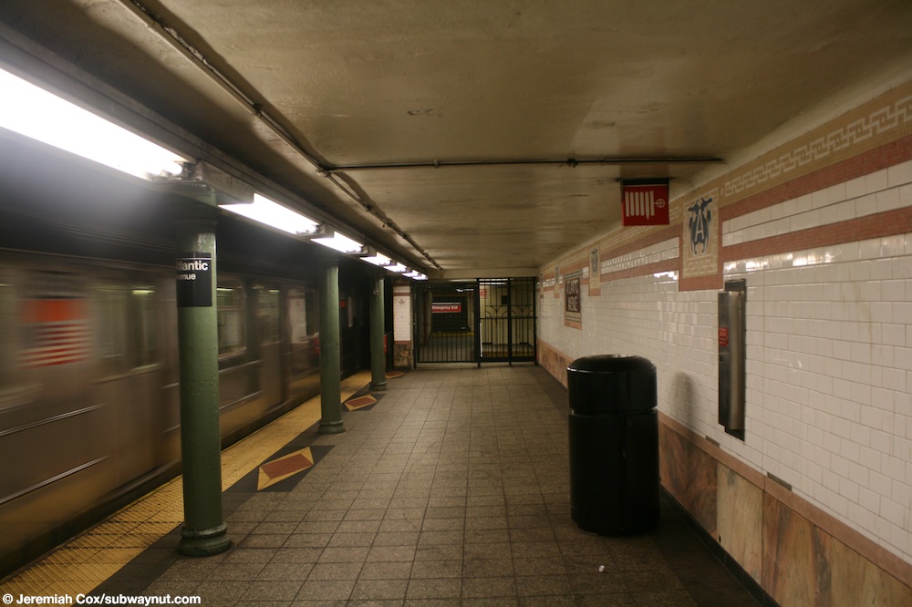
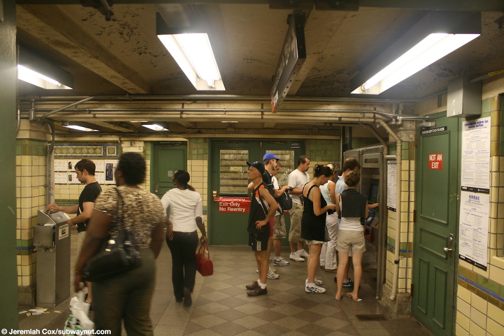
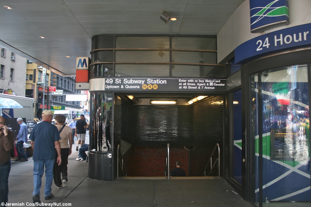
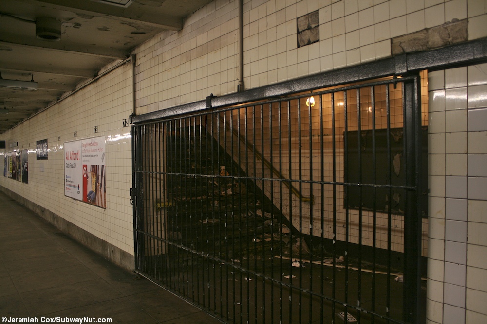
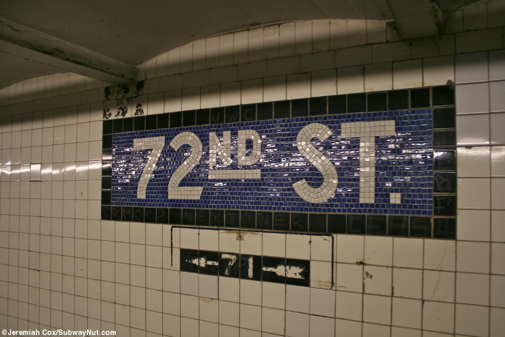
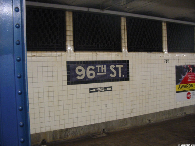
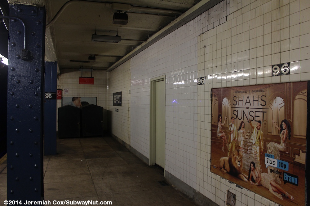
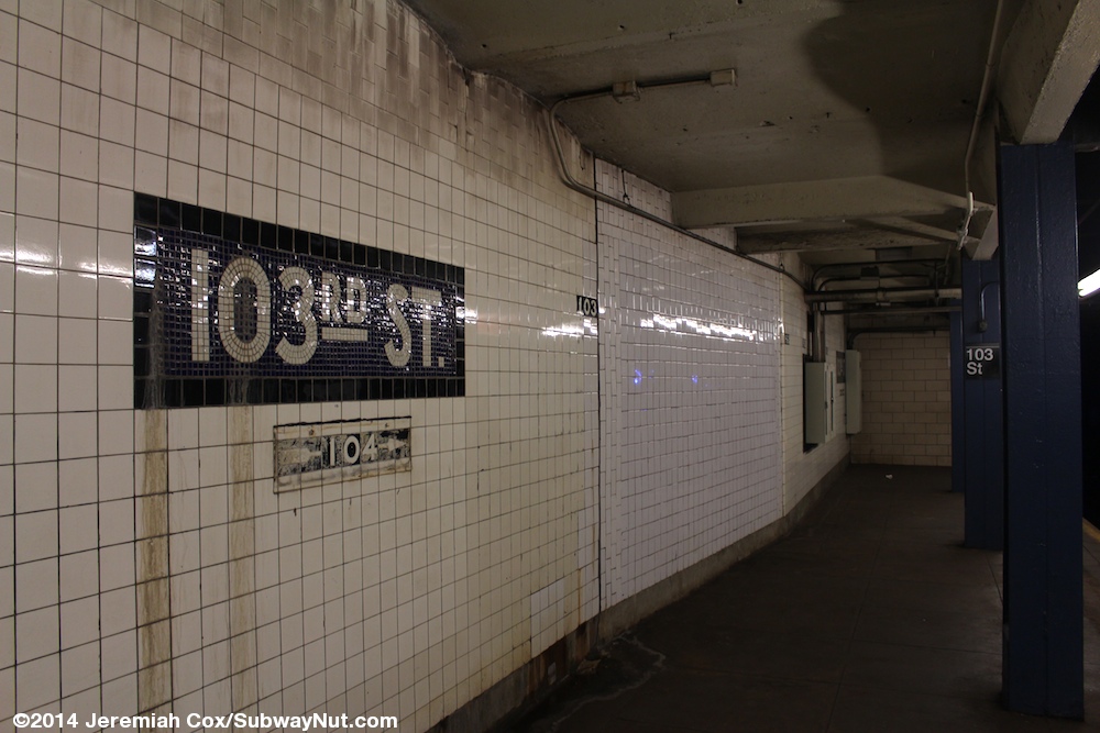
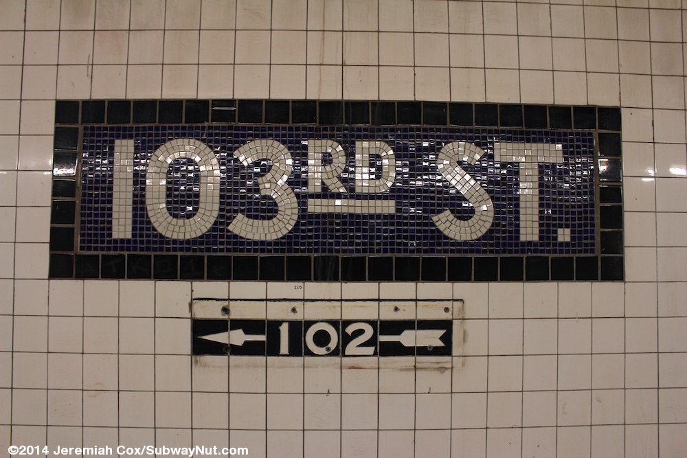
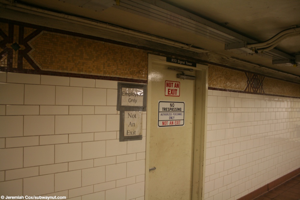
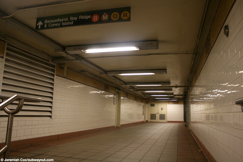
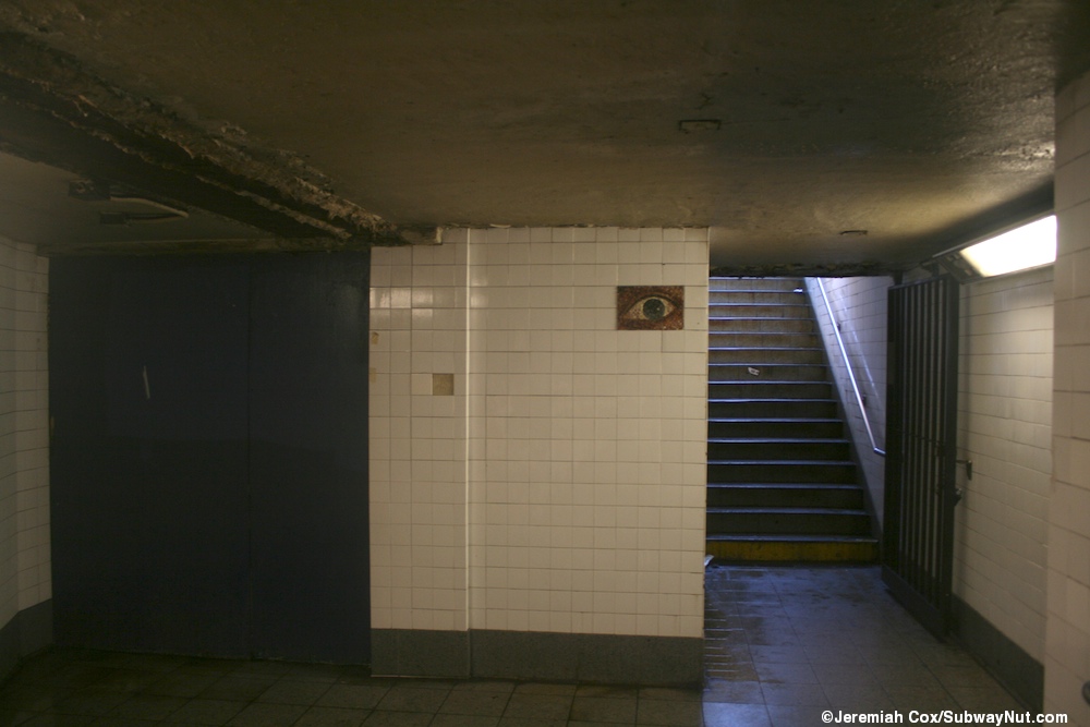
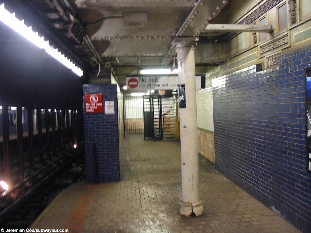
See also
editEntrances
edit- User:Kew Gardens 613/List of easement New York City Subway entrances
- User:Kew Gardens 613/List of new New York City Subway entrances
- User:Kew Gardens 613/List of part-time New York City Subway entrances
- User:Kew Gardens 613/List of exit-only New York City Subway entrances
Closed areas
edit- User:Kew Gardens 613/List of New York City Subway closed mezzanines and platform staircases
- User:Kew Gardens 613/List of closed New York City Subway crossovers/crossunders
Turnstiles
editToken Booths
edit- User:Kew Gardens 613/List of removed New York City Subway token booths
- User:Kew Gardens 613/List of part-time New York City Subway token booths
Rare subway signs
editProvisions
editExternal links
edit- Unused NYC Subway
- Subway Station Access Changes from MTA Board Materials
- Stationreporter.net
- Subway Nut
- nycsubway.org
- WNYC data
- WNYC Entrance Map
- No Exit: What Closed Subway Entrances Have to Do with Delays and Crowding