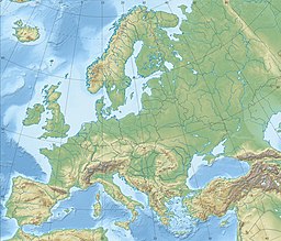
Vesterbotn (Northern Sami: Leavdnjavuotna, Kven: Lemmivuono,[2] and Finnish: Lemmivuono)[3] is an arm of the Porsangerfjorden[4] located in Porsanger Municipality, Finnmark county, Norway.[5]
| Vesterbotn | |
|---|---|
| Leavdnjavuotna | |
| Location | Porsanger Municipality, Finnmark County, Norway |
| Coordinates | 70°5′34.43″N 24°58′38.08″E / 70.0928972°N 24.9772444°E |
| Type | Fjord |
| Part of | Porsangerfjorden |
| Average depth | 17.5 metres (57 ft) |
| Max. depth | 27 metres (89 ft) |
| Surface elevation | 39 metres (128 ft)[1] |
Geography
editThe fjord is particularly shallow, especially along the sides and in its outer half, Vesterbotn reaches a depth of only 8 metres (26 ft). Banak Airport is situated south of the fjord,[6][7] with the northern section of the fjord being up to 27 metres (89 ft) deep, marking the fjord's deepest point. Overall, the fjord has an average depth of 17.5 metres (57 ft). The airport's runway extends nearly one kilometer into the fjord. At this point, the fjord takes a slight eastward turn before continuing south on the eastern side of Banak, forming the section known as Brennelvfjorden.
Climate
editVesterbotn experiences varying weather conditions throughout the year. Located in the Arctic, this area witnesses distinct seasonal changes. The highest recorded temperature occurred in June 2022, reaching 24 °C (75 °F) during a heat wave.[1][8] Conversely, the lowest recorded temperature was observed in March, reaching −17 °C (1 °F). Furthermore, the highest amount of snowfall in 2022 was 164 centimetres (65 in) on 22 March.[1]
Location
editIt spans the entire western side of Oldereidneset, a peninsula in Norway. The fjord features an inlet between Stabbursnes in the northwest and Reassetnjárga in the southeast,[9] stretching 12 kilometres (7.5 mi) to its southernmost point at Lakselv, where the fjord ends.[10]
E6 runs alongside the western side of Vesterbotn, while County Road 91 follows the eastern side of Brennelvfjorden. Brennelv and Lakselv are located at the head of Brennelvfjorden, with Lakselva flowing into the fjord west of the airport.[5]
References
edit- ^ a b c "Vesterbotn". yr.no. Norwegian Meteorological Institute. 2023-05-18. Archived from the original on 2023-05-18.
- ^ "Stedsnamn faktaark - for søk på stedsnavn og tilhørende fakta" [Place name fact sheet - for site name search and associated facts]. Kartverket (in Norwegian). Retrieved 2023-05-18.
- ^ "Lemmivuono - Eksonyymit". Eksonyymit – Kotimaisten kielten keskus. Retrieved 2023-05-18.
- ^ Askheim, Svein (2021-03-30). "Porsangerfjorden". Store norske leksikon (in Norwegian). Retrieved 2023-05-18.
- ^ a b "Vesterbotn". Norgeskart (in Norwegian). Norwegian Mapping Authority. Retrieved 2023-05-18.
- ^ "LAKSELV/Banak" (PDF). International Plant Protection Convention (in Norwegian). Archived from the original (PDF) on 2012-07-22. Retrieved 2023-05-18.
- ^ "Banak Airport - ENNA - LKL - Airport Guide". AirportGuide. Retrieved 2023-05-13.
- ^ "Europe heatwave breaks multiple June records". BBC Weather. 2022-06-30. Retrieved 2023-05-18.
- ^ Ryvarden, Leif (2023-01-26), "Stabbursnes naturreservat", Store norske leksikon (in Norwegian), retrieved 2023-05-18
- ^ Askheim, Svein (2022-12-28), "Lakselv", Store norske leksikon (in Norwegian), retrieved 2023-05-18


