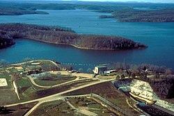
Wappapello is an unincorporated community in southeastern Wayne County, Missouri, United States. It is located approximately thirteen miles northeast of Poplar Bluff, next to Lake Wappapello.
Wappapello | |
|---|---|
 Wappapello Lake near the town of Wappapello, Missouri | |
| Coordinates: 36°56′08″N 90°16′15″W / 36.93556°N 90.27083°W | |
| Country | United States |
| State | Missouri |
| County | Wayne |
| Elevation | 354 ft (108 m) |
| Time zone | UTC-6 (Central (CST)) |
| • Summer (DST) | UTC-5 (CDT) |
| ZIP code | 63966[2] |
| Area code | 573 |
| GNIS feature ID | 752753[1] |
Wappapello was laid out in 1884 when the railroad was extended to that point.[3] The community has the name of a Native American chieftain.[4] A post office called Wappapello has been in operation since 1884.[5]
References
edit- ^ a b U.S. Geological Survey Geographic Names Information System: Wappapello, Missouri
- ^ "Wappapello ZIP Code". zipdatamaps.com. 2022. Retrieved November 11, 2022.
- ^ "Wayne County Place Names, 1928–1945". The State Historical Society of Missouri. Archived from the original on June 24, 2016. Retrieved January 1, 2017.
- ^ Eaton, David Wolfe (1918). How Missouri Counties, Towns and Streams Were Named. The State Historical Society of Missouri. p. 371.
- ^ "Post Offices". Jim Forte Postal History. Retrieved January 1, 2017.
Wappapello was founded by Samuel R. Kelley, a veteran of the Civil War. He was originally from Ohio, saw the Wappapello area as a young Union soldier, and homesteaded land there after the war.
