Wapse is a village in the Dutch province of Drenthe. It is a part of the municipality of Westerveld, and lies about 21 km northwest of Hoogeveen.
Wapse | |
|---|---|
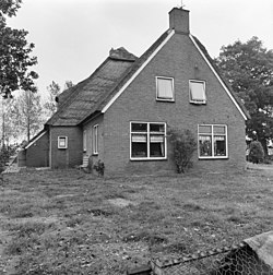
 Farm in Wapse | |
 The village centre (dark green) and the statistical district (light green) of Wapse in the municipality of Westerveld. | |
Location in province of Drenthe in the Netherlands | |
| Coordinates: 52°52′N 6°16′E / 52.867°N 6.267°E | |
| Country | Netherlands |
| Province | Drenthe |
| Municipality | Westerveld |
| Area | |
• Total | 17.17 km2 (6.63 sq mi) |
| Elevation | 7 m (23 ft) |
| Population (2021)[1] | |
• Total | 655 |
| • Density | 38/km2 (99/sq mi) |
| Time zone | UTC+1 (CET) |
| • Summer (DST) | UTC+2 (CEST) |
| Postal code | 7983[1] |
| Dialing code | 0521 |
The village was first mentioned in 1384 as "Johanni de Wapse". The etymology is unknown.[3] Wapse is a circular esdorp from the Early Middle Ages. There used to be five hamlets around the central communal pasture.[4]
Wapse was home to 252 people in 1840.[5] In 1897, a cooperative dairy factory was founded in Wapse.[5] In 2016, the village school was scheduled to be closed due to lack of students, however protests have prevented its closure.[6]
References
edit- ^ a b c "Kerncijfers wijken en buurten 2021". Central Bureau of Statistics. Retrieved 12 April 2022.
- ^ "Postcodetool for 7983KA". Actueel Hoogtebestand Nederland (in Dutch). Het Waterschapshuis. Retrieved 12 April 2022.
- ^ "Wapse - (geografische naam)". Etymologiebank (in Dutch). Retrieved 12 April 2022.
- ^ Ronald Stenvert (2001). Wapse (in Dutch). Zwolle: Waanders. ISBN 90 400 9454 3. Retrieved 12 April 2022.
- ^ a b "Wapse". Plaatsengids (in Dutch). Retrieved 12 April 2022.
- ^ "Ten Darperschoele in Wapse kan er weer even tegen". RTV Drenthe (in Dutch). Retrieved 12 April 2022.
Wikimedia Commons has media related to Wapse.


