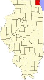
Wauconda Township is a township in Lake County, Illinois, USA. As of the 2020 census, its population was 23,628.[2]
Wauconda Township | |
|---|---|
 Location in Lake County | |
 Lake County's location in Illinois | |
| Coordinates: 42°17′02″N 88°09′19″W / 42.28389°N 88.15528°W | |
| Country | United States |
| State | Illinois |
| County | Lake |
| Established | November 6, 1849 |
| Government | |
| • Supervisor | Glenn L. Swanson |
| Area | |
• Total | 24.2 sq mi (62.8 km2) |
| • Land | 22.9 sq mi (59.3 km2) |
| • Water | 1.4 sq mi (3.5 km2) |
| Elevation | 797 ft (243 m) |
| Population (2020) | |
• Total | 23,628 |
• Estimate (2016)[1] | 22,514 |
| • Density | 970/sq mi (380/km2) |
| Time zone | UTC-6 (CST) |
| • Summer (DST) | UTC-5 (CDT) |
| FIPS code | 17-097-79280 |
| Website | www |
Geography
editWauconda Township covers an area of 24.2 square miles (62.8 km2); of this, 1.4 square miles (3.5 km2) or 5.59 percent is water.[2] Lakes in this township include Bangs Lake and Slocum Lake. The stream of Mutton Creek runs through this township.
Cities and towns
edit- Port Barrington (southwest corner)
- Island Lake (east half)
- Lake Barrington (south edge)
- Lakemoor (north edge)
- Volo (north edge)
- Wauconda (southeast corner)
Adjacent townships
edit- Grant Township (north)
- Avon Township (northeast)
- Fremont Township (east)
- Ela Township (southeast)
- Cuba Township (south)
- Algonquin Township, McHenry County (southwest)
- Nunda Township, McHenry County (west)
- McHenry Township, McHenry County (northwest)
Cemeteries
editThe township contains six cemeteries: Fisher Family (historic) west of Volo; Hope Grove (historic) east of Volo; Saint Peter Catholic in Volo; Slocum Family (historic) west of Wauconda; Volo (historic) in Volo; and Wauconda in Wauconda.
Major highways
edit- U.S. Route 12
- Illinois State Route 59
- Illinois State Route 60
- Illinois State Route 120
- Illinois State Route 176
Airports and landing strips
edit- Oak Knoll Farm Airport
Demographics
edit| Census | Pop. | Note | %± |
|---|---|---|---|
| 2016 (est.) | 22,514 | [1] | |
| U.S. Decennial Census[3] | |||
References
edit- ^ a b "Population and Housing Unit Estimates". Retrieved June 9, 2017.
- ^ a b "Geographic Identifiers: 2010 Demographic Profile Data (G001): Wauconda township, Lake County, Illinois". U.S. Census Bureau, American Factfinder. Archived from the original on February 12, 2020. Retrieved December 19, 2012.
- ^ "Census of Population and Housing". Census.gov. Retrieved June 4, 2016.