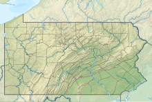
Wellsboro Johnston Airport (FAA LID: N38) is a public non-towered general aviation Airport that is located 4 miles SW of and serves Wellsboro, Pennsylvania.[2]
Wellsboro Johnston Airport | |||||||||||||||
|---|---|---|---|---|---|---|---|---|---|---|---|---|---|---|---|
| Summary | |||||||||||||||
| Airport type | Public | ||||||||||||||
| Serves | Wellsboro, Pennsylvania | ||||||||||||||
| Location | Wellsboro, Pennsylvania[1] | ||||||||||||||
| Opened | March 1947 | ||||||||||||||
| Elevation AMSL | 1,892 ft / 577 m | ||||||||||||||
| Coordinates | 41°43′40″N 077°23′43″W / 41.72778°N 77.39528°W | ||||||||||||||
| Map | |||||||||||||||
 | |||||||||||||||
| Runways | |||||||||||||||
| |||||||||||||||

Facilities and aircraft
editThe airport covers 349 acres (141 hectares) at an elevation of 1,891.5 ft (576.5 m). The airport has two active runways: 10/28 is an asphalt runway 3,597 ft in length and 60 ft wide (1,096 x 18 m), and 11/29 is a turf surface that is 1,600 by 100 ft (488 by 30 m).
Aircraft operations average 109 a week, approximately 5,500 a year. Operations are divided: 53% local general aviation, 44% transient general aviation, 4% air taxi. There are 28 aircraft based on the field: 22 are single engine, 1 multi-engine and 5 ultralights.[3]
See also
editReferences
edit- ^ "Grand Canyon RGNL".
- ^ "Wellsboro Johnston Airport (N38) PennDOT". PennDOT.gov. Retrieved 23 August 2017.
- ^ "N38 airport - AirNav info". AirNav. Retrieved 23 August 2017.
External links
edit- Resources for this airport:
- FAA airport information for N38
- AirNav airport information for N38
- FlightAware airport information and live flight tracker
- SkyVector aeronautical chart for N38

