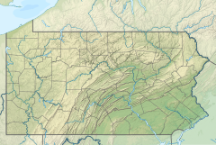
West Branch Tunungwant Creek is a 9.80 mi (15.77 km) long fourth-order tributary to Tunungwant Creek.[2] This is the only stream of this name in the United States.[1]
| West Branch Tunungwant Creek Tributary to Tunungwant Creek | |
|---|---|
| Location | |
| Country | United States |
| State | Pennsylvania |
| County | McKean |
| City | Bradford |
| Physical characteristics | |
| Source | Chappel Fork divide |
| • location | about 5 miles west-southwest of Lewis Run, Pennsylvania |
| • coordinates | 41°51′43.22″N 078°44′55.11″W / 41.8620056°N 78.7486417°W[1] |
| • elevation | 2,180 ft (660 m)[1] |
| Mouth | Tunungwant Creek |
• location | Bradford, Pennsylvania |
• coordinates | 41°57′29.23″N 078°38′29.10″W / 41.9581194°N 78.6414167°W[1] |
• elevation | 1,421 ft (433 m)[1] |
| Length | 9.80 mi (15.77 km)[2] |
| Basin size | 42.10 square miles (109.0 km2)[3] |
| Discharge | |
| • location | Tunungwant Creek |
| • average | 84.40 cu ft/s (2.390 m3/s) at mouth with Tunungwant Creek[3] |
| Basin features | |
| Progression | Tunungwant Creek → Allegheny River → Ohio River → Mississippi River → Gulf of Mexico |
| River system | Allegheny River |
| Tributaries | |
| • left | South Penn Run Fuller Brook Langmade Brook Marilla Brook Bennett Brook |
| • right | Two Mile Run Kissem Run |
| Waterbodies | Bradford City Number 5 Reservoir |
| Bridges | Glendorn Drive, Crookerhouse Lane, Clarks Lane, Dorothy Lane, Barbour Street, Mechanic Street, Kennedy Street, Davis Street, Forman Street, US 219 |
Course
editWest Branch Tunungwant Creek rises about 5 miles (8.0 km) west-southwest of Lewis Run, Pennsylvania, and then flows northeast to meet Tunungwant Creek at Bradford, Pennsylvania to form Tunungwant Creek with East Branch Tunungwant Creek.
Watershed
editWest Branch Tunungwant Creek drains 42.90 square miles (111.1 km2) of area, receives about 46.6 in/year (118 cm/year) of precipitation, and is about 84.55% forested.[3]
See also
editReferences
edit- ^ a b c d e "Geographic Names Information System". edits.nationalmap.gov. US Geological Survey. Retrieved January 19, 2023.
- ^ a b "ArcGIS Web Application". epa.maps.arcgis.com. US EPA. Retrieved January 19, 2023.
- ^ a b c "Watershed Report | Office of Water | US EPA". watersgeo.epa.gov. US EPA. Retrieved January 19, 2023.

