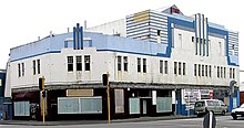
Woburn is a suburb of Lower Hutt, Wellington situated at the bottom of the North Island of New Zealand.
Woburn | |
|---|---|
 Hutt Railway Workshops pattern shop in 1930 | |
 | |
| Coordinates: 41°13′S 174°54′E / 41.217°S 174.900°E | |
| Country | New Zealand |
| City | Lower Hutt |
| Local authority | Hutt City Council |
| Electoral ward | Central / Harbour |
| Established | 1840s |
| Area | |
| • Land | 0.62 ha (1.53 acres) |
| Population (June 2024)[2] | |
• Total | 1,850 |
| Train stations | Woburn Railway Station |
| Lower Hutt CBD | Waterloo | |
|
|
Waiwhetū | |
| Ava | Moera |

Henry Petre farmed the area in the 1840s and named the area after the Duke of Bedford's estate, Woburn Abbey. Petre's farm was later taken over by Daniel and Harriet Riddiford, whose descendants built a large home there, with the land being gradually subdivided.[3] Riddiford Street in Lower Hutt commemorates them.
Demographics
editWoburn statistical area covers 0.62 km2 (0.24 sq mi).[1] It had an estimated population of 1,850 as of June 2024,[2] with a population density of 2,984 people per km2.
| Year | Pop. | ±% p.a. |
|---|---|---|
| 2006 | 1,734 | — |
| 2013 | 1,692 | −0.35% |
| 2018 | 1,752 | +0.70% |
| Source: [4] | ||
Woburn had a population of 1,752 at the 2018 New Zealand census, an increase of 60 people (3.5%) since the 2013 census, and an increase of 18 people (1.0%) since the 2006 census. There were 660 households, comprising 831 males and 921 females, giving a sex ratio of 0.9 males per female. The median age was 43.1 years (compared with 37.4 years nationally), with 279 people (15.9%) aged under 15 years, 321 (18.3%) aged 15 to 29, 849 (48.5%) aged 30 to 64, and 300 (17.1%) aged 65 or older.
Ethnicities were 71.9% European/Pākehā, 8.9% Māori, 2.6% Pasifika, 23.6% Asian, and 2.2% other ethnicities. People may identify with more than one ethnicity.
The percentage of people born overseas was 30.0, compared with 27.1% nationally.
Although some people chose not to answer the census's question about religious affiliation, 45.0% had no religion, 40.8% were Christian, 0.2% had Māori religious beliefs, 5.8% were Hindu, 0.7% were Muslim, 1.2% were Buddhist and 1.9% had other religions.
Of those at least 15 years old, 561 (38.1%) people had a bachelor's or higher degree, and 156 (10.6%) people had no formal qualifications. The median income was $41,300, compared with $31,800 nationally. 435 people (29.5%) earned over $70,000 compared to 17.2% nationally. The employment status of those at least 15 was that 738 (50.1%) people were employed full-time, 243 (16.5%) were part-time, and 45 (3.1%) were unemployed.[4]
References
edit- ^ a b "ArcGIS Web Application". statsnz.maps.arcgis.com. Retrieved 12 June 2021.
- ^ a b "Aotearoa Data Explorer". Statistics New Zealand. Retrieved 26 October 2024.
- ^ Te Ara: The Encyclopedia of New Zealand - Hutt Valley - central and west Retrieved: 10 January 2009
- ^ a b "Statistical area 1 dataset for 2018 Census". Statistics New Zealand. March 2020. Woburn (245300). 2018 Census place summary: Woburn