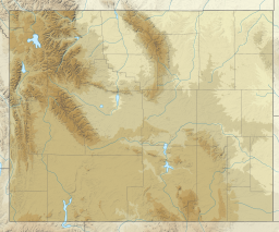
Worthen Meadow Reservoir is a reservoir located in the Shoshone National Forest. The reservoir is fed by Roaring Fork Creek, and it holds around 1,500 acre feet of water with a surface elevation of 8,819 ft (2,688 m) (crest of the service spillway). The reservoir's two section earth-fill dam was constructed in 1958, and the reservoir acts as a supplemental supply of water for the City of Lander, Wyoming.[1] The total length of the dam is 917 ft (280 m) with a maximum height of 43 ft (13 m) above the stream bed of Roaring Fork Creek.
| Worthen Meadow Reservoir | |
|---|---|
 | |
| Location | Fremont County, Wyoming |
| Coordinates | 42°42′00″N 108°55′20″W / 42.70000°N 108.92222°W |
| Type | reservoir |
| Primary inflows | Roaring Fork Creek |
| Primary outflows | Enterprise Ditch |
| Basin countries | United States |
| Water volume | 1,500 acre-feet (1,900,000 m3) |
| Surface elevation | 8,819 ft (2,688 m)[1] |
| Islands | 0 |
Recreation
editNumerous trails and campsites are located near the reservoir including Worthen Meadow Campground and trail-heads leading into the Wind River Range.[2]
Wildlife
editThe reservoir contains different species of fish including rainbow trout, brook trout and arctic grayling.[3]
Safety Concerns
editThe reservoir's upstream location 17 mi (27 km) from Lander creates a significant hazard to the city in the event of dam failure.[1] However, the dam has been reinforced and maintained to avoid failure.
Climate
editTownsend Creek is a SNOTEL weather station located roughly halfway between Worthen Meadow Reservoir and Frye Lake at an altitude of 8700 feet (2652 m). Townsend Creek has a subalpine climate (Köppen Dfc), with long, cold winters and short, mild summers.
| Climate data for Townsend Creek, Wyoming, 1991–2020 normals, 2010-2020 snowfall: 8700ft (2652m) | |||||||||||||
|---|---|---|---|---|---|---|---|---|---|---|---|---|---|
| Month | Jan | Feb | Mar | Apr | May | Jun | Jul | Aug | Sep | Oct | Nov | Dec | Year |
| Record high °F (°C) | 59 (15) |
57 (14) |
62 (17) |
70 (21) |
80 (27) |
84 (29) |
91 (33) |
88 (31) |
83 (28) |
72 (22) |
64 (18) |
53 (12) |
91 (33) |
| Mean maximum °F (°C) | 49.9 (9.9) |
49.3 (9.6) |
55.8 (13.2) |
61.7 (16.5) |
69.6 (20.9) |
77.6 (25.3) |
82.8 (28.2) |
81.4 (27.4) |
76.1 (24.5) |
66.2 (19.0) |
54.6 (12.6) |
47.2 (8.4) |
83.5 (28.6) |
| Mean daily maximum °F (°C) | 34.1 (1.2) |
34.7 (1.5) |
41.5 (5.3) |
46.1 (7.8) |
54.4 (12.4) |
65.0 (18.3) |
73.9 (23.3) |
72.1 (22.3) |
62.3 (16.8) |
49.5 (9.7) |
39.0 (3.9) |
32.0 (0.0) |
50.4 (10.2) |
| Daily mean °F (°C) | 20.2 (−6.6) |
20.2 (−6.6) |
27.2 (−2.7) |
32.9 (0.5) |
41.5 (5.3) |
50.1 (10.1) |
57.4 (14.1) |
56.0 (13.3) |
47.7 (8.7) |
36.7 (2.6) |
26.2 (−3.2) |
19.1 (−7.2) |
36.3 (2.4) |
| Mean daily minimum °F (°C) | 6.3 (−14.3) |
5.6 (−14.7) |
12.7 (−10.7) |
19.5 (−6.9) |
28.4 (−2.0) |
35.1 (1.7) |
40.9 (4.9) |
39.9 (4.4) |
33.0 (0.6) |
23.8 (−4.6) |
13.4 (−10.3) |
6.2 (−14.3) |
22.1 (−5.5) |
| Mean minimum °F (°C) | −17.0 (−27.2) |
−18.2 (−27.9) |
−11.2 (−24.0) |
−0.6 (−18.1) |
12.6 (−10.8) |
25.9 (−3.4) |
32.2 (0.1) |
29.9 (−1.2) |
19.8 (−6.8) |
3.1 (−16.1) |
−11.6 (−24.2) |
−18.5 (−28.1) |
−24.7 (−31.5) |
| Record low °F (°C) | −29 (−34) |
−32 (−36) |
−27 (−33) |
−15 (−26) |
−2 (−19) |
19 (−7) |
23 (−5) |
20 (−7) |
3 (−16) |
−16 (−27) |
−26 (−32) |
−40 (−40) |
−40 (−40) |
| Average precipitation inches (mm) | 1.25 (32) |
1.60 (41) |
2.51 (64) |
3.67 (93) |
3.90 (99) |
1.86 (47) |
1.00 (25) |
1.11 (28) |
1.90 (48) |
2.37 (60) |
1.72 (44) |
1.40 (36) |
24.29 (617) |
| Average snowfall inches (cm) | 11.1 (28) |
18.3 (46) |
17.4 (44) |
24.4 (62) |
12.9 (33) |
0.0 (0.0) |
0.0 (0.0) |
0.0 (0.0) |
2.0 (5.1) |
7.3 (19) |
11.1 (28) |
14.0 (36) |
118.5 (301.1) |
| Source 1: XMACIS2 (records, monthly max/mins & Lander 5.7SW snowfall)[4] | |||||||||||||
| Source 2: NOAA (Precipitation)[5] | |||||||||||||
References
edit- ^ a b c ARIX Corporation (1987). LANDER REHABILITATION PROJECT LEVEL II FEASIBILITY STUDY (PDF). ARIX Corporation. p. 1.
- ^ "Worthen Meadow Campground". US Forest Service. Retrieved June 7, 2018.
- ^ Tim Kelly (1985). Tim Kelly's Fishing Guide. Hart Publications, Inc. p. 277. ISBN 9780912553016.
- ^ "xmACIS2". National Oceanic and Atmospheric Administration. Retrieved December 5, 2023.
- ^ "Townsend Creek, Wyoming 1991-2020 Monthly Normals". Retrieved December 5, 2023.

