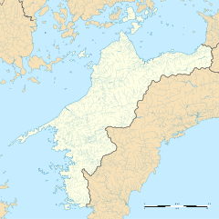
Yanagihara Station (柳原駅, Yanagihara-eki) is a passenger railway station located in the city of Matsuyama, Ehime Prefecture, Japan. It is operated by JR Shikoku and has the station number "Y49".[1][2]
Y49 Yanagihara Station 柳原駅 | |||||
|---|---|---|---|---|---|
 Yanagihara Station in 2006 | |||||
| General information | |||||
| Location | Fuchu, Matsuyama-shi, Ehime-ken 799-2435 Japan | ||||
| Coordinates | 33°57′13″N 132°46′25″E / 33.95361°N 132.77361°E | ||||
| Operated by | |||||
| Line(s) | ■ Yosan Line | ||||
| Distance | 179.1 km from Takamatsu | ||||
| Platforms | 1 side platform | ||||
| Tracks | 1 | ||||
| Construction | |||||
| Structure type | At grade | ||||
| Parking | None | ||||
| Bicycle facilities | Designated parking area for bicycles | ||||
| Accessible | Yes - ramp from access road to platform | ||||
| Other information | |||||
| Status | Unstaffed | ||||
| Station code | Y49 | ||||
| History | |||||
| Opened | 1 June 1961 | ||||
| Passengers | |||||
| FY2019 | 268 | ||||
| |||||
Lines
editYanagihara Station is served by the JR Shikoku Yosan Line and is located 179.1 km from the beginning of the line at Takamatsu.[3] Only Yosan Line local trains stop at the station and they only serve the sector between Iyo-Saijō and Matsuyama. Connections with other local or limited express trains are needed to travel further east or west along the line.[4]
Layout
editThe station, which is unstaffed, consists of a side platform serving a single track. There is no station building, only a shelter for waiting passengers and a "tickets corner", a small shelter containing an automatic ticket vending machine. A ramp leads from the access road to the platform. A designated space for the parking of bicycles is provided behind the platform.[2][5][6][3]
Adjacent stations
edit| « | Service | » | ||
|---|---|---|---|---|
| Yosan Line | ||||
| Iyo-Hōjō | Local | Awai | ||
History
editJapanese National Railways (JNR) opened Yanagihara Station as a new stop on the existing Yosan Line on 1 June 1961. With the privatization of JNR on 1 April 1987, control of the station passed to JR Shikoku.[7][8]
Surrounding area
editSee also
editReferences
edit- ^ "Shikoku Railway Route Map" (PDF). JR Shikoku. Retrieved 27 December 2017.
- ^ a b "柳原" [Yanagihara]. hacchi-no-he.net. Retrieved 6 January 2018.
- ^ a b Kawashima, Ryōzō (2013). 図説: 日本の鉄道 四国・九州ライン 全線・全駅・全配線・第2巻 四国西部エリア [Japan Railways Illustrated. Shikoku and Kyushu. All lines, all stations, all track layouts. Volume 2 Western Shikoku] (in Japanese). Kodansha. pp. 15, 68. ISBN 9784062951616.
- ^ "Yanagihara Station Timetable" (PDF). JR Shikoku. Retrieved 6 January 2018.
- ^ "柳原駅" [Yanagihara Station]. shikoku.org.uk. Retrieved 6 January 2018.
- ^ "柳原" [Yanagihara]. sanyukai.sakura.ne.jp. Retrieved 6 January 2018.
- ^ Ishino, Tetsu; et al., eds. (1998). 停車場変遷大事典 国鉄・JR編 [Station Transition Directory – JNR/JR] (in Japanese). Vol. II. Tokyo: JTB Corporation. p. 638. ISBN 4-533-02980-9.
- ^ Ishino, Tetsu; et al., eds. (1998). 停車場変遷大事典 国鉄・JR編 [Station Transition Directory – JNR/JR] (in Japanese). Vol. I. Tokyo: JTB Corporation. pp. 213–215. ISBN 4-533-02980-9.
External links
editMedia related to Yanagihara Station (Ehime) at Wikimedia Commons

