This is a list of the highest feature on Earth for each category.
| Category | Highest feature | Altitude (MASL) | Photo | Notes | References |
|---|---|---|---|---|---|
| Point | Mount Everest, China/Nepal | 8,850 |  |
The altitude officially recognized for both China and Nepal is the former figure of 8,848 57°18′22″N 4°27′32″W / 57.30611°N 4.45889°W | [1] |
| Glacier | Khumbu, Nepal | 8,000 |  |
It begins on the west side of Lhotse at an elevation of 7,600 m (24,934 ft) to 8,000 m (26,247 ft) | .[2] |
| Volcano | Ojos del Salado, Argentina/Chile | 6,893 |  |
[3] | |
| Archeological site | Summit of Llullaillaco volcano, Argentina/Chile (inca burial) | 6,739 |  |
[4] | |
| Motorable attainable place | Slope of Ojos del Salado volcano, Chile | 6,688 | [5] | ||
| Helipad | Sonam, Siachen Glacier, India | 6,400 |  |
[6] | |
| Lake/Lagoon | Lagoon at eastern side of Ojos del Salado, Chile | 6,390 | 27°06′49″S 68°31′35″W / 27.11361°S 68.52639°W | [7] | |
| Road (dead end) | Aucanquilcha, Chile | 6,176 |  |
Mining road to summit of volcano, once usable by 20-ton mining trucks. The road is no longer usable. | [8] |
| Continuously inhabited place (ever) | Aucanquilcha, Chile | 5,950 | Miners slept lower, at Quilcha (5,334m) | [9] | |
| Habitable cabin | High Andes Rescue Unit, Ojos del Salado, Chile | 6,100 | [10] | ||
| Astronomical observatory | University of Tokyo Atacama Observatory (TAO), Chile | 5,640 |  |
22°59′12″S 67°44′32″W / 22.98667°S 67.74222°W | [11] |
| Road (mountain pass) | Mana Pass, India/China | 5,610 |  |
[12] | |
| Ski lift (ever) | Chacaltaya, Bolivia | 5,422 |  |
The ski ended when the glacier disappeared, in 2009 | [9] |
| City | La Rinconada, Perú | 5,100 |  |
Over 7,000 inhabitants, associated with a gold mine | [13] |
| Railway | Xining-Golmud-Lhasa at Tanggula, China | 5,068 |  |
[14] | |
| Road (asphalted) | Ticlio, Peru | 4,818 |  |
[15] | |
| Ski lift (current) | Lijiang/Jade Dragon Snow Mountain, China | 4,700 | [16] | ||
| Commercial airport | Daocheng Yading Airport, Sichuan, China | 4,411 | The proposed Nagqu Dagring Airport in Tibet, 4,436 m (14,554 ft), if built, will be higher. | [17] | |
| Golf course | Yak golf course, Sikkim, India | 3,970 | [18] | ||
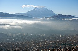
| National capital, de facto | La Paz, Bolivia | 3,650 |  |
Average elevation at the city centre. Bolivia is a country with multiple capitals - Sucre (constitutional capital) and La Paz (seat of government). | [19] |
| National capital, official | Quito, Ecuador | 2,850 |  |
[20] | |
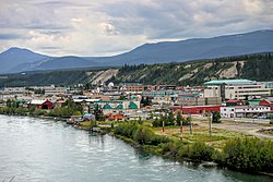
| Point accessible by an oceangoing vessel (ever) | Whitehorse, Yukon Territory | 640 |  |
[21] | |
| Point accessible by an oceangoing vessel (current) | Rhine–Main–Danube Canal, between Hilpoltstein and Bachhausen, Germany | 406 |  |
[22] |
References
edit- ^ "Elevation of Mount Everest newly defined". Swiss Foundation for Alpine Research. 12 November 1999. Archived from the original on 3 January 2007. Retrieved 1 April 2007.
- ^ "ASTER measurement of supraglacial lakes in the Mount Everest region of the Himalaya: The main Khumbu Glacier is about 17 km long with elevations ranging from 4900m at the terminus to 7600m at the source....The 7600m to 8000m elevations are also depicted on numerous detailed topographic maps". Retrieved 24 November 2008.
- ^ "Andes ultra-prominent peaks". Peaklist.
- ^ Reinhard, Johan; Ceruti, Constanza (2010). Inca Rituals and Sacred Mountains: A Study of the World's Highest Archaeological Sites. Institute of Archaeology Press. ISBN 9781931745765.
- ^ Barreno, Jorge (February 1, 2011). "Ascenso al volcán activo más alto del mundo". El País. Retrieved 6 September 2015.
- ^ "Siachen: The world's highest cold war". CNN. 20 May 2002. Retrieved 2 May 2010.
- ^ Sahay, R.N. (2014). Ecosystems and Water Resource Management. AGROTECH PRESS. p. 285. ISBN 9789384568061. Retrieved 6 September 2015.
- ^ McIntyre, Loren (April 1987). "The High Andes". National Geographic. 171 (4). National Geographic Society: 422–460. (includes description and photos of Aucanquilcha summit road and mine)
- ^ a b D. Miller, Ronald (2014). Miller's Anesthesia. Elsevier Health Sciences. p. 676. ISBN 9780323280112. Retrieved 6 September 2015.
- ^ "Se instala en Chile el refugio más alto del mundo (6.100 msnm) en los Ojos del Salado". Retrieved 14 September 2019.
- ^ Yoshii, Yuzuru; et al. (11 August 2009). "The 1m telescope at the Atacama Observatory has Started Scientific Operation, detecting the Hydrogen Emission Line from the Galactic Center in the Infrared Light". Press Release. School of Science, the University of Tokyo. Retrieved 21 December 2009.
- ^ Skok, Eugene (2015). Asphalt Paving Technology 2014. DEStech Publications. p. 695. ISBN 9781605952062. Retrieved 6 September 2015.
- ^ West, John B. (July 6, 2004). "Highest Permanent Human Habitation". High Altitude Medicine & Biology. 3 (4): 401–407. doi:10.1089/15270290260512882. PMID 12631426.
- ^ "World's highest railway station enters key construction period". Canada Tibet Committee. July 28, 2005. Retrieved December 6, 2012.
- ^ Wilder-Smith, Annelies; Schwartz, Eli; Shaw, Marc (2007). Travel Medicine: Tales Behind the Science. Routledge. ISBN 9781136352164. Retrieved 6 September 2015.
- ^ "China: highest ski resorts". Ski Resort. Retrieved 6 September 2015.
- ^ Ben Blanchard (16 September 2013). "China opens world's highest civilian airport". Reuters. Retrieved 16 September 2013.
- ^ "Highest golf course". Guinness World Records. Retrieved 5 August 2016.
- ^ Borsdorf, Axel; Christoph, Stadel (2015). The Andes: A Geographical Portrait. Springer. p. 177. ISBN 9783319035307. Retrieved 6 September 2015.
- ^ "Plaza Grande" (in Spanish). Sitio Oficial Turístico de Quito. Archived from the original on October 6, 2008. Retrieved August 1, 2008.
{{cite journal}}: Cite journal requires|journal=(help) - ^ "White Pass & Yukon Route" (PDF). Archived from the original (PDF) on 8 April 2014. Retrieved 6 September 2015.
{{cite journal}}: Cite journal requires|journal=(help) - ^ Marc, Cogen (2015). An Introduction to European Intergovernmental Organizations. Ashgate Publishing, Ltd. p. 237. ISBN 9781472445704. Retrieved 6 September 2015.