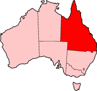
Queensland, being the second largest (by area) state in Australia, is also the most decentralised. Hence the highways and roads cover most parts of the state unlike the sparsely populated Western Australia. Even Queensland's outback is well served as it is relatively populated.


Road quality varies from 8-laned Pacific Motorway linking Brisbane–Gold Coast to earth-packed outback tracks, reflecting the great diversity of its terrain and climatic conditions. The route markings are also unique in the sense that Queensland uses all available schemes, from old-style National Routes and Highways scheme and the blue-shielded State Routes scheme to the latest alphanumeric numbering scheme and the Metroads metropolitan route numbering scheme.
National Land Transport Network
editState highways
edit- Isis Highway
- Scenic Highway (Queensland)
- Port of Brisbane Motorway
- Capricorn Highway
- Leichhardt Highway
- David Low Way
- Fitzroy Developmental Road
- Maroochydore Road
- Suttor Developmental Road
- Mount Lindesay Highway
- Palmerston Highway
- Burke Developmental Road
- Mulligan Highway
- Cunningham Highway
- Captain Cook Highway
- Carnarvon Highway
- Dawson Highway
- Kennedy Developmental Road
- Gregory Developmental Road
- Fitzroy Developmental Road
- Mitchell Highway
- Bowen Developmental Road
- Wills Developmental Road
- Surat Developmental Road
- D'Aguilar Highway
- – Toowoomba–Athol Road
- No shield
Outback track
editSee also
edit- Highways in Australia for highways in other states and territories
- List of highways in Australia for roads named as highways, and roads that function as highways but are not necessarily classified as highways
- List of road routes in Queensland
External links
editMedia related to Highways in Queensland at Wikimedia Commons