Template:Infobox mountain/test versus status quo ante 3

Example 1

edit
Side by side comparison
Status quo anteCurrent infobox
1839 Metre Summit
1839峰
A view from Mount Kamui
Highest point
Elevation1,842 m (6,043 ft)
ListingList of mountains and hills of Japan by height
Coordinates42°32′22″N 142°48′29″E / 42.53944°N 142.80806°E / 42.53944; 142.80806
Naming
English translation1839 metre summit
Language of nameJapanese
Geography
1839 Metre Summit is located in Japan
1839 Metre Summit
1839 Metre Summit
Parent rangeHidaka Mountains
Topo mapGeographical Survey Institute (国土地理院, Kokudochiriin) 25000:1 ヤオロマップ岳
Geology
Mountain typeFold
1839 Metre Summit
1839峰
A view from Mount Kamui
Highest point
Elevation1,842 m (6,043 ft)
ListingList of mountains and hills of Japan by height
Coordinates42°32′22″N 142°48′29″E / 42.53944°N 142.80806°E / 42.53944; 142.80806
Naming
English translation1839 metre summit
Language of nameJapanese
Geography
1839 Metre Summit is located in Japan
1839 Metre Summit
1839 Metre Summit
Parent rangeHidaka Mountains
Topo map(s)Geographical Survey Institute (国土地理院, Kokudochiriin) 25000:1 ヤオロマップ岳
Geology
Mountain typeFold

Example 2

edit
Side by side comparison
Status quo anteCurrent infobox
A' Chràlaig
A' Chralaig from the northwest
Highest point
Elevation1,120 m (3,670 ft) [1]
Prominence786 m (2,579 ft) 
Ranked 38th in British Isles
Parent peakCarn Eige
ListingMunro, Marilyn
Coordinates57°11′5″N 05°09′16″W / 57.18472°N 5.15444°W / 57.18472; -5.15444
Naming
English translationthe basket [2]
Language of nameGaelic
PronunciationScottish Gaelic: [əˈxɾaːl̪ˠɛkʲ]
English approximation: ə-KHRAH-lek
Geography
A' Chràlaig is located in Highland
A' Chràlaig
A' Chràlaig
Parent rangeNorthwest Highlands
OS gridNH094148
Topo mapOS Landranger 33 / 34
Geology
Mountain typemountain
A' Chràlaig
A' Chralaig from the northwest
Highest point
Elevation1,120 m (3,670 ft)[1]
Prominence786 m (2,579 ft)
Ranked 38th in British Isles
Parent peakCarn Eige
ListingMunro, Marilyn
Coordinates57°11′5″N 05°09′16″W / 57.18472°N 5.15444°W / 57.18472; -5.15444
Naming
English translationthe basket [2]
Language of nameGaelic
PronunciationScottish Gaelic: [əˈxɾaːl̪ˠɛkʲ]
English approximation: ə-KHRAH-lek
Geography
A' Chràlaig is located in Highland
A' Chràlaig
A' Chràlaig
Parent rangeNorthwest Highlands
OS gridNH094148
Topo mapOS Landranger 33 / 34
Geology
Mountain typemountain

Example 3

edit
Side by side comparison
Status quo anteCurrent infobox
Absaroka Range
Absaroka range as seen from west of Livingston, Montana
Highest point
PeakFrancs Peak
Elevation13,153 ft (4,009 m) [3]
Coordinates43°57′41″N 109°19′51″W / 43.96139°N 109.33083°W / 43.96139; -109.33083[4]
Dimensions
Length150 mi (240 km)
Width75 mi (121 km)
Geography
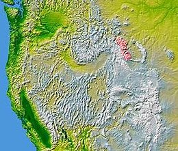
Absaroka Range is shown highlighted in pink on a map of the western United States
CountryUnited States
StateMontana and Wyoming
Parent rangeRocky Mountains
Borders onBeartooth Mountains and Wind River Range
Absaroka Range
Absaroka range as seen from west of Livingston, Montana
Highest point
PeakFrancs Peak
Elevation13,153 ft (4,009 m)[3]
Coordinates43°57′41″N 109°19′51″W / 43.96139°N 109.33083°W / 43.96139; -109.33083[4]
Dimensions
Length150 mi (240 km)
Width75 mi (121 km)
Geography
Absaroka Range is shown highlighted in pink on a map of the western United States
CountryUnited States
State(s)Montana and Wyoming
Parent rangeRocky Mountains
Borders onBeartooth Mountains and Wind River Range

Example 4

edit
Side by side comparison
Status quo anteCurrent infobox
Hajar Mountains
Oman Mountains[5][6]
Rocky Mountains[7][8]
Stone Mountains
Highest point
PeakJebel Shams (Oman)
Elevation3,009 m (9,872 ft)
Naming
Native nameError {{native name}}: an IETF language tag as parameter {{{1}}} is required (help)
Geography
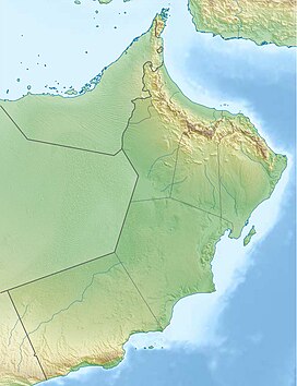
Infobox mountain/test versus status quo ante 3 is located in Oman
Infobox mountain/test versus status quo ante 3
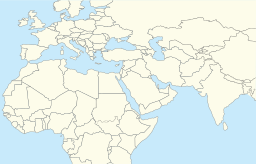
Infobox mountain/test versus status quo ante 3 is located in Middle East
Infobox mountain/test versus status quo ante 3
Infobox mountain/test versus status quo ante 3 is located in Asia
Infobox mountain/test versus status quo ante 3
Country Oman and  United Arab Emirates
State/ProvinceAsia
Range coordinates23°18′N 57°06′E / 23.3°N 57.1°E / 23.3; 57.1
Hajar Mountains
Oman Mountains[5][6]
Rocky Mountains[7][8]
Stone Mountains
Highest point
PeakJebel Shams, Oman
Elevation3,009 m (9,872 ft)
Naming
Native nameجِبَال ٱلْحَجَر
Geography
Hajar Mountains is located in Oman
Hajar Mountains
Hajar Mountains
Hajar Mountains is located in Middle East
Hajar Mountains
Hajar Mountains
Hajar Mountains is located in Asia
Hajar Mountains
Hajar Mountains
Countries Oman and  United Arab Emirates
RegionAsia
Range coordinates23°18′N 57°06′E / 23.3°N 57.1°E / 23.3; 57.1

Example 5

edit
Side by side comparison
Status quo anteCurrent infobox
Aldan Highlands
Алданское нагорье / Алдан үрдэлэ
Highest point
Elevation2,306 m (7,566 ft)
Dimensions
Length600 km (370 mi)
Width300 km (190 mi)
Geography
Infobox mountain/test versus status quo ante 3 is located in Sakha Republic
Infobox mountain/test versus status quo ante 3
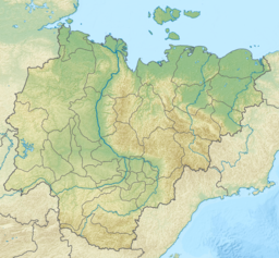
Location in the Sakha Republic, Russia
CountryRussia
Federal subjectSakha Republic
Range coordinates57°0′N 128°0′E / 57.000°N 128.000°E / 57.000; 128.000
Parent rangeSouth Siberian System
Geology
Age of rockPrecambrian[9] and Late Archaean
Type of rockGneiss, slate, Granulite and amphibolite
Climbing
Easiest routefrom Aldan
Aldan Highlands
Алданское нагорье / Алдан үрдэлэ
Highest point
Elevation2,306 m (7,566 ft)
Dimensions
Length600 km (370 mi)
Width300 km (190 mi)
Geography
Aldan Highlands is located in Sakha Republic
Aldan Highlands
Aldan Highlands
Location in the Sakha Republic, Russia
CountryRussia
Federal subjectSakha Republic
Range coordinates57°0′N 128°0′E / 57.000°N 128.000°E / 57.000; 128.000
Parent rangeSouth Siberian System
Geology
Rock agesPrecambrian[9] and Late Archaean
Rock typesGneiss, slate, Granulite and amphibolite
Climbing
Easiest routefrom Aldan

Example 6

edit
Side by side comparison
Status quo anteCurrent infobox
Adrar des Ifoghas
Adrar n Ifoghas
View of a guelta near Oubankort
Highest point
Elevation890 m (2,920 ft)
Geography
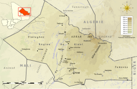
Topographic map of the Kidal Region
LocationCentral Sahara
CountriesMali and Algeria
States/ProvincesKidal Region, Tamanrasset and Adrar
Adrar des Ifoghas
Adrar n Ifoghas
View of a guelta near Oubankort
Highest point
Elevation890 m (2,920 ft)
Geography
Topographic map of the Kidal Region
LocationCentral Sahara
CountriesMali and Algeria
RegionsKidal Region, Tamanrasset and Adrar

Example 7

edit
Side by side comparison
Status quo anteCurrent infobox
Alpi Cusiane
Prealpi Cusiane
Mottarone summit
Highest point
PeakCima Altemberg
Elevation2,395 m (7,858 ft)
Coordinates45°56′10″N 8°12′13″E / 45.93611°N 8.20361°E / 45.93611; 8.20361
Geography
Alpi Cusiane is located in Alps
Alpi Cusiane
Alpi Cusiane
CountryItaly
Region/ProvincesPiedmont, Novara, Verbano-Cusio-Ossola and Vercelli
SettlementOmegna, Stresa, Arona
Parent rangePennine Alps
RiversTicino, Sesia and Agogna
Geology
OrogenyAlpine orogeny
Alpi Cusiane
Prealpi Cusiane
Mottarone summit
Highest point
PeakCima Altemberg
Elevation2,395 m (7,858 ft)
Coordinates45°56′10″N 8°12′13″E / 45.93611°N 8.20361°E / 45.93611; 8.20361
Geography
Alpi Cusiane is located in Alps
Alpi Cusiane
Alpi Cusiane
CountryItaly
Region/ProvincesPiedmont, Novara, Verbano-Cusio-Ossola and Vercelli
RiversTicino, Sesia and Agogna
Settlement(s)Omegna, Stresa, Arona
Parent rangePennine Alps
Geology
OrogenyAlpine orogeny

Example 8

edit
Side by side comparison
Status quo anteCurrent infobox
Blackstairs Mountains
Panorama of the Blackstairs Mountains
Highest point
PeakMount Leinster (East of Borris)
Elevation796 m (2,612 ft)
Coordinates52°37′1.2″N 6°46′40.8″W / 52.617000°N 6.778000°W / 52.617000; -6.778000
Naming
Native nameError {{native name}}: an IETF language tag as parameter {{{1}}} is required (help)
Geography
CountryIreland
ProvinceLeinster
CountiesCarlow and Wexford
Towns
Range coordinates52°35′17″N 6°46′48″W / 52.588°N 6.780°W / 52.588; -6.780
Blackstairs Mountains
Panorama of the Blackstairs Mountains
Highest point
PeakMount Leinster, East of Borris
Elevation796 m (2,612 ft)
Coordinates52°37′1.2″N 6°46′40.8″W / 52.617000°N 6.778000°W / 52.617000; -6.778000
Naming
Native nameNa Staighrí Dubha Error {{native name checker}}: parameter value is malformed (help)
Geography
Map
CountryIreland
ProvinceLeinster
CountiesCarlow and Wexford
TownsBunclody, Borris, Kiltealy, Rathnure, Ballywilliam, St Mullin's and Graiguenamanagh
Range coordinates52°35′17″N 6°46′48″W / 52.588°N 6.780°W / 52.588; -6.780

Example 9

edit
Side by side comparison
Status quo anteCurrent infobox
Appalachian Mountains
Appalachians
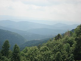
August 2007 view from the slopes of Back Allegheny Mountain, looking east; visible are Allegheny Mountain (in the Monongahela National Forest of West Virginia, middle distance), and Shenandoah Mountain (in the George Washington National Forest of Virginia, far distance)
Highest point
PeakMount Mitchell
Elevation6,684 ft (2,037 m)
Dimensions
Length1,500 mi (2,400 km)
Geography
CountriesUnited States, Canada and France
States/Provinces
Range coordinates40°N 78°W / 40°N 78°W / 40; -78
Geology
OrogenyTaconic, Acadian, Alleghanian
Age of rockOrdovicianPermian
Appalachian Mountains
Appalachians
August 2007 view from the slopes of Back Allegheny Mountain, looking east; visible are Allegheny Mountain (in the Monongahela National Forest of West Virginia, middle distance), and Shenandoah Mountain (in the George Washington National Forest of Virginia, far distance)
Highest point
PeakMount Mitchell
Elevation6,684 ft (2,037 m)
Dimensions
Length1,500 mi (2,400 km)
Geography
CountriesUnited States, Canada and France
RegionsNewfoundland and Labrador, Saint Pierre and Miquelon, Québec, Nova Scotia, New Brunswick, Maine, New Hampshire, Vermont, Massachusetts, Connecticut, New York, New Jersey, Pennsylvania, Maryland, Delaware, Virginia, West Virginia, Ohio, Kentucky, Tennessee, North Carolina, South Carolina, Georgia and Alabama
Range coordinates40°N 78°W / 40°N 78°W / 40; -78
Geology
OrogeniesTaconic, Acadian, Alleghanian
Rock ageOrdovicianPermian

Example 10

edit
Side by side comparison
Status quo anteCurrent infobox
Lepontine Alps
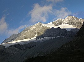
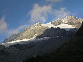
Monte Leone
Highest point
PeakMonte Leone
Elevation3,553 m (11,657 ft)
Coordinates46°24′N 8°08′E / 46.400°N 8.133°E / 46.400; 8.133
Naming
Native nameError {{native name}}: an IETF language tag as parameter {{{1}}} is required (help)
Geography
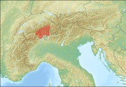
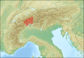
Lepontine Alps (red)
CountriesSwitzerland and Italy
Cantons, Regions
Range coordinates46°25′N 8°40′E / 46.417°N 8.667°E / 46.417; 8.667
Parent rangeWestern Alps
Borders on
Topo mapSwiss Federal Office of Topography swisstopo
Geology
OrogenyAlpine orogeny
Lepontine Alps
Monte Leone
Highest point
PeakMonte Leone
Elevation3,553 m (11,657 ft)
Coordinates46°24′N 8°08′E / 46.400°N 8.133°E / 46.400; 8.133
Naming
Native name
Geography
Lepontine Alps (red)
CountriesSwitzerland and Italy
Cantons, RegionsValais, Ticino, Graubünden, Uri, Piedmont and Lombardy
Range coordinates46°25′N 8°40′E / 46.417°N 8.667°E / 46.417; 8.667
Parent rangeWestern Alps
Borders onPennine Alps, Bernese Alps, Uri Alps, Glarus Alps, Western Rhaetian Alps and Lugano Prealps
Topo mapSwiss Federal Office of Topography swisstopo
Geology
OrogenyAlpine orogeny

Example 11

edit
Side by side comparison
Status quo anteCurrent infobox
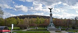
Mount Royal
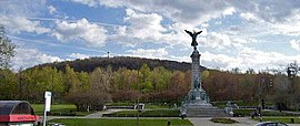
Mount Royal's eastern slope.
Highest point
Elevation233 m (764 ft)
Coordinates45°30′23″N 73°35′20″W / 45.50639°N 73.58889°W / 45.50639; -73.58889
Naming
Native nameError {{native name}}: an IETF language tag as parameter {{{1}}} is required (help)
Geography
Mount Royal is located in Quebec
Mount Royal
Mount Royal
Montréal, Quebec, Canada
Parent rangeMonteregian Hills
Topo mapNTS 31H
Geology
Age of rockEarly Cretaceous
Mountain typeIntrusive stock
Climbing
First ascentJacques Cartier, 1535
(first European)
Easiest routeHiking or Cycling
Mount Royal
Mount Royal's eastern slope.
Highest point
Elevation233 m (764 ft)
Coordinates45°30′23″N 73°35′20″W / 45.50639°N 73.58889°W / 45.50639; -73.58889
Naming
Native nameMont Royal Error {{native name checker}}: parameter value is malformed (help)
Geography
Mount Royal is located in Quebec
Mount Royal
Mount Royal
Montréal, Quebec, Canada
Parent rangeMonteregian Hills
Topo mapNTS 31H
Geology
Rock ageEarly Cretaceous
Mountain typeIntrusive stock
Climbing
First ascentJacques Cartier, 1535
(first European)
Easiest routeHiking or Cycling

Example 12

edit
Side by side comparison
Status quo anteCurrent infobox
Skjaldbreiður
Skjaldbreiður as seen from Þingvellir
Highest point
Elevation1,060 m (3,480 ft)
Coordinates64°24′36″N 20°45′44″W / 64.41000°N 20.76222°W / 64.41000; -20.76222
Naming
English translationbroad shield
Language of nameIcelandic
Geography
Skjaldbreiður is located in Iceland
Skjaldbreiður
Skjaldbreiður
Iceland
Geology
Age of rock9,000 years
Mountain typeshield volcano
Skjaldbreiður
Skjaldbreiður as seen from Þingvellir
Highest point
Elevation1,060 m (3,480 ft)
Coordinates64°24′36″N 20°45′44″W / 64.41000°N 20.76222°W / 64.41000; -20.76222
Naming
English translationbroad shield
Language of nameIcelandic
Geography
Skjaldbreiður is located in Iceland
Skjaldbreiður
Skjaldbreiður
Iceland
Geology
Rock age9,000 years
Mountain typeshield volcano

Example 13

edit
Side by side comparison
Status quo anteCurrent infobox
Mount Omusha
双子山 (オムシャヌプリ)
Highest point
Elevation1,379 m (4,524 ft)
ListingList of mountains and hills of Japan by height
Coordinates42°18′33″N 143°3′17″E / 42.30917°N 143.05472°E / 42.30917; 143.05472
Naming
English translationtwin children[10] mountain
Language of nameAinu language
PronunciationJapanese: [omɯɕanɯpɯɾi]
Geography
LocationHokkaidō, Japan
Parent rangeHidaka Mountains
Topo mapGeographical Survey Institute (国土地理院, Kokudochiriin) 25000:1 楽古岳
Geology
Mountain typeFold
Mount Omusha
双子山 (オムシャヌプリ)
Map
Highest point
Elevation1,379 m (4,524 ft)
ListingList of mountains and hills of Japan by height
Coordinates42°18′33″N 143°3′17″E / 42.30917°N 143.05472°E / 42.30917; 143.05472
Naming
English translationtwin children[10] mountain
Language of nameAinu language
PronunciationJapanese: [omɯɕanɯpɯɾi]
Geography
LocationHokkaidō, Japan
Parent rangeHidaka Mountains
Topo map(s)Geographical Survey Institute (国土地理院, Kokudochiriin) 25000:1 楽古岳
Geology
Mountain typeFold

Example 14

edit
Side by side comparison
Status quo anteCurrent infobox
Alps
Mont Blanc, the highest mountain in the Alps, view from the Savoy side
Highest point
PeakMont Blanc
Elevation4,808.73 m (15,776.7 ft) [11]
Coordinates45°49′58″N 06°51′54″E / 45.83278°N 6.86500°E / 45.83278; 6.86500
Dimensions
Length1,200 km (750 mi)
Width250 km (160 mi)
Area200,000 km2 (77,000 sq mi)
Naming
Native nameError {{native name}}: an IETF language tag as parameter {{{1}}} is required (help)
Geography
Relief of the Alps. See also map with international borders marked.
Countries
Range coordinates46°30′N 09°19′E / 46.500°N 9.317°E / 46.500; 9.317
Geology
OrogenyAlpine orogeny
Age of rockTertiary
Type of rockBündner schist, flysch and molasse
Alps
Mont Blanc, the highest mountain in the Alps, view from the Savoy side
Highest point
PeakMont Blanc
Elevation4,808.73 m (15,776.7 ft)[11]
Coordinates45°49′58″N 06°51′54″E / 45.83278°N 6.86500°E / 45.83278; 6.86500
Dimensions
Length1,200 km (750 mi)
Width250 km (160 mi)
Area200,000 km2 (77,000 sq mi)
Naming
Native name
Geography
Relief of the Alps. See also map with international borders marked.
Countries Austria,  France,  Germany,  Italy,  Liechtenstein,  Monaco,  Slovenia and   Switzerland
Range coordinates46°30′N 09°19′E / 46.500°N 9.317°E / 46.500; 9.317
Geology
OrogenyAlpine orogeny
Rock ageTertiary
Rock typesBündner schist, flysch and molasse

Example 15

edit
Side by side comparison
Status quo anteCurrent infobox
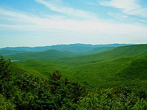
Catskill Mountains
Slide Mountain and nearby peaks as seen from Twin Mountain in the northern Catskills
Highest point
PeakSlide Mountain
Elevation4,180 ft (1,270 m)
Coordinates41°59′55″N 74°23′11″W / 41.99861°N 74.38639°W / 41.99861; -74.38639
Dimensions
Length111 mi (179 km) N/S
Width102 mi (164 km) E/W
Area15,259 km2 (5,892 sq mi)
Geography
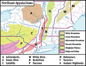
Main regions of the northeast Appalachians, with the Catskills as "C"
CountryUnited States
StateNew York
RegionHudson Valley
Counties
Communities
Parent rangeAppalachian (Allegheny Plateau)
Borders on
RiversEsopus Creek, Neversink River, Rondout Creek and Schoharie Creek
Geology
Age of rockDevonian and Mississippian
Type of rockSedimentary
Catskill Mountains
Slide Mountain and nearby peaks as seen from Twin Mountain in the northern Catskills
Highest point
PeakSlide Mountain
Elevation4,180 ft (1,270 m)
Coordinates41°59′55″N 74°23′11″W / 41.99861°N 74.38639°W / 41.99861; -74.38639
Dimensions
Length111 mi (179 km) N/S
Width102 mi (164 km) E/W
Area15,259 km2 (5,892 sq mi)
Geography
Main regions of the northeast Appalachians, with the Catskills as "C"
CountryUnited States
StateNew York
RegionHudson Valley
CountiesDelaware, Greene, Schoharie, Sullivan and Ulster
RiversEsopus Creek, Neversink River, Rondout Creek and Schoharie Creek
CommunitiesEllenville, Fleischmanns, Hunter, Liberty, Margaretville, Hancock, New York, Palenville, Phoenicia, Shandaken, Shokan, Tannersville, Wawarsing, Windham and Woodstock
Parent rangeAppalachian (Allegheny Plateau)
Borders onPoconos, Shawangunk Ridge, Hudson Valley, Great Appalachian Valley and Mohawk Valley
Geology
Rock agesDevonian and Mississippian
Rock typeSedimentary

Example 16

edit
Side by side comparison
Status quo anteCurrent infobox
Hajar Mountains
Oman Mountains[5][6]
Rocky Mountains[7][8]
Stone Mountains
Highest point
PeakJebel Shams (Oman)
Elevation3,009 m (9,872 ft)
Naming
Native nameError {{native name}}: an IETF language tag as parameter {{{1}}} is required (help)
Geography
Infobox mountain/test versus status quo ante 3 is located in Oman
Infobox mountain/test versus status quo ante 3
Infobox mountain/test versus status quo ante 3 is located in Middle East
Infobox mountain/test versus status quo ante 3
Infobox mountain/test versus status quo ante 3 is located in Asia
Infobox mountain/test versus status quo ante 3
Countries Oman and  United Arab Emirates
State/ProvinceAsia
Range coordinates23°18′N 57°06′E / 23.3°N 57.1°E / 23.3; 57.1
Hajar Mountains
Oman Mountains[5][6]
Rocky Mountains[7][8]
Stone Mountains
Highest point
PeakJebel Shams, Oman
Elevation3,009 m (9,872 ft)
Naming
Native nameجِبَال ٱلْحَجَر
Geography
Hajar Mountains is located in Oman
Hajar Mountains
Hajar Mountains
Hajar Mountains is located in Middle East
Hajar Mountains
Hajar Mountains
Hajar Mountains is located in Asia
Hajar Mountains
Hajar Mountains
Countries Oman and  United Arab Emirates
RegionAsia
Range coordinates23°18′N 57°06′E / 23.3°N 57.1°E / 23.3; 57.1
  1. ^ "walkhighlands A' Chralaig". walkhighlands.co.uk. 2014. Retrieved 9 January 2014.
  2. ^ "A' Chralaig". MunroMagic.com.
  3. ^ "Francs Peak, Wyoming". Peakbagger.com. Retrieved October 18, 2020.
  4. ^ "Francs Peak". Geographic Names Information System. United States Geological Survey, United States Department of the Interior. Retrieved October 18, 2020.
  5. ^ a b Allen, Calvin H. Jr. (2016-02-05). "1: Land and People". Oman: the Modernization of the Sultanate. Abingdon, New York: Routledge. pp. 1–8. ISBN 978-1-3172-9164-0.
  6. ^ a b Geukens, F. (1966). Bowers, S. D. (ed.). United States Geological Survey Professional Paper. Washington, D.C.: U.S. Government Printing Office.
  7. ^ a b Al-Yahyai, Sultan; Charabi, Yassine; Al-Sarmi, Said; Al-Maskari, Juma (2017-05-09). "3: Scenarios Based Climate Projection for Oman's Water Resources". In Abdalla, Omar; Kacimov, Anvar; Chen, Mingjie; Al-Maktoumi, Ali; Al-Hosni, Talal; Clark, Ian (eds.). Water Resources in Arid Areas: The Way Forward. Springer. p. 49. ISBN 978-3-3195-1856-5.
  8. ^ a b Megdiche-Kharrat, Fairouz; Ragala, Rachid; Moussa, Mohamed (2016-11-25). "12: The Aqueducts of the Sultanate of Oman: Sustainable Water-Supplying Irrigating Oases Cities". In Angelakis, Andreas N.; Chiotis, Eustathios; Eslamian, Saeid; Weingartner, Herbert (eds.). Underground Aqueducts Handbook. CRC Press. p. 206. ISBN 978-1-4987-4831-5.
  9. ^ The tectonics and metallogeny of the Precambrian of the Aldan-Stanovoy Shield
  10. ^ This is the translation based on the reading of the kanji.
  11. ^ "Le Mont-Blanc passe de 4.810 mètres à 4.808,7 mètres".